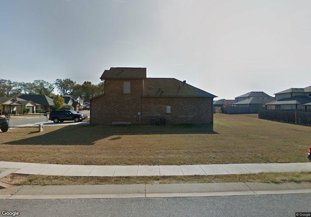
321 Union Station Way Calera, AL 35040
Estimated Value: $243,000 - $326,000
3
Beds
3
Baths
1,473
Sq Ft
$185/Sq Ft
Est. Value
About This Home
This home is located at 321 Union Station Way, Calera, AL 35040 and is currently estimated at $273,236, approximately $185 per square foot. 321 Union Station Way is a home located in Shelby County with nearby schools including Calera Intermediate School, Calera Elementary School, and Calera Middle School.
Ownership History
Date
Name
Owned For
Owner Type
Purchase Details
Closed on
Dec 3, 2020
Sold by
Valor Communities Llc
Bought by
Boston Jairus
Current Estimated Value
Home Financials for this Owner
Home Financials are based on the most recent Mortgage that was taken out on this home.
Original Mortgage
$226,842
Outstanding Balance
$202,317
Interest Rate
2.8%
Mortgage Type
FHA
Estimated Equity
$70,919
Purchase Details
Closed on
Oct 19, 2009
Sold by
W A Mcneely Co Inc
Bought by
Snead Thomas
Home Financials for this Owner
Home Financials are based on the most recent Mortgage that was taken out on this home.
Original Mortgage
$131,147
Interest Rate
5.05%
Mortgage Type
New Conventional
Create a Home Valuation Report for This Property
The Home Valuation Report is an in-depth analysis detailing your home's value as well as a comparison with similar homes in the area
Home Values in the Area
Average Home Value in this Area
Purchase History
| Date | Buyer | Sale Price | Title Company |
|---|---|---|---|
| Boston Jairus | $231,028 | South Oak Title | |
| Snead Thomas | $128,525 | None Available |
Source: Public Records
Mortgage History
| Date | Status | Borrower | Loan Amount |
|---|---|---|---|
| Open | Boston Jairus | $226,842 | |
| Previous Owner | Snead Thomas | $131,147 |
Source: Public Records
Tax History Compared to Growth
Tax History
| Year | Tax Paid | Tax Assessment Tax Assessment Total Assessment is a certain percentage of the fair market value that is determined by local assessors to be the total taxable value of land and additions on the property. | Land | Improvement |
|---|---|---|---|---|
| 2024 | $1,258 | $23,300 | $0 | $0 |
| 2023 | $1,176 | $22,540 | $0 | $0 |
| 2022 | $910 | $17,620 | $0 | $0 |
| 2021 | $849 | $16,480 | $0 | $0 |
| 2020 | $794 | $15,460 | $0 | $0 |
| 2019 | $755 | $14,740 | $0 | $0 |
| 2017 | $663 | $13,040 | $0 | $0 |
| 2015 | $631 | $12,440 | $0 | $0 |
| 2014 | $637 | $12,560 | $0 | $0 |
Source: Public Records
Map
Nearby Homes
- 316 Union Station Way
- 157 Union Station Dr
- 511 Union Station Place
- 173 Union Station Dr
- 5714 Smokey Rd
- 112 Stonecreek Place
- 212 Creekstone Trail
- 205 the Heights Dr
- 2051 Rossburg Place
- 623 the Heights Ln
- 302 Nottingham Dr
- 253 Union Station Dr
- 589 Waterstone Dr
- 562 the Heights Ln
- 656 the Heights Ln
- 796 Michelle Manor
- 244 Koslin Loop
- The Penwell Plan at Koslin Farms
- The Hayden Plan at Koslin Farms
- The Freeport Plan at Koslin Farms
- 317 Union Station Way
- 313 Union Station Way
- 379 Union Station Way Unit 47
- 379 Union Station Way Unit 78
- 379 Union Station Way
- 300 Union Station Way
- 383 Union Station Way Unit 48
- 383 Union Station Way
- 309 Union Station Way
- 344 Union Station Way Unit 29
- 344 Union Station Way
- 348 Union Station Way Unit 28
- 348 Union Station Way
- 340 Union Station Way
- 387 Union Station Way Unit 49
- 387 Union Station Way
- 320 Union Station Way Unit 35
- 352 Union Station Way Unit 27
- 352 Union Station Way
- 316 Union Station Way Unit 36