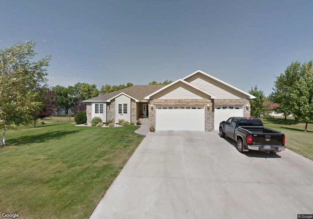
321 W 17th St Grafton, ND 58237
Estimated Value: $434,492 - $496,000
--
Bed
--
Bath
--
Sq Ft
0.49
Acres
About This Home
This home is located at 321 W 17th St, Grafton, ND 58237 and is currently estimated at $460,831. 321 W 17th St is a home with nearby schools including Century Elementary School, Grafton Central Middle School, and Grafton High School.
Ownership History
Date
Name
Owned For
Owner Type
Purchase Details
Closed on
Mar 15, 2019
Sold by
Gorder Daniel E and Gorder Monica
Bought by
Hoenke David K and Hoenke Jaime A
Current Estimated Value
Home Financials for this Owner
Home Financials are based on the most recent Mortgage that was taken out on this home.
Original Mortgage
$284,000
Outstanding Balance
$249,684
Interest Rate
4.4%
Mortgage Type
New Conventional
Estimated Equity
$211,147
Create a Home Valuation Report for This Property
The Home Valuation Report is an in-depth analysis detailing your home's value as well as a comparison with similar homes in the area
Home Values in the Area
Average Home Value in this Area
Purchase History
| Date | Buyer | Sale Price | Title Company |
|---|---|---|---|
| Hoenke David K | $355,000 | Grand Forks Abstract |
Source: Public Records
Mortgage History
| Date | Status | Borrower | Loan Amount |
|---|---|---|---|
| Open | Hoenke David K | $284,000 |
Source: Public Records
Tax History Compared to Growth
Tax History
| Year | Tax Paid | Tax Assessment Tax Assessment Total Assessment is a certain percentage of the fair market value that is determined by local assessors to be the total taxable value of land and additions on the property. | Land | Improvement |
|---|---|---|---|---|
| 2024 | $7,279 | $198,800 | $15,750 | $183,050 |
| 2023 | $6,801 | $180,750 | $9,650 | $171,100 |
| 2022 | $6,184 | $165,750 | $9,650 | $156,100 |
| 2021 | $5,596 | $152,000 | $9,650 | $142,350 |
| 2020 | $5,425 | $138,500 | $9,650 | $128,850 |
| 2019 | $4,955 | $11,341 | $0 | $0 |
| 2018 | $4,859 | $11,341 | $0 | $0 |
| 2017 | $4,723 | $11,116 | $0 | $0 |
| 2016 | $4,051 | $10,801 | $0 | $0 |
| 2015 | $4,047 | $10,801 | $0 | $0 |
| 2014 | $4,124 | $9,901 | $0 | $0 |
| 2013 | $4,124 | $9,226 | $0 | $0 |
Source: Public Records
Map
Nearby Homes
- 568 Northstar Dr
- 1550 Kittson Ave
- 1481 Dogwood Ave
- 1452 Hill Ave
- 1471 Manvel Ave
- 1135 Hill Ave
- 919 Lawler Ave
- 916 Manvel Ave
- 1240 Eastview Dr
- 323 Kittson Ave
- 21 Eastwood Dr
- 133 Adamsen Dr
- 7012 County 4 Rd
- 15495 County Road 9 Unit 9
- 678 Wilson Ave
- XX Farmhouse To Be Moved
- 14785 79th St NE
- 6086 County Road 4
- 14363 58th St NE
- 101 Oak Ridge Place
- 336 W 17th St
- 1633 Western Ave
- 348 Northstar Dr
- 1607 Western Ave
- 1636 Western Ave
- 360 Northstar Dr
- 1704 Western Ave
- 310 W 17th St
- 344 Northstar Dr
- 422 Northstar Dr
- 364 Northstar Dr
- 230 W 16th St
- 342 Northstar Dr
- 351 Northstar Dr
- 418 Northstar Dr
- 220 W 16th St
- 405 Northstar Dr
- 1567 Western Ave
- 1574 Western Ave
- 516 Northstar Dr