Estimated Value: $217,458 - $251,000
2
Beds
2
Baths
1,268
Sq Ft
$179/Sq Ft
Est. Value
About This Home
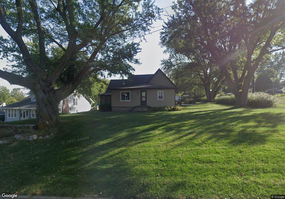
This home is located at 321 W 6th St, Logan, IA 51546 and is currently estimated at $227,365, approximately $179 per square foot. 321 W 6th St is a home located in Harrison County with nearby schools including Logan-Magnolia Elementary School and Logan-Magnolia Junior/Senior High School.
Ownership History
Date
Name
Owned For
Owner Type
Purchase Details
Closed on
Jul 15, 2005
Sold by
Meyer Jeff and Meyer Cheryl
Bought by
Sanne Ronda J
Current Estimated Value
Create a Home Valuation Report for This Property
The Home Valuation Report is an in-depth analysis detailing your home's value as well as a comparison with similar homes in the area
Purchase History
| Date | Buyer | Sale Price | Title Company |
|---|---|---|---|
| Sanne Ronda J | $128,000 | None Available |
Source: Public Records
Tax History
| Year | Tax Paid | Tax Assessment Tax Assessment Total Assessment is a certain percentage of the fair market value that is determined by local assessors to be the total taxable value of land and additions on the property. | Land | Improvement |
|---|---|---|---|---|
| 2025 | $3,692 | $234,140 | $22,950 | $211,190 |
| 2024 | $3,692 | $210,120 | $22,950 | $187,170 |
| 2023 | $3,564 | $210,120 | $22,950 | $187,170 |
| 2022 | $3,034 | $155,621 | $22,950 | $132,671 |
| 2021 | $3,034 | $155,621 | $22,950 | $132,671 |
| 2020 | $2,742 | $144,762 | $22,950 | $121,812 |
| 2019 | $2,844 | $144,762 | $22,950 | $121,812 |
| 2018 | $2,784 | $141,932 | $0 | $0 |
| 2017 | $2,856 | $141,932 | $0 | $0 |
| 2016 | $2,918 | $141,932 | $0 | $0 |
| 2015 | $2,918 | $127,867 | $0 | $0 |
| 2014 | $2,574 | $127,867 | $0 | $0 |
Source: Public Records
Map
Nearby Homes
- 1010 Skyline Dr
- 217 N 2nd Ave
- 317 S 3rd Ave
- 322 Hillcrest Dr
- 2613 Niagara Trail
- Lot 18 Mulligan Trail
- LOT 27 Mulligan Trail
- LOT 26 Lmvcc Estates
- 2464 Mulligan Trail
- LOT 20 Lmvcc Estates
- LOT 17 Lmvcc Estates
- 2144 Norton Ave
- LOT 15 Mulligan Trail
- TBD Preston Place 3 Parcels
- TBD Preston Place 2 Parcels
- LOT D Fieldcrest Dr
- LOT 9 & 10 Fieldcrest Dr
- LOT 1 Fieldcrest Dr
- LOT E & K Fieldcrest Dr
- LOT C Fieldcrest Dr
Your Personal Tour Guide
Ask me questions while you tour the home.