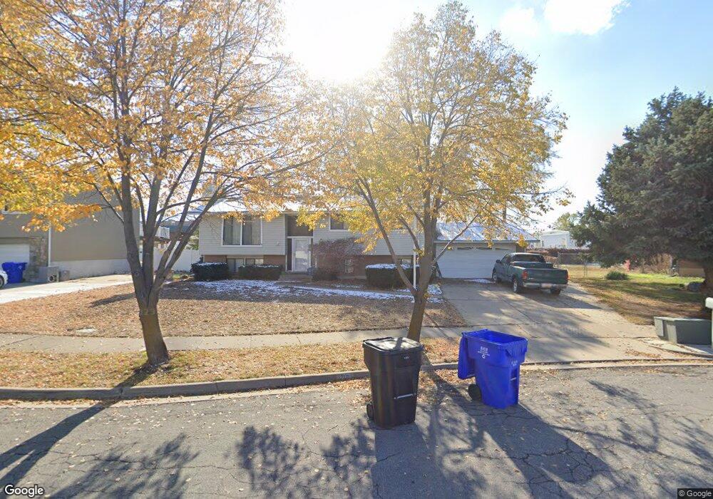
321 W 800 N Bountiful, UT 84010
Estimated Value: $488,000 - $580,000
4
Beds
2
Baths
2,540
Sq Ft
$211/Sq Ft
Est. Value
About This Home
This home is located at 321 W 800 N, Bountiful, UT 84010 and is currently estimated at $535,463, approximately $210 per square foot. 321 W 800 N is a home located in Davis County with nearby schools including Meadowbrook Elementary School, Bountiful Junior High School, and Viewmont High School.
Ownership History
Date
Name
Owned For
Owner Type
Purchase Details
Closed on
Nov 7, 2007
Sold by
Davies Fred J and Davies Ethel Jean N
Bought by
Jackson Greg and Jackson Maria
Current Estimated Value
Home Financials for this Owner
Home Financials are based on the most recent Mortgage that was taken out on this home.
Original Mortgage
$233,338
Outstanding Balance
$146,734
Interest Rate
6.35%
Mortgage Type
FHA
Estimated Equity
$388,729
Create a Home Valuation Report for This Property
The Home Valuation Report is an in-depth analysis detailing your home's value as well as a comparison with similar homes in the area
Purchase History
| Date | Buyer | Sale Price | Title Company |
|---|---|---|---|
| Jackson Greg | -- | First American Title |
Source: Public Records
Mortgage History
| Date | Status | Borrower | Loan Amount |
|---|---|---|---|
| Open | Jackson Greg | $233,338 |
Source: Public Records
Tax History
| Year | Tax Paid | Tax Assessment Tax Assessment Total Assessment is a certain percentage of the fair market value that is determined by local assessors to be the total taxable value of land and additions on the property. | Land | Improvement |
|---|---|---|---|---|
| 2025 | $2,962 | $271,150 | $123,558 | $147,592 |
| 2024 | $2,768 | $262,900 | $107,919 | $154,981 |
| 2023 | $2,643 | $455,000 | $200,887 | $254,113 |
| 2022 | $2,807 | $265,650 | $110,330 | $155,320 |
| 2021 | $2,584 | $374,000 | $144,291 | $229,709 |
| 2020 | $2,188 | $317,000 | $124,015 | $192,985 |
| 2019 | $2,211 | $313,000 | $136,245 | $176,755 |
| 2018 | $2,067 | $288,000 | $133,676 | $154,324 |
| 2016 | $1,789 | $134,970 | $53,886 | $81,084 |
| 2015 | $1,630 | $115,500 | $53,886 | $61,614 |
| 2014 | $1,441 | $104,208 | $53,886 | $50,322 |
| 2013 | -- | $108,376 | $36,190 | $72,186 |
Source: Public Records
Map
Nearby Homes
- 563 N 200 W
- 366 W 1000 N
- 184 Park Shadows Cir
- 499 N 200 W Unit 30
- 106 W 700 N
- 1130 N 200 W
- 401 W 400 N Unit 49
- 399 W 400 N Unit 47
- 332 N 300 W
- 290 N 500 W Unit 108
- 290 N 500 W Unit 305
- 320 N 200 W Unit 4
- 1260 N 200 W
- 235 W 1400 N
- 449 W 200 N Unit 3
- 75 N Peregrine Ln W Unit 8
- 252 N Main St
- 256 N Main St
- 254 N Main St
- 1520 N 550 W
Your Personal Tour Guide
Ask me questions while you tour the home.