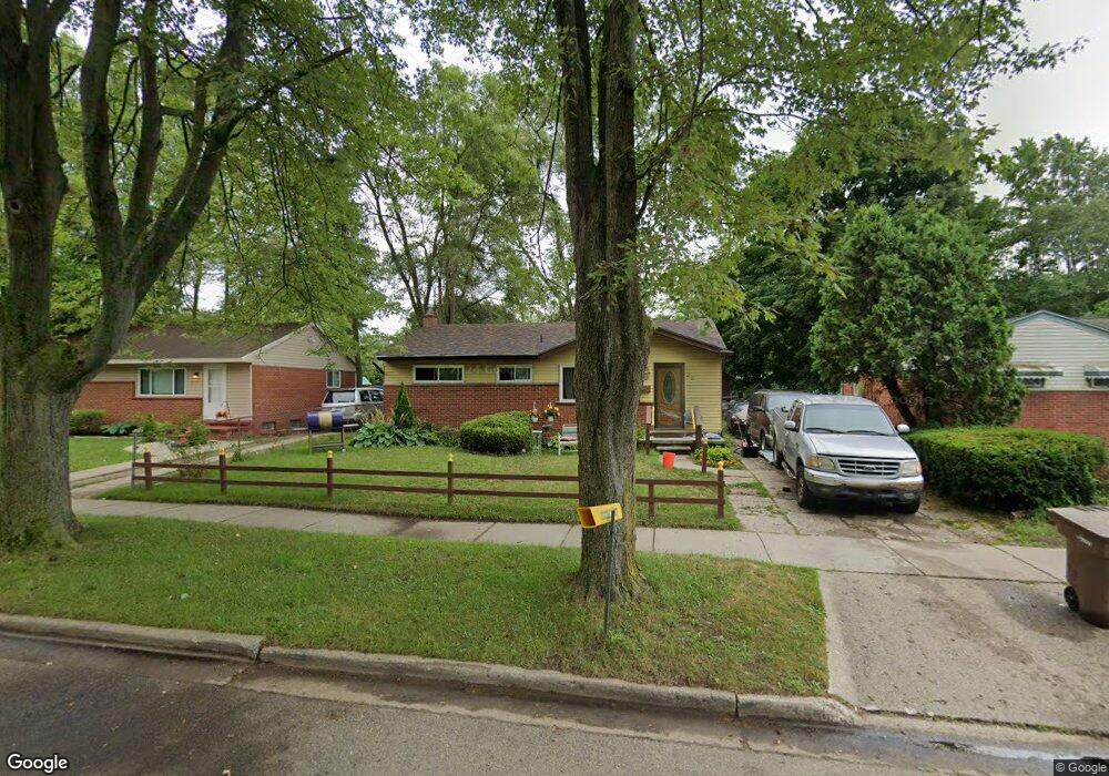
321 W Hopkins Ave Pontiac, MI 48340
Estimated Value: $140,502 - $167,000
3
Beds
1
Bath
910
Sq Ft
$173/Sq Ft
Est. Value
About This Home
This home is located at 321 W Hopkins Ave, Pontiac, MI 48340 and is currently estimated at $157,376, approximately $172 per square foot. 321 W Hopkins Ave is a home located in Oakland County with nearby schools including Alcott School, Pontiac Middle School, and Pontiac High School.
Ownership History
Date
Name
Owned For
Owner Type
Purchase Details
Closed on
Aug 25, 1997
Sold by
Macintosh Richard R
Bought by
Wellons Connie E
Current Estimated Value
Home Financials for this Owner
Home Financials are based on the most recent Mortgage that was taken out on this home.
Original Mortgage
$27,500
Outstanding Balance
$4,288
Interest Rate
7.54%
Estimated Equity
$153,088
Purchase Details
Closed on
Jan 3, 1991
Sold by
State Of Michigan Nat Re
Bought by
Wellons Connie E
Create a Home Valuation Report for This Property
The Home Valuation Report is an in-depth analysis detailing your home's value as well as a comparison with similar homes in the area
Home Values in the Area
Average Home Value in this Area
Purchase History
| Date | Buyer | Sale Price | Title Company |
|---|---|---|---|
| Wellons Connie E | $21,900 | -- | |
| Wellons Connie E | -- | -- |
Source: Public Records
Mortgage History
| Date | Status | Borrower | Loan Amount |
|---|---|---|---|
| Open | Wellons Connie E | $27,500 |
Source: Public Records
Tax History Compared to Growth
Tax History
| Year | Tax Paid | Tax Assessment Tax Assessment Total Assessment is a certain percentage of the fair market value that is determined by local assessors to be the total taxable value of land and additions on the property. | Land | Improvement |
|---|---|---|---|---|
| 2024 | $672 | $39,210 | $0 | $0 |
| 2023 | $641 | $35,170 | $0 | $0 |
| 2022 | $685 | $31,470 | $0 | $0 |
| 2021 | $666 | $27,230 | $0 | $0 |
| 2020 | $582 | $24,050 | $0 | $0 |
| 2019 | $640 | $20,980 | $0 | $0 |
| 2018 | $610 | $19,560 | $0 | $0 |
| 2017 | $581 | $18,650 | $0 | $0 |
| 2016 | $608 | $16,380 | $0 | $0 |
| 2015 | -- | $15,970 | $0 | $0 |
| 2014 | -- | $15,250 | $0 | $0 |
| 2011 | -- | $19,410 | $0 | $0 |
Source: Public Records
Map
Nearby Homes
- 310 W Princeton Ave
- 1153 Stanley Ave
- 228 W Walton Blvd
- 1123 Cherrylawn Dr
- 240 W Fairmount Ave
- 405 W Walton Blvd
- 207 W Strathmore Ave
- 1558 Richmond Ave
- 255 W Rutgers Ave
- 200 W Chicago Ave
- 112 W Strathmore Ave
- 117 W Strathmore Ave
- 134 W Fairmount Ave
- 161 W Brooklyn Ave
- 64 W Colgate Ave
- 1017 Cherrylawn Dr
- 89 W Fairmount Ave
- 18 E Hopkins Ave
- 18 E Princeton Ave
- 108 W Brooklyn Ave
- 327 W Hopkins Ave
- 333 W Hopkins Ave
- 317 W Hopkins Ave
- 328 W Yale Ave
- 322 W Yale Ave
- 339 W Hopkins Ave
- 311 W Hopkins Ave
- 334 W Yale Ave
- 318 W Yale Ave
- 328 W Hopkins Ave
- 340 W Yale Ave
- 312 W Yale Ave
- 318 W Hopkins Ave
- 334 W Hopkins Ave
- 305 W Hopkins Ave
- 312 W Hopkins Ave
- 340 W Hopkins Ave
- 322 W Hopkins Ave
- 306 W Yale Ave Unit Bldg-Unit
- 299 W Hopkins Ave Unit Bldg-Unit