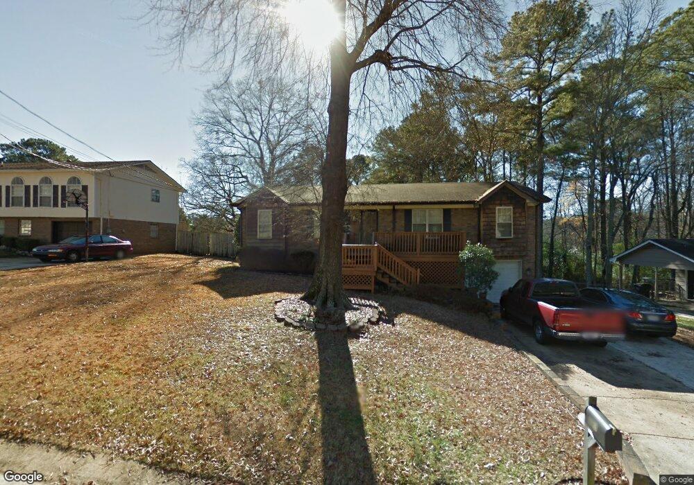
321 Wink Cir Center Point, AL 35215
Estimated Value: $152,000 - $210,000
3
Beds
2
Baths
1,428
Sq Ft
$127/Sq Ft
Est. Value
About This Home
This home is located at 321 Wink Cir, Center Point, AL 35215 and is currently estimated at $181,619, approximately $127 per square foot. 321 Wink Cir is a home located in Jefferson County with nearby schools including Center Point Elementary School, Erwin Elementary School, and Erwin Middle School.
Ownership History
Date
Name
Owned For
Owner Type
Purchase Details
Closed on
Jul 18, 2000
Sold by
Brown Marcus and Brown Atonya D
Bought by
Brown Marcus and Brown Atonya D
Current Estimated Value
Home Financials for this Owner
Home Financials are based on the most recent Mortgage that was taken out on this home.
Original Mortgage
$86,702
Interest Rate
8.23%
Mortgage Type
FHA
Purchase Details
Closed on
May 23, 2000
Sold by
Joel Cotney William
Bought by
Brown Marcus and Brown Atonya D
Home Financials for this Owner
Home Financials are based on the most recent Mortgage that was taken out on this home.
Original Mortgage
$86,702
Interest Rate
8.23%
Mortgage Type
FHA
Purchase Details
Closed on
Feb 25, 1999
Sold by
Cotney Valerie Christine
Bought by
Cotney William Joel
Create a Home Valuation Report for This Property
The Home Valuation Report is an in-depth analysis detailing your home's value as well as a comparison with similar homes in the area
Home Values in the Area
Average Home Value in this Area
Purchase History
| Date | Buyer | Sale Price | Title Company |
|---|---|---|---|
| Brown Marcus | $500 | -- | |
| Brown Marcus | -- | -- | |
| Cotney William Joel | -- | -- |
Source: Public Records
Mortgage History
| Date | Status | Borrower | Loan Amount |
|---|---|---|---|
| Previous Owner | Brown Marcus | $86,702 |
Source: Public Records
Tax History Compared to Growth
Tax History
| Year | Tax Paid | Tax Assessment Tax Assessment Total Assessment is a certain percentage of the fair market value that is determined by local assessors to be the total taxable value of land and additions on the property. | Land | Improvement |
|---|---|---|---|---|
| 2024 | $981 | $20,900 | -- | -- |
| 2022 | $844 | $16,380 | $2,100 | $14,280 |
| 2021 | $770 | $14,940 | $2,100 | $12,840 |
| 2020 | $724 | $14,100 | $2,100 | $12,000 |
| 2019 | $724 | $14,100 | $0 | $0 |
| 2018 | $635 | $12,480 | $0 | $0 |
| 2017 | $635 | $12,480 | $0 | $0 |
| 2016 | $499 | $11,020 | $0 | $0 |
| 2015 | $572 | $12,480 | $0 | $0 |
| 2014 | $820 | $11,800 | $0 | $0 |
| 2013 | $820 | $11,800 | $0 | $0 |
Source: Public Records
Map
Nearby Homes
- 1798 Reed Rd NE
- 525 Polly Reed Rd
- 1857 Woodvine Ln
- 133 16th Terrace NE
- 1804 Stonehenge Dr
- 1628 Bobolink Ln NE
- 1824 Stonehenge Dr
- 1839 Mara Dr
- 1810 Oakleaf Ln
- 1834 Oakleaf Ln
- 553 Polly Reed Rd
- 1624 Lake Dr NE Unit 1
- 421 19th Terrace NE
- 309 20th Ave NE
- 1711 Old Springville Rd
- 1637 1st St NE
- 108 16th Ave NE
- 724 Sunny Lane Dr
- 513 20th Ave NE
- 1836 1st St NE