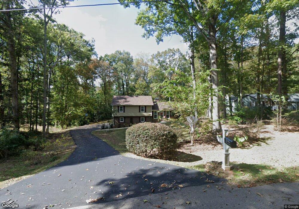
321 Woodfield Cir Lagrange, GA 30240
Estimated Value: $285,417 - $328,000
3
Beds
2
Baths
2,397
Sq Ft
$124/Sq Ft
Est. Value
About This Home
This home is located at 321 Woodfield Cir, Lagrange, GA 30240 and is currently estimated at $298,104, approximately $124 per square foot. 321 Woodfield Cir is a home located in Troup County with nearby schools including Long Cane Elementary School, Berta Weathersbee Elementary School, and Whitesville Road Elementary School.
Ownership History
Date
Name
Owned For
Owner Type
Purchase Details
Closed on
Mar 29, 2011
Sold by
Federal National Mortgage Association
Bought by
Jordan Brian
Current Estimated Value
Purchase Details
Closed on
Jul 22, 2009
Sold by
Sosa Heather Hardison
Bought by
Sosa Pedro A
Purchase Details
Closed on
Aug 26, 1999
Sold by
Bridges Harry D and Bridges Patricia M
Bought by
Sosa Pedro A
Purchase Details
Closed on
Nov 5, 1997
Sold by
Skinner Wallace G and Skinner Jane P
Bought by
Bridges Harry D and Bridges Patricia M
Purchase Details
Closed on
Jun 14, 1980
Sold by
Cousins A Lucian
Bought by
Skinner Wallace G and Skinner Jane P
Purchase Details
Closed on
Oct 14, 1978
Sold by
Davis William B
Bought by
Cousins A Lucian
Purchase Details
Closed on
Feb 14, 1978
Sold by
Knight & Knight Of Laginc
Bought by
Davis William B
Purchase Details
Closed on
Nov 24, 1975
Sold by
Knight W Hooper Etal
Bought by
Knight & Knight Of Laginc
Create a Home Valuation Report for This Property
The Home Valuation Report is an in-depth analysis detailing your home's value as well as a comparison with similar homes in the area
Purchase History
| Date | Buyer | Sale Price | Title Company |
|---|---|---|---|
| Jordan Brian | $74,690 | -- | |
| Sosa Pedro A | -- | -- | |
| Sosa Pedro A | -- | -- | |
| Sosa Pedro A | $97,000 | -- | |
| Bridges Harry D | $88,000 | -- | |
| Skinner Wallace G | $70,100 | -- | |
| Cousins A Lucian | $61,500 | -- | |
| Davis William B | $6,000 | -- | |
| Knight & Knight Of Laginc | -- | -- |
Source: Public Records
Tax History
| Year | Tax Paid | Tax Assessment Tax Assessment Total Assessment is a certain percentage of the fair market value that is determined by local assessors to be the total taxable value of land and additions on the property. | Land | Improvement |
|---|---|---|---|---|
| 2025 | $2,438 | $99,680 | $14,000 | $85,680 |
| 2024 | $2,027 | $76,320 | $14,000 | $62,320 |
| 2023 | $1,382 | $5,823 | $0 | $5,823 |
| 2022 | $1,794 | $66,280 | $8,000 | $58,280 |
| 2021 | $1,687 | $57,920 | $8,000 | $49,920 |
| 2020 | $1,687 | $57,920 | $8,000 | $49,920 |
| 2019 | $1,537 | $52,960 | $8,000 | $44,960 |
| 2018 | $1,526 | $50,600 | $8,000 | $42,600 |
| 2017 | $1,466 | $50,600 | $8,000 | $42,600 |
Source: Public Records
Map
Nearby Homes
- 266 Glass Bridge Rd
- 119 Plymouth Dr
- 640 Hudson Rd
- 113 Colonial Ct Unit 100
- 311 Cumberland Dr
- 101 Ivy Springs Dr
- 112 Foxdale Dr
- 124 Lincoln Ln
- 0 Glass Bridge Rd Unit 10679358
- 124 Foxdale Dr
- 104 Bridlewood Dr
- 135 Planters Ridge Dr
- 474 Newton Rd
- 40 River Point Dr
- 275 Hanson Dr
- 0 Hanson Dr Unit 10641272
- 808 S Fling Rd
- 509 Connie Dr
- 105 Redwood Dr
- 4.5 ACRES Whatley Rd N
- 323 Woodfield Cir
- 319 Woodfield Cir
- 325 Woodfield Cir
- 324 Woodfield Cir
- 324 Woodfield Cir Unit 27
- 317 Woodfield Cir
- 320 Woodfield Cir
- 327 Woodfield Cir
- 359 Maley Rd
- 1049 Pyne Rd
- 1059 Pyne Rd
- 318 Woodfield Cir
- 315 Woodfield Cir
- 328 Woodfield Cir
- 329 Woodfield Cir
- 1029 Pyne Rd
- 109 Oakdale Dr
- 107 Oakdale Dr
- 314 Woodfield Cir
- 313 Woodfield Cir
Your Personal Tour Guide
Ask me questions while you tour the home.