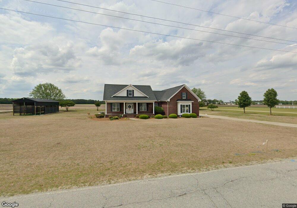
3210 Jim Sutton Rd La Grange, NC 28551
Estimated Value: $233,000 - $390,000
3
Beds
2
Baths
1,985
Sq Ft
$158/Sq Ft
Est. Value
About This Home
This home is located at 3210 Jim Sutton Rd, La Grange, NC 28551 and is currently estimated at $313,865, approximately $158 per square foot. 3210 Jim Sutton Rd is a home with nearby schools including La Grange Elementary School, E.B. Frink Middle School, and North Lenoir High School.
Ownership History
Date
Name
Owned For
Owner Type
Purchase Details
Closed on
Jun 15, 2011
Sold by
Upton & Co
Bought by
Fulghum James David
Current Estimated Value
Home Financials for this Owner
Home Financials are based on the most recent Mortgage that was taken out on this home.
Original Mortgage
$218,321
Outstanding Balance
$151,351
Interest Rate
4.75%
Mortgage Type
FHA
Estimated Equity
$162,514
Create a Home Valuation Report for This Property
The Home Valuation Report is an in-depth analysis detailing your home's value as well as a comparison with similar homes in the area
Home Values in the Area
Average Home Value in this Area
Purchase History
| Date | Buyer | Sale Price | Title Company |
|---|---|---|---|
| Fulghum James David | $224,000 | None Available |
Source: Public Records
Mortgage History
| Date | Status | Borrower | Loan Amount |
|---|---|---|---|
| Open | Fulghum James David | $218,321 |
Source: Public Records
Tax History Compared to Growth
Tax History
| Year | Tax Paid | Tax Assessment Tax Assessment Total Assessment is a certain percentage of the fair market value that is determined by local assessors to be the total taxable value of land and additions on the property. | Land | Improvement |
|---|---|---|---|---|
| 2024 | $2,011 | $207,713 | $16,200 | $191,513 |
| 2023 | $1,928 | $207,713 | $16,200 | $191,513 |
| 2022 | $1,928 | $207,713 | $16,200 | $191,513 |
| 2021 | $1,928 | $207,713 | $16,200 | $191,513 |
| 2020 | $1,928 | $207,713 | $16,200 | $191,513 |
| 2019 | $1,928 | $207,713 | $16,200 | $191,513 |
| 2018 | $1,897 | $207,713 | $16,200 | $191,513 |
| 2017 | $1,901 | $207,713 | $16,200 | $191,513 |
| 2014 | $2,058 | $225,613 | $16,200 | $209,413 |
| 2013 | -- | $225,613 | $16,200 | $209,413 |
Source: Public Records
Map
Nearby Homes
- 3077 Brakefield Dr
- 6272 Highway 70 E
- 112 Abbey Frank St
- 3777 Waters Mill Rd
- 3619 S Caswell St
- Belhaven Plan at Blair Ridge
- Hayden Plan at Blair Ridge
- Cali Plan at Blair Ridge
- Freeport Plan at Blair Ridge
- 4725 Packhouse Rd
- 217 Wood St
- 210 Wood St
- 208 Wood St
- 201 Wood St
- 204 Wood St
- 205 Wood St
- 206 Wood St
- 202 Wood St
- 3263 N Carolina 903
- 3220 Jim Sutton Rd
- 3226 Jim Sutton Rd
- 3229 Jim Sutton Rd
- 3155 Jim Sutton Rd
- 3249 Jim Sutton Rd
- 3147 Jim Sutton Rd
- 3151 Jim Sutton Rd
- 3263 Jim Sutton Rd
- 3273 Jim Sutton Rd
- 3280 Jim Sutton Rd
- 3285 Jim Sutton Rd
- 3094 Jim Sutton Rd
- 3317 Jim Sutton Rd
- 3118 Brakefield Dr
- 7801 Us Highway 70 W
- 3108 Brakefield Dr
- 3098 Brakefield Dr
- 3088 Brakefield Dr
- 4780 Castelloe Dr
- 4710 Willie White Rd