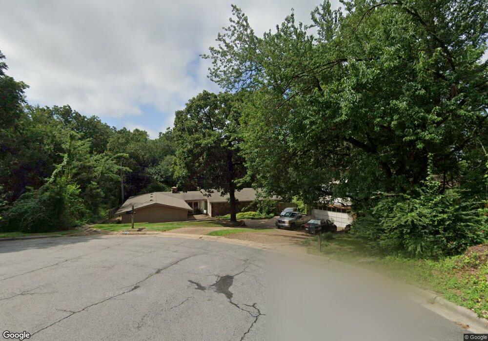
3210 S 34th Ct Fort Smith, AR 72903
Estimated Value: $227,000 - $336,000
--
Bed
3
Baths
2,706
Sq Ft
$106/Sq Ft
Est. Value
About This Home
This home is located at 3210 S 34th Ct, Fort Smith, AR 72903 and is currently estimated at $285,653, approximately $105 per square foot. 3210 S 34th Ct is a home located in Sebastian County with nearby schools including Fairview Elementary School, Ramsey Junior High School, and Southside High School.
Ownership History
Date
Name
Owned For
Owner Type
Purchase Details
Closed on
Sep 30, 2016
Sold by
Roebuck Cistelyn U
Bought by
Cruce Logan R
Current Estimated Value
Home Financials for this Owner
Home Financials are based on the most recent Mortgage that was taken out on this home.
Original Mortgage
$96,000
Outstanding Balance
$76,889
Interest Rate
3.43%
Mortgage Type
New Conventional
Estimated Equity
$208,764
Purchase Details
Closed on
Aug 5, 1998
Bought by
Roebuck James D and Roebuck Cristely
Purchase Details
Closed on
Dec 21, 1993
Bought by
Frye Barbara A and Frye Ralph H
Purchase Details
Closed on
May 12, 1987
Bought by
Mills Barbara A
Purchase Details
Closed on
Sep 29, 1976
Bought by
Glidewell James A and Glidewell Carol E
Purchase Details
Closed on
May 17, 1973
Bought by
Latta Robert A and Latta Loretta M
Create a Home Valuation Report for This Property
The Home Valuation Report is an in-depth analysis detailing your home's value as well as a comparison with similar homes in the area
Home Values in the Area
Average Home Value in this Area
Purchase History
| Date | Buyer | Sale Price | Title Company |
|---|---|---|---|
| Cruce Logan R | $120,000 | Waco Title Co | |
| Roebuck James D | $155,000 | -- | |
| Frye Barbara A | -- | -- | |
| Mills Barbara A | -- | -- | |
| Glidewell James A | -- | -- | |
| Latta Robert A | -- | -- |
Source: Public Records
Mortgage History
| Date | Status | Borrower | Loan Amount |
|---|---|---|---|
| Open | Cruce Logan R | $96,000 |
Source: Public Records
Tax History Compared to Growth
Tax History
| Year | Tax Paid | Tax Assessment Tax Assessment Total Assessment is a certain percentage of the fair market value that is determined by local assessors to be the total taxable value of land and additions on the property. | Land | Improvement |
|---|---|---|---|---|
| 2024 | $1,981 | $37,730 | $5,000 | $32,730 |
| 2023 | $1,766 | $37,730 | $5,000 | $32,730 |
| 2022 | $1,816 | $37,730 | $5,000 | $32,730 |
| 2021 | $1,816 | $37,730 | $5,000 | $32,730 |
| 2020 | $1,816 | $37,730 | $5,000 | $32,730 |
| 2019 | $1,796 | $37,400 | $5,000 | $32,400 |
| 2018 | $1,821 | $37,400 | $5,000 | $32,400 |
| 2017 | $1,614 | $37,400 | $5,000 | $32,400 |
| 2016 | $1,964 | $37,400 | $5,000 | $32,400 |
| 2015 | $1,614 | $37,400 | $5,000 | $32,400 |
| 2014 | $1,629 | $37,450 | $5,000 | $32,450 |
Source: Public Records
Map
Nearby Homes
- 3422 Fresno St
- 3315 Independence St
- 5222 S 31st St
- 3415 S 32nd St
- 3405 S 29th Cir
- 3205 Independence St
- 2925 Gary St Unit 12
- 2906 S Carthage St
- 2929 Gary St Unit 14
- 2808 May Branch Point
- 3725 Hendricks Cir
- 3000 Independence St
- 3820 Dallas St
- 2715 Dallas St
- 3009 Hendricks Blvd
- 3823 Dallas St
- 70 Haven Dr
- 3900 Fresno St
- 2601 Dallas St
- 2522 May Branch Dr