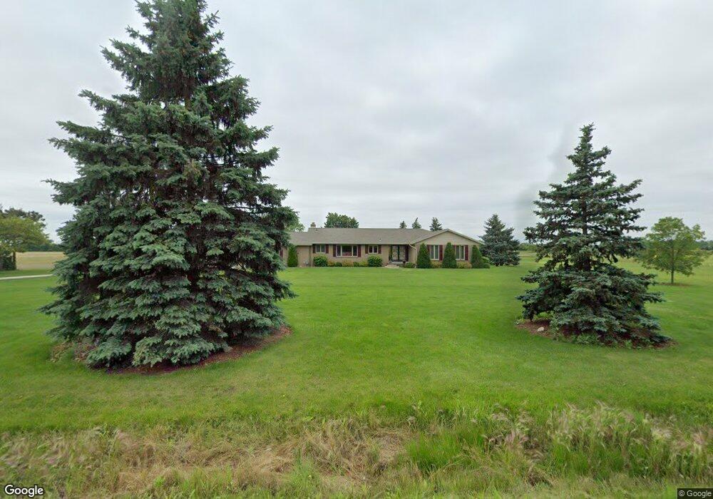
3212 Post Rd Unit Bldg-Unit Newport, MI 48166
Estimated Value: $443,000 - $547,000
4
Beds
3
Baths
2,438
Sq Ft
$203/Sq Ft
Est. Value
About This Home
This home is located at 3212 Post Rd Unit Bldg-Unit, Newport, MI 48166 and is currently estimated at $494,146, approximately $202 per square foot. 3212 Post Rd Unit Bldg-Unit is a home located in Monroe County with nearby schools including Jefferson High School and St. Charles Borromeo Academy.
Ownership History
Date
Name
Owned For
Owner Type
Purchase Details
Closed on
Jul 9, 2021
Sold by
Masserant Rebecca
Bought by
Masserant Mark M and Masserant Deborah L
Current Estimated Value
Purchase Details
Closed on
Jun 15, 2021
Sold by
Masserant Deborah L
Bought by
Masserant Rebecca
Purchase Details
Closed on
Jun 28, 2018
Sold by
Gritter and Michelle
Bought by
Masserant Rebecca and Masserant Deborah L
Purchase Details
Closed on
Jun 27, 2018
Sold by
Gritter and Michelle
Bought by
Masserant Rebecca and Masserant Deborah L
Purchase Details
Closed on
Oct 19, 2000
Sold by
Micallef Ray
Bought by
Laskey Eric
Home Financials for this Owner
Home Financials are based on the most recent Mortgage that was taken out on this home.
Original Mortgage
$34,500
Interest Rate
7.91%
Mortgage Type
New Conventional
Create a Home Valuation Report for This Property
The Home Valuation Report is an in-depth analysis detailing your home's value as well as a comparison with similar homes in the area
Home Values in the Area
Average Home Value in this Area
Purchase History
| Date | Buyer | Sale Price | Title Company |
|---|---|---|---|
| Masserant Mark M | -- | None Available | |
| Masserant Rebecca | -- | None Available | |
| Masserant Rebecca | $330,000 | Lawyers Title | |
| Masserant Rebecca | $330,000 | Lawyers Title | |
| Laskey Eric | $54,500 | -- |
Source: Public Records
Mortgage History
| Date | Status | Borrower | Loan Amount |
|---|---|---|---|
| Previous Owner | Laskey Eric | $34,500 |
Source: Public Records
Tax History Compared to Growth
Tax History
| Year | Tax Paid | Tax Assessment Tax Assessment Total Assessment is a certain percentage of the fair market value that is determined by local assessors to be the total taxable value of land and additions on the property. | Land | Improvement |
|---|---|---|---|---|
| 2025 | $5,332 | $188,100 | $53,100 | $135,000 |
| 2024 | $1,941 | $179,800 | $0 | $0 |
| 2023 | $1,857 | $167,100 | $0 | $0 |
| 2022 | $4,902 | $167,100 | $0 | $0 |
| 2021 | $4,713 | $166,400 | $0 | $0 |
| 2020 | $4,793 | $153,000 | $0 | $0 |
| 2019 | $4,570 | $153,000 | $0 | $0 |
| 2018 | $3,944 | $157,300 | $0 | $0 |
| 2017 | $1,402 | $152,300 | $0 | $0 |
| 2016 | $3,830 | $152,300 | $0 | $0 |
| 2015 | $3,705 | $127,000 | $0 | $0 |
| 2014 | $3,655 | $127,000 | $0 | $0 |
| 2013 | -- | $126,200 | $0 | $0 |
Source: Public Records
Map
Nearby Homes
- 7393 Newport Rd S
- 0 Williams Rd Unit 50112219
- 8199 Hunters Ridge Dr
- 8187 Hunters Ridge Dr
- 8139 Hunters Ridge Dr
- 8127 Hunters Ridge Dr
- 8103 Hunters Ridge Dr
- 8091 Hunters Ridge Dr
- 8118 Hunters Ridge Dr
- 4468 Partridge Ln
- 00000 N Dixie Hwy
- 8082 Hunters Ridge Dr
- 8070 Hunters Ridge Dr
- 8478 Cobblestone Dr
- 0 Nadeau Rd
- 8502 Cobblestone Dr
- 8489 Cobblestone Dr
- 0 N Dixie Hwy Unit 50186292
- 8459 Talon Ct
- 8584 Cobblestone Dr
- 3212 Post Rd
- 3130 Post Rd
- 3143 Post Rd
- 3328 Post Rd
- 3207 Post Rd
- 3339 Post Rd
- 3081 Post Rd
- 000 Post
- 3019 Post Rd
- 3301 Post Rd
- 6858 Newport South Rd
- 6770 Newport South Rd
- 6800 Newport South Rd
- 6800 Newport South Rd
- 6800 Newport Rd S
- 6843 Newport South Rd
- 6843 Newport
- 6775 Newport South Rd
- 6775 Newport South Rd
- 3504 Post Rd