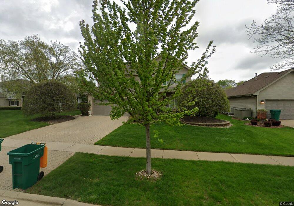
3213 Apache Dr New Lenox, IL 60451
Estimated Value: $406,157 - $479,000
4
Beds
3
Baths
--
Sq Ft
10,019
Sq Ft Lot
About This Home
This home is located at 3213 Apache Dr, New Lenox, IL 60451 and is currently estimated at $459,789. 3213 Apache Dr is a home located in Will County with nearby schools including Haines Elementary School, Oster-Oakview School, and Lincoln Way West.
Ownership History
Date
Name
Owned For
Owner Type
Purchase Details
Closed on
Mar 12, 2015
Sold by
Baker Robert and Baker Debra
Bought by
Baker Robert
Current Estimated Value
Purchase Details
Closed on
Feb 17, 2006
Sold by
Weis Kyle R and Weis Danielle L
Bought by
Baker Robert and Baker Debra
Home Financials for this Owner
Home Financials are based on the most recent Mortgage that was taken out on this home.
Original Mortgage
$287,820
Outstanding Balance
$162,031
Interest Rate
6.2%
Mortgage Type
New Conventional
Estimated Equity
$297,758
Purchase Details
Closed on
Aug 20, 1999
Sold by
Standard Bank & Trust Company
Bought by
Weis Kyle R and Weis Danielle L
Home Financials for this Owner
Home Financials are based on the most recent Mortgage that was taken out on this home.
Original Mortgage
$180,000
Interest Rate
7.61%
Create a Home Valuation Report for This Property
The Home Valuation Report is an in-depth analysis detailing your home's value as well as a comparison with similar homes in the area
Home Values in the Area
Average Home Value in this Area
Purchase History
| Date | Buyer | Sale Price | Title Company |
|---|---|---|---|
| Baker Robert | -- | None Available | |
| Baker Robert | $360,000 | Millennium Title Group | |
| Weis Kyle R | $201,000 | -- |
Source: Public Records
Mortgage History
| Date | Status | Borrower | Loan Amount |
|---|---|---|---|
| Open | Baker Robert | $287,820 | |
| Previous Owner | Weis Kyle R | $180,000 |
Source: Public Records
Tax History
| Year | Tax Paid | Tax Assessment Tax Assessment Total Assessment is a certain percentage of the fair market value that is determined by local assessors to be the total taxable value of land and additions on the property. | Land | Improvement |
|---|---|---|---|---|
| 2024 | $10,464 | $134,083 | $33,732 | $100,351 |
| 2023 | $10,464 | $122,227 | $30,749 | $91,478 |
| 2022 | $9,431 | $112,600 | $28,327 | $84,273 |
| 2021 | $8,984 | $105,897 | $26,641 | $79,256 |
| 2020 | $8,710 | $102,118 | $25,690 | $76,428 |
| 2019 | $8,428 | $98,951 | $24,893 | $74,058 |
| 2018 | $8,197 | $95,540 | $24,035 | $71,505 |
| 2017 | $7,970 | $92,793 | $23,344 | $69,449 |
| 2016 | $7,774 | $90,309 | $22,719 | $67,590 |
| 2015 | $7,513 | $87,466 | $22,004 | $65,462 |
| 2014 | $7,513 | $86,386 | $21,732 | $64,654 |
| 2013 | $7,513 | $87,550 | $22,025 | $65,525 |
Source: Public Records
Map
Nearby Homes
- 3211 Apache Dr Unit 1
- 2909 Bisbee Dr
- 0 Silver Cross Blvd
- 918 Neufairfield Dr
- 1301 Silver Cross Blvd
- 14119 W Maple Rd
- 1999 Silver Cross Blvd
- 933 Saddle Ridge Dr
- 931 Saddle Ridge Dr
- 207 York Place
- 2433 Rocky Hill Cir
- 1111 Canyon View Ln
- 1013 Brush Hill Cir
- 2412 Silver Hill Cir
- 1110 Colonial Dr Unit 1
- 2216 Beechwood Rd
- 1500 Ramp
- 135 Sonoma Rd
- 542 Doxbury Ln
- 550 Doxbury Ln
Your Personal Tour Guide
Ask me questions while you tour the home.