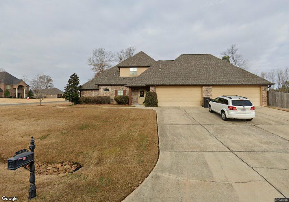
3213 Mossy Rock Point Haughton, LA 71037
Eastwood NeighborhoodEstimated Value: $522,000 - $555,399
5
Beds
3
Baths
3,167
Sq Ft
$169/Sq Ft
Est. Value
About This Home
This home is located at 3213 Mossy Rock Point, Haughton, LA 71037 and is currently estimated at $536,350, approximately $169 per square foot. 3213 Mossy Rock Point is a home with nearby schools including T.L. Rodes Elementary School, Platt Elementary School, and Princeton Elementary School.
Ownership History
Date
Name
Owned For
Owner Type
Purchase Details
Closed on
Mar 21, 2016
Sold by
Jordan Cory Gaylyn and Jordan April Karyn
Bought by
West Terry Blair and West Cynthia Marie
Current Estimated Value
Purchase Details
Closed on
Feb 4, 2010
Sold by
White Brandon Michael and White Kristi Michell Loe
Bought by
Jordan Cory Gaylyn and Jordan April Karyn Lang
Home Financials for this Owner
Home Financials are based on the most recent Mortgage that was taken out on this home.
Original Mortgage
$426,000
Interest Rate
5.08%
Mortgage Type
Purchase Money Mortgage
Create a Home Valuation Report for This Property
The Home Valuation Report is an in-depth analysis detailing your home's value as well as a comparison with similar homes in the area
Home Values in the Area
Average Home Value in this Area
Purchase History
| Date | Buyer | Sale Price | Title Company |
|---|---|---|---|
| West Terry Blair | $449,900 | None Available | |
| Jordan Cory Gaylyn | -- | None Available |
Source: Public Records
Mortgage History
| Date | Status | Borrower | Loan Amount |
|---|---|---|---|
| Previous Owner | Jordan Cory Gaylyn | $426,000 |
Source: Public Records
Tax History Compared to Growth
Tax History
| Year | Tax Paid | Tax Assessment Tax Assessment Total Assessment is a certain percentage of the fair market value that is determined by local assessors to be the total taxable value of land and additions on the property. | Land | Improvement |
|---|---|---|---|---|
| 2024 | $36 | $50,057 | $5,200 | $44,857 |
| 2023 | $4,249 | $41,921 | $3,950 | $37,971 |
| 2022 | $4,226 | $41,921 | $3,950 | $37,971 |
| 2021 | $4,226 | $41,921 | $3,950 | $37,971 |
| 2020 | $4,226 | $41,921 | $3,950 | $37,971 |
| 2019 | $4,248 | $41,677 | $3,500 | $38,177 |
| 2018 | $4,248 | $41,677 | $3,500 | $38,177 |
| 2017 | $4,018 | $40,220 | $3,500 | $36,720 |
| 2016 | $4,018 | $40,220 | $3,500 | $36,720 |
| 2015 | $3,765 | $40,040 | $3,500 | $36,540 |
| 2014 | $3,765 | $40,040 | $3,500 | $36,540 |
Source: Public Records
Map
Nearby Homes
- 2115 Hollow Wood Way
- 2816 Sunrise Point
- 2549 Bloomfield Ln
- 2228 Grapevine Ln
- 2117 Forest Hills Blvd
- 2200 Grapevine Ln
- 2805 Clearbrook Way
- 1940 Honeytree Trail
- 212 Sweetgum Dr
- 1859 Sparrow Ridge
- 108 Wisteria Cir
- 105 Flagg Dr
- 4705 Highway 80 Unit 1
- 1908 Highpoint Place
- 305 Pine Cone Cir
- 995 Wafer Rd
- 123 Taylor Bend St
- 128 Taylor Bend St
- 1197 Wafer Rd
- 506 Whispering Pine Cir
- 2101 Hollow Wood Way
- 3209 Mossy Rock Point
- 2103 Hollow Wood Way
- 2100 Hollow Wood Way
- 3205 Mossy Rock Point
- 3208 Mossy Rock Point
- 3221 Mossy Rock Point
- 2104 Hollow Wood Way
- 2105 Hollow Wood Way
- 3204 Mossy Rock Point
- 2107 Hollow Wood Way
- 2106 Hollow Wood Way
- 2643 Firefly Trail
- 2831 Sunrise Point
- 3200 Mossy Rock Point
- 1808 Coldwater Creek
- 1804 Coldwater Creek
- 1810 Coldwater Creek
- 2108 Hollow Wood Way