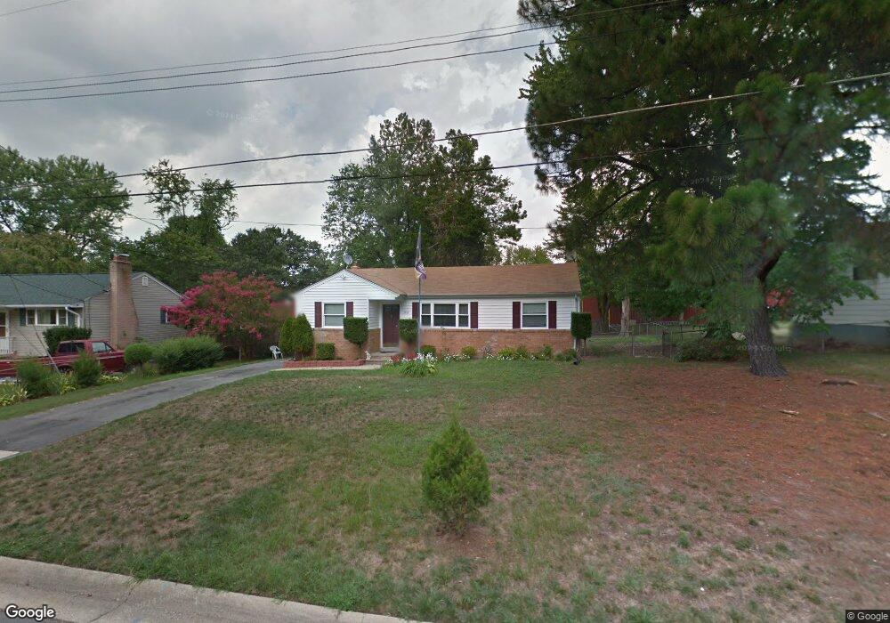
3214 Dalewood Rd Fort Washington, MD 20744
Estimated Value: $353,000 - $399,000
--
Bed
1
Bath
1,123
Sq Ft
$330/Sq Ft
Est. Value
About This Home
This home is located at 3214 Dalewood Rd, Fort Washington, MD 20744 and is currently estimated at $370,227, approximately $329 per square foot. 3214 Dalewood Rd is a home located in Prince George's County with nearby schools including Tayac Elementary School, Friendly High School, and The Messiah Academy.
Ownership History
Date
Name
Owned For
Owner Type
Purchase Details
Closed on
Dec 7, 2004
Sold by
Provident Bank
Bought by
Olivas Luis E and Olivas Deisy Rivas
Current Estimated Value
Purchase Details
Closed on
Sep 24, 2004
Sold by
Provident Bank
Bought by
Olivas Luis E and Olivas Deisy Rivas
Purchase Details
Closed on
May 26, 2004
Sold by
Mcdonald Stephen G
Bought by
Provident Bank
Purchase Details
Closed on
Jul 25, 1991
Sold by
Mcdonald Stephen G
Bought by
Mcdonald Stephen G
Create a Home Valuation Report for This Property
The Home Valuation Report is an in-depth analysis detailing your home's value as well as a comparison with similar homes in the area
Home Values in the Area
Average Home Value in this Area
Purchase History
| Date | Buyer | Sale Price | Title Company |
|---|---|---|---|
| Olivas Luis E | $195,000 | -- | |
| Olivas Luis E | $195,000 | -- | |
| Provident Bank | $121,627 | -- | |
| Mcdonald Stephen G | $8,000 | -- |
Source: Public Records
Tax History Compared to Growth
Tax History
| Year | Tax Paid | Tax Assessment Tax Assessment Total Assessment is a certain percentage of the fair market value that is determined by local assessors to be the total taxable value of land and additions on the property. | Land | Improvement |
|---|---|---|---|---|
| 2025 | $4,047 | $254,967 | -- | -- |
| 2024 | $4,047 | $245,500 | $101,500 | $144,000 |
| 2023 | $3,825 | $230,633 | $0 | $0 |
| 2022 | $3,604 | $215,767 | $0 | $0 |
| 2021 | $3,383 | $200,900 | $100,700 | $100,200 |
| 2020 | $3,339 | $188,033 | $0 | $0 |
| 2019 | $3,001 | $175,167 | $0 | $0 |
| 2018 | $2,810 | $162,300 | $75,700 | $86,600 |
| 2017 | $2,694 | $154,500 | $0 | $0 |
| 2016 | -- | $146,700 | $0 | $0 |
| 2015 | $2,541 | $138,900 | $0 | $0 |
| 2014 | $2,541 | $138,900 | $0 | $0 |
Source: Public Records
Map
Nearby Homes
- 8515 Allentown Rd
- 0 Allentown Rd Unit MDPG2162754
- 0 Allentown Rd Unit MDPG2161340
- 10125 Allentown Rd
- 3316 Marston Dr
- 3019 Brodkin Ave
- 3004 Alderton Ave
- 8211 Joselle Ct
- 8502 Waco Dr
- 8136 Comet Dr
- 8703 Pamper Ln
- 3407 Wayneswood Rd
- 3105 Calydon Ct
- 3506 Wayneswood Rd
- 2804 Testway Ave
- 3910 Oaklawn Rd
- 9202 Pinehurst Dr
- 8016 Bock Rd
- 9012 Doris Dr
- 7808 Den Meade Ave
- 3216 Dalewood Rd
- 3212 Dalewood Rd
- 8509 Allentown Rd
- 3210 Dalewood Rd
- 8505 Allentown Rd
- 8427 Allentown Rd
- 8427 Allentown Rd Unit 1
- 8427 Allentown Rd Unit 2
- 3215 Dalewood Rd
- 3213 Dalewood Rd
- 3217 Dalewood Rd
- 8501 Allentown Rd
- 3208 Dalewood Rd
- 3211 Dalewood Rd
- 8423 Allentown Rd
- 3206 Dalewood Rd
- 9604, 08, 12, 16 & 9 Allentown Rd
- 3207 Dalewood Rd
- 8419 Allentown Rd
- 8517 Allentown Rd