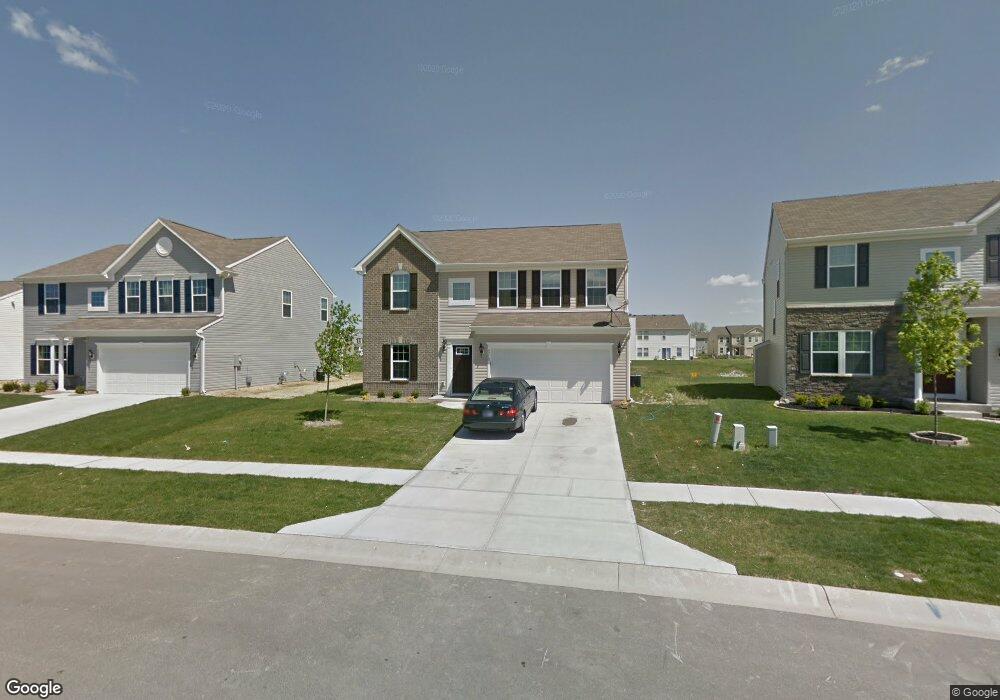
3215 Hurst St Whiteland, IN 46184
Estimated Value: $292,000 - $324,000
4
Beds
3
Baths
2,384
Sq Ft
$130/Sq Ft
Est. Value
About This Home
This home is located at 3215 Hurst St, Whiteland, IN 46184 and is currently estimated at $310,627, approximately $130 per square foot. 3215 Hurst St is a home located in Johnson County with nearby schools including Pleasant Crossing Elementary School, Clark-Pleasant Middle School, and Whiteland Community High School.
Ownership History
Date
Name
Owned For
Owner Type
Purchase Details
Closed on
Oct 29, 2016
Sold by
Kaur Rupinderjeet and Singh Manavdeep
Bought by
Kaur Rupinderjeet and Singh Jarnail
Current Estimated Value
Purchase Details
Closed on
Nov 7, 2011
Sold by
Nvr Inc
Bought by
Kaur Rupinderjeet and Singh Manavdeep
Home Financials for this Owner
Home Financials are based on the most recent Mortgage that was taken out on this home.
Original Mortgage
$133,663
Interest Rate
3.97%
Create a Home Valuation Report for This Property
The Home Valuation Report is an in-depth analysis detailing your home's value as well as a comparison with similar homes in the area
Home Values in the Area
Average Home Value in this Area
Purchase History
| Date | Buyer | Sale Price | Title Company |
|---|---|---|---|
| Kaur Rupinderjeet | -- | None Available | |
| Kaur Rupinderjeet | -- | None Available |
Source: Public Records
Mortgage History
| Date | Status | Borrower | Loan Amount |
|---|---|---|---|
| Previous Owner | Kaur Rupinderjeet | $133,663 |
Source: Public Records
Tax History Compared to Growth
Tax History
| Year | Tax Paid | Tax Assessment Tax Assessment Total Assessment is a certain percentage of the fair market value that is determined by local assessors to be the total taxable value of land and additions on the property. | Land | Improvement |
|---|---|---|---|---|
| 2025 | $3,036 | $297,000 | $56,000 | $241,000 |
| 2024 | $3,036 | $290,200 | $56,000 | $234,200 |
| 2023 | $2,930 | $281,000 | $56,000 | $225,000 |
| 2022 | $2,521 | $242,400 | $29,900 | $212,500 |
| 2021 | $2,149 | $206,200 | $29,900 | $176,300 |
| 2020 | $1,887 | $180,300 | $29,900 | $150,400 |
| 2019 | $1,770 | $169,300 | $29,900 | $139,400 |
| 2018 | $1,662 | $166,100 | $18,100 | $148,000 |
| 2017 | $1,598 | $158,800 | $18,100 | $140,700 |
| 2016 | $1,560 | $156,000 | $18,100 | $137,900 |
| 2014 | $1,451 | $145,100 | $22,100 | $123,000 |
| 2013 | $1,451 | $146,400 | $22,100 | $124,300 |
Source: Public Records
Map
Nearby Homes
- 3196 Underwood Dr
- 2916 Lodgepole Dr
- 577 Stobus Dr
- 2545 Wildflower Ln
- 2489 Wildflower Ln
- 698 Pine Lake Dr
- 767 Mountain Pine Dr
- 2400 Grand Fir Dr
- 2418 Ashton Ln
- 731 W 600 N
- 2357 Grand Fir Dr
- 700 Mountain Pine Dr
- 2277 Maple Stone Ln
- 2284 Blossom Dr
- 3481 S Honey Creek Rd
- 389 Springfield Cir
- 0 W Worthsville Rd
- 1059 Cherry Tree Ln
- 2288 Shadow Trace Way
- 2525 Summerwood Ln