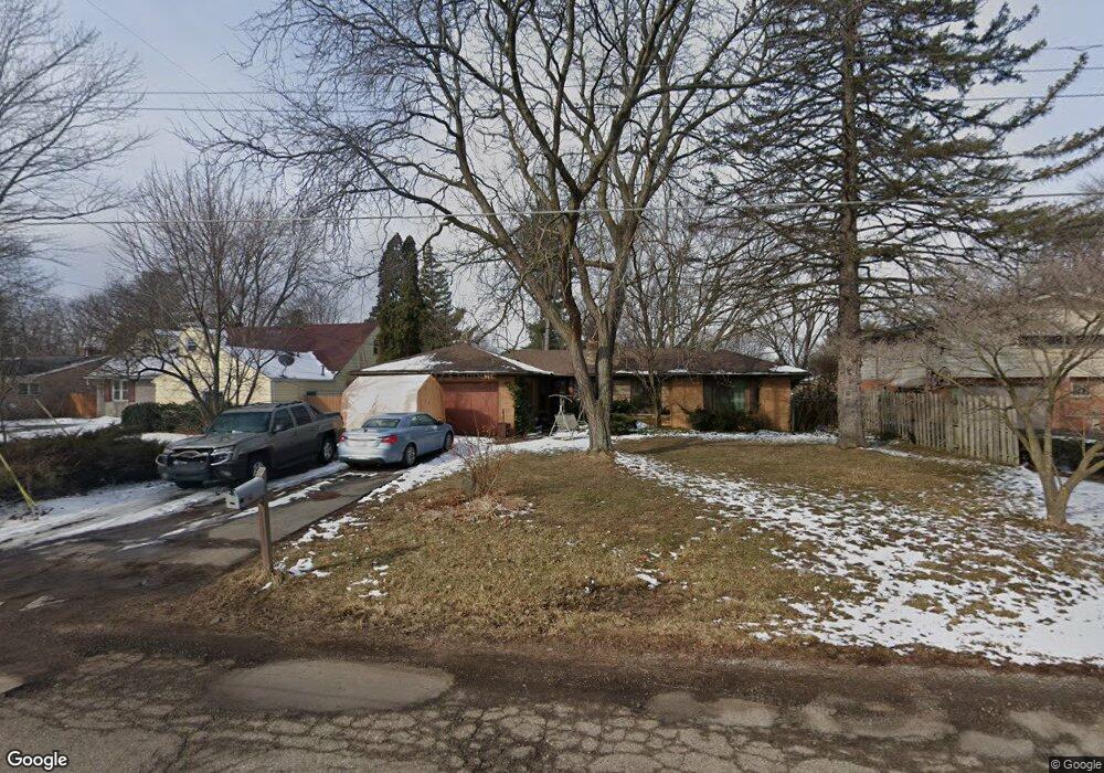
3216 Circle Dr Flint, MI 48507
Circle Neighborhood NeighborhoodEstimated Value: $148,000 - $180,000
3
Beds
3
Baths
2,172
Sq Ft
$74/Sq Ft
Est. Value
About This Home
This home is located at 3216 Circle Dr, Flint, MI 48507 and is currently estimated at $161,797, approximately $74 per square foot. 3216 Circle Dr is a home located in Genesee County with nearby schools including Freeman Elementary School, Flint Southwestern Classical Academy, and International Academy of Flint (K-12).
Ownership History
Date
Name
Owned For
Owner Type
Purchase Details
Closed on
Feb 29, 2024
Sold by
Bonnett Kerry K and Pokrak-Bonnett Jayne
Bought by
Bonnett Kerry K and Pokrak-Bonnett Jayne
Current Estimated Value
Home Financials for this Owner
Home Financials are based on the most recent Mortgage that was taken out on this home.
Original Mortgage
$55,500
Outstanding Balance
$53,267
Interest Rate
6.6%
Mortgage Type
New Conventional
Estimated Equity
$108,530
Purchase Details
Closed on
Sep 4, 2013
Sold by
Henry Diane D and Janet E Rice Living Trust
Bought by
Bonnett Kerry K
Purchase Details
Closed on
Mar 6, 2006
Sold by
Rice Janet E and Rice Jan E
Bought by
Rice Janet E and The Janet E Rice Living Trust
Create a Home Valuation Report for This Property
The Home Valuation Report is an in-depth analysis detailing your home's value as well as a comparison with similar homes in the area
Home Values in the Area
Average Home Value in this Area
Purchase History
| Date | Buyer | Sale Price | Title Company |
|---|---|---|---|
| Bonnett Kerry K | -- | Mortgage Connect | |
| Bonnett Kerry K | -- | None Available | |
| Rice Janet E | -- | None Available |
Source: Public Records
Mortgage History
| Date | Status | Borrower | Loan Amount |
|---|---|---|---|
| Open | Bonnett Kerry K | $55,500 |
Source: Public Records
Tax History
| Year | Tax Paid | Tax Assessment Tax Assessment Total Assessment is a certain percentage of the fair market value that is determined by local assessors to be the total taxable value of land and additions on the property. | Land | Improvement |
|---|---|---|---|---|
| 2025 | $2,112 | $76,600 | $0 | $0 |
| 2024 | $1,874 | $75,200 | $0 | $0 |
| 2023 | $2,419 | $69,300 | $0 | $0 |
| 2022 | $0 | $56,600 | $0 | $0 |
| 2021 | $2,470 | $54,500 | $0 | $0 |
| 2020 | $2,234 | $51,400 | $0 | $0 |
| 2019 | $2,156 | $41,400 | $0 | $0 |
| 2018 | $2,229 | $40,200 | $0 | $0 |
| 2017 | $2,161 | $0 | $0 | $0 |
| 2016 | $2,144 | $0 | $0 | $0 |
| 2015 | -- | $0 | $0 | $0 |
| 2014 | -- | $0 | $0 | $0 |
| 2012 | -- | $35,500 | $0 | $0 |
Source: Public Records
Map
Nearby Homes
- 720 Algonquin Ave
- 3505 Comanche Ave
- 3617 Circle Dr
- 2910 Shawnee Ave
- 3110 Menominee Ave
- 630 Buckingham Ave
- 3009 Menominee Ave
- 621 Burroughs Ave
- 366 E Atherton Rd
- 420 Burroughs Ave
- 352 Buckingham Ave
- 4126 Circle Dr
- 4127 Custer Ave
- 326 Burroughs Ave
- 3218 Collingwood Pkwy
- 3056 Shaw St
- 3914 Red Arrow Rd
- 213 E Lakeview Ave
- 2221 Howard Ave
- 617 McKeighan Ave
- 3202 Circle Dr
- 3224 Circle Dr
- 3306 Circle Dr
- 3122 Circle Dr
- 3314 Circle Dr
- 3215 Circle Dr
- 3201 Circle Dr
- 3301 Circle Dr
- 3114 Circle Dr
- 3309 Circle Dr
- 3123 Circle Dr
- 3402 Circle Dr
- 3317 Circle Dr
- 711 Eldon Baker Dr
- 3210 Dearborn Ave
- 3202 Dearborn Ave
- 712 Eldon Baker Dr
- 3102 Circle Dr
- 3126 Dearborn Ave
- 3325 Circle Dr
Your Personal Tour Guide
Ask me questions while you tour the home.