Estimated Value: $338,000 - $360,000
7
Beds
3
Baths
3,252
Sq Ft
$107/Sq Ft
Est. Value
About This Home
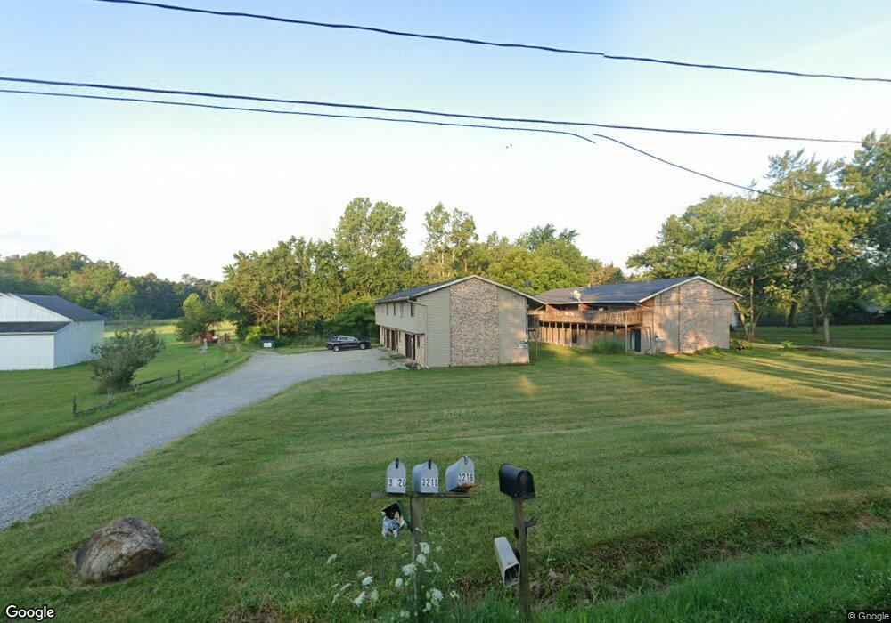
This home is located at 3216 Mayfair Rd Unit 3220, Akron, OH 44312 and is currently estimated at $347,370, approximately $106 per square foot. 3216 Mayfair Rd Unit 3220 is a home located in Summit County with nearby schools including Greenwood Elementary School, Green Primary School, and Green Intermediate Elementary School.
Ownership History
Date
Name
Owned For
Owner Type
Purchase Details
Closed on
Aug 12, 2020
Sold by
Gangl and Christina
Bought by
Gangl Alexander and Gangl Christina
Current Estimated Value
Purchase Details
Closed on
Aug 11, 2020
Sold by
Gangl and Christina
Bought by
Gangl Alexander and Gangl Christina
Purchase Details
Closed on
Apr 16, 2001
Sold by
Woodford Michael and Woodford Susan
Bought by
Gangl Alexander and Gangl Christina
Home Financials for this Owner
Home Financials are based on the most recent Mortgage that was taken out on this home.
Original Mortgage
$153,450
Interest Rate
7.03%
Create a Home Valuation Report for This Property
The Home Valuation Report is an in-depth analysis detailing your home's value as well as a comparison with similar homes in the area
Home Values in the Area
Average Home Value in this Area
Purchase History
| Date | Buyer | Sale Price | Title Company |
|---|---|---|---|
| Gangl Alexander | -- | None Listed On Document | |
| Gangl Alexander | -- | None Listed On Document | |
| Gangl Alexander | $170,500 | Endress/Lawyers Title |
Source: Public Records
Mortgage History
| Date | Status | Borrower | Loan Amount |
|---|---|---|---|
| Previous Owner | Gangl Alexander | $153,450 |
Source: Public Records
Tax History Compared to Growth
Tax History
| Year | Tax Paid | Tax Assessment Tax Assessment Total Assessment is a certain percentage of the fair market value that is determined by local assessors to be the total taxable value of land and additions on the property. | Land | Improvement |
|---|---|---|---|---|
| 2025 | $5,002 | $104,265 | $18,977 | $85,288 |
| 2024 | $5,002 | $104,265 | $18,977 | $85,288 |
| 2023 | $5,002 | $104,265 | $18,977 | $85,288 |
| 2022 | $3,918 | $73,501 | $15,061 | $58,440 |
| 2021 | $3,678 | $73,501 | $15,061 | $58,440 |
| 2020 | $4,070 | $82,910 | $15,060 | $67,850 |
| 2019 | $3,530 | $67,410 | $15,060 | $52,350 |
| 2018 | $3,611 | $67,410 | $15,060 | $52,350 |
| 2017 | $3,275 | $67,410 | $15,060 | $52,350 |
| 2016 | $3,259 | $57,380 | $15,060 | $42,320 |
| 2015 | $3,275 | $57,380 | $15,060 | $42,320 |
| 2014 | $3,254 | $57,380 | $15,060 | $42,320 |
| 2013 | $3,272 | $57,440 | $15,060 | $42,380 |
Source: Public Records
Map
Nearby Homes
- 3117 Imrek Dr
- 2189 E Park Dr
- 1959 Fairway Dr
- 3003 Myersville Rd
- 2577 Sweitzer Rd
- 2944 Sunset Dr
- 3598 Elmhurst Cir
- 2619 Henrietta Dr
- 2575 Myersville Rd
- 3523 Parfoure Blvd
- 3541 Elmhurst Cir
- 3083 Massillon Rd
- 2664 Pine Lake Trail
- 1702 Far View Rd
- 2418 Island Dr
- 2771 Superior Dr
- 2518 Glenshire Cir Unit 36A
- 2500 Marlborough Dr
- 3514 Chanticleer Ct
- 3534 Chanticleer Ct
- 3206 Mayfair Rd Unit 3210
- 3238 Mayfair Rd
- 3238 Mayfair Rd
- 3202 Mayfair Rd
- 3217 Mayfair Rd
- 3209 Mayfair Rd
- 3190 Mayfair Rd
- 3250 Mayfair Rd
- 3241 Mayfair Rd
- 3180 Mayfair Rd
- 3185 Mayfair Rd
- 3260 Mayfair Rd
- 3170 Mayfair Rd
- 3257 Mayfair Rd
- 3179 Mayfair Rd
- 3270 Mayfair Rd
- 3267 Mayfair Rd
- 3280 Mayfair Rd
- 3160 Mayfair Rd
- 3048 Lomae Rd