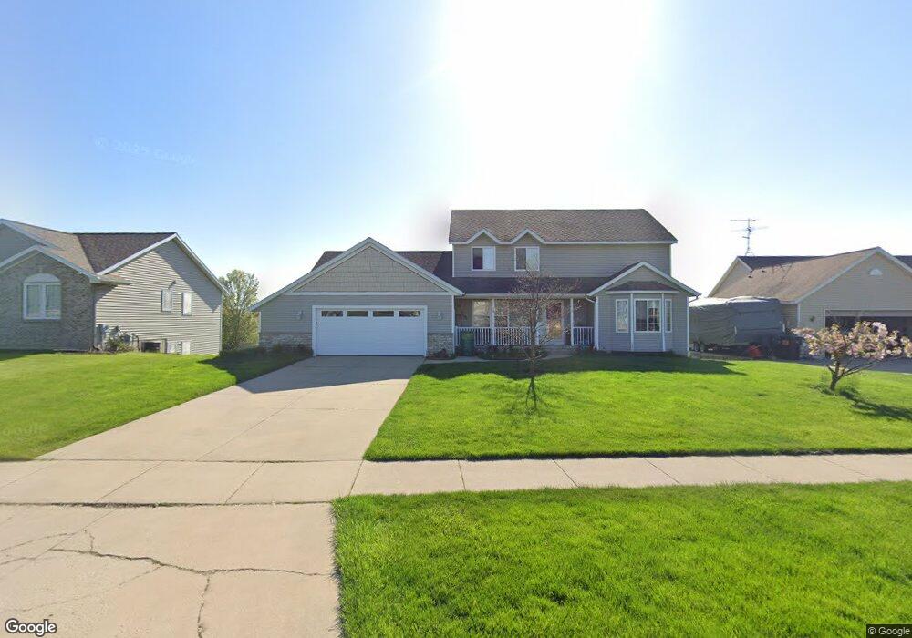
3217 Camrose Dr Hudsonville, MI 49426
Estimated Value: $473,000 - $542,000
4
Beds
3
Baths
2,600
Sq Ft
$195/Sq Ft
Est. Value
About This Home
This home is located at 3217 Camrose Dr, Hudsonville, MI 49426 and is currently estimated at $507,079, approximately $195 per square foot. 3217 Camrose Dr is a home located in Ottawa County with nearby schools including Georgetown Elementary School, Baldwin Street Middle School, and Hudsonville Freshman Campus.
Ownership History
Date
Name
Owned For
Owner Type
Purchase Details
Closed on
Oct 3, 2025
Sold by
Folkert Bradley and Folkert Janel K
Bought by
Folkert Bradley M and Folkert Janel K
Current Estimated Value
Purchase Details
Closed on
Nov 27, 2002
Sold by
Mulder Curtis and Mulder Sally A
Bought by
Folkert Bradley and Folkert Janel K
Home Financials for this Owner
Home Financials are based on the most recent Mortgage that was taken out on this home.
Original Mortgage
$148,000
Interest Rate
6.23%
Mortgage Type
Purchase Money Mortgage
Purchase Details
Closed on
Jun 27, 2002
Sold by
Kvw Venture
Bought by
Mulder Curtis L and Mulder Sally A
Create a Home Valuation Report for This Property
The Home Valuation Report is an in-depth analysis detailing your home's value as well as a comparison with similar homes in the area
Home Values in the Area
Average Home Value in this Area
Purchase History
| Date | Buyer | Sale Price | Title Company |
|---|---|---|---|
| Folkert Bradley M | -- | None Listed On Document | |
| Folkert Bradley | $219,000 | Metropolitan Title Co | |
| Mulder Curtis L | $41,900 | -- |
Source: Public Records
Mortgage History
| Date | Status | Borrower | Loan Amount |
|---|---|---|---|
| Previous Owner | Folkert Bradley | $148,000 |
Source: Public Records
Tax History Compared to Growth
Tax History
| Year | Tax Paid | Tax Assessment Tax Assessment Total Assessment is a certain percentage of the fair market value that is determined by local assessors to be the total taxable value of land and additions on the property. | Land | Improvement |
|---|---|---|---|---|
| 2025 | $3,809 | $245,500 | $0 | $0 |
| 2024 | $3,296 | $222,200 | $0 | $0 |
| 2023 | $3,148 | $192,800 | $0 | $0 |
| 2022 | $3,459 | $180,800 | $0 | $0 |
| 2021 | $3,361 | $172,800 | $0 | $0 |
| 2020 | $3,326 | $164,200 | $0 | $0 |
| 2019 | $3,331 | $148,900 | $0 | $0 |
| 2018 | $3,105 | $139,500 | $0 | $0 |
| 2017 | $3,048 | $140,000 | $0 | $0 |
| 2016 | $3,031 | $132,500 | $0 | $0 |
| 2015 | $2,892 | $127,000 | $0 | $0 |
| 2014 | $2,892 | $111,600 | $0 | $0 |
Source: Public Records
Map
Nearby Homes
- 7313 Valhalla Dr
- 7318 Alycia Dr
- 3528 Tearose Dr
- 2921 N Wentward Ct
- 7381 Rolling Hills Dr
- 2969 Osprey Dr Unit 27
- 6760 N Wentward Ct
- 3544 Nobb Hill Dr
- 3617 Teton Dr
- 6722 N Wentward Ct Unit 77
- V/L Port Sheldon St
- 3204 Port Sheldon St
- 7068 Jasper Dr
- 6714 Cedar Grove W
- 6724 28th Ave
- 2698 Cedargrove N
- 6950 Meadowcreek Dr
- 3808 Port Sheldon St
- 6340 Summer Dr
- 4101 Blair St
- 3229 Camrose Dr
- 3209 Camrose Dr
- 7043 Crimson Ct
- 3197 Rosewood St
- 3197 Rosewood St
- 3237 Camrose Dr
- 7053 Crimson Ct
- 3240 Camrose Dr
- 3239 Rosewood St
- 3179 Rosewood St
- 3248 Camrose Dr
- 3215 Deep Rose Dr
- 7065 Crimson Ct
- 7048 Crimson Ct
- 3198 Rosewood St
- 3214 Rosewood St
- 3254 Camrose Dr
- 7077 Crimson Ct
- 7018 Rosewood Ct
- 3219 Deep Rose Dr