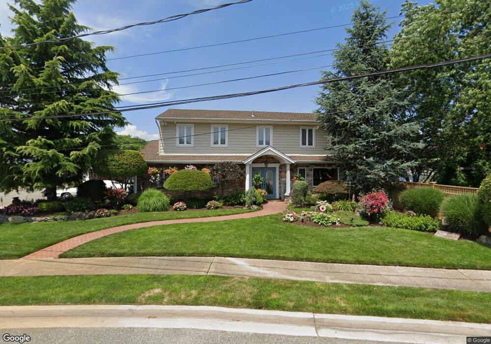
3217 Leeward Ln Merrick, NY 11566
Estimated Value: $1,319,597 - $1,376,000
4
Beds
3
Baths
2,701
Sq Ft
$499/Sq Ft
Est. Value
About This Home
This home is located at 3217 Leeward Ln, Merrick, NY 11566 and is currently estimated at $1,347,799, approximately $499 per square foot. 3217 Leeward Ln is a home located in Nassau County with nearby schools including Burcham Elementary School, Merrick Avenue Middle School, and John F. Kennedy High School.
Ownership History
Date
Name
Owned For
Owner Type
Purchase Details
Closed on
Dec 19, 2016
Sold by
Morgan Tracey and Morgan Barbara
Bought by
Morgan Tracey
Current Estimated Value
Purchase Details
Closed on
Jun 18, 1997
Sold by
Edelman Phyllis
Bought by
Morgan Trucey Barbara
Create a Home Valuation Report for This Property
The Home Valuation Report is an in-depth analysis detailing your home's value as well as a comparison with similar homes in the area
Home Values in the Area
Average Home Value in this Area
Purchase History
| Date | Buyer | Sale Price | Title Company |
|---|---|---|---|
| Morgan Tracey | -- | Stewart Title Insurance Comp | |
| Morgan Trucey Barbara | $370,000 | -- |
Source: Public Records
Tax History Compared to Growth
Tax History
| Year | Tax Paid | Tax Assessment Tax Assessment Total Assessment is a certain percentage of the fair market value that is determined by local assessors to be the total taxable value of land and additions on the property. | Land | Improvement |
|---|---|---|---|---|
| 2025 | $24,588 | $810 | $339 | $471 |
| 2024 | $5,769 | $822 | $344 | $478 |
| 2023 | $24,804 | $871 | $374 | $497 |
| 2022 | $24,804 | $822 | $344 | $478 |
| 2021 | $31,697 | $859 | $336 | $523 |
| 2020 | $25,260 | $1,423 | $1,126 | $297 |
| 2019 | $27,069 | $1,403 | $993 | $410 |
| 2018 | $23,581 | $1,707 | $0 | $0 |
| 2017 | $18,216 | $1,707 | $1,208 | $499 |
| 2016 | $25,521 | $1,707 | $1,208 | $499 |
| 2015 | $6,774 | $1,707 | $1,208 | $499 |
| 2014 | $6,774 | $1,707 | $1,208 | $499 |
| 2013 | $6,410 | $1,707 | $1,208 | $499 |
Source: Public Records
Map
Nearby Homes
- 3141 Wynsum Ave
- 3225 Leeward Ln
- 3218 Leeward Ln
- 3135 Wynsum Ave
- 3231 Leeward Ln
- 3148 Wynsum Ave
- 3142 Wynsum Ave
- 3156 Wynsum Ave
- 3136 Wynsum Ave
- 3163 Wynsum Ave
- 3236 Leeward Ln
- 3164 Wynsum Ave
- 3130 Wynsum Ave
- 2104 Vine Dr
- 2110 Vine Dr
- 3167 Wynsum Ave
- 3170 Wynsum Ave
- 2116 Vine Dr
- 2100 Vine Dr
- 3275 Gary Ln