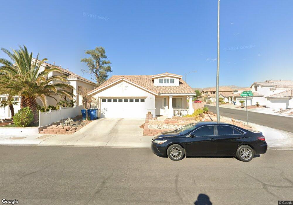
3217 Paragon Pointe St Las Vegas, NV 89129
Lone Mountain NeighborhoodEstimated Value: $411,000 - $424,899
3
Beds
2
Baths
1,545
Sq Ft
$271/Sq Ft
Est. Value
About This Home
This home is located at 3217 Paragon Pointe St, Las Vegas, NV 89129 and is currently estimated at $417,975, approximately $270 per square foot. 3217 Paragon Pointe St is a home located in Clark County with nearby schools including Edith Garehime Elementary School, Justice Myron E Leavitt Middle School, and Centennial High School.
Ownership History
Date
Name
Owned For
Owner Type
Purchase Details
Closed on
May 31, 2024
Sold by
Sturonas Michael David
Bought by
Michael D Sturonas Revocable Living Trust and Sturonas
Current Estimated Value
Purchase Details
Closed on
Mar 25, 1994
Sold by
Bilt Perma
Bought by
Sturonas Michael David
Home Financials for this Owner
Home Financials are based on the most recent Mortgage that was taken out on this home.
Original Mortgage
$121,450
Interest Rate
8.35%
Mortgage Type
VA
Create a Home Valuation Report for This Property
The Home Valuation Report is an in-depth analysis detailing your home's value as well as a comparison with similar homes in the area
Home Values in the Area
Average Home Value in this Area
Purchase History
| Date | Buyer | Sale Price | Title Company |
|---|---|---|---|
| Michael D Sturonas Revocable Living Trust | -- | None Listed On Document | |
| Sturonas Michael David | $123,000 | Fidelity National Title |
Source: Public Records
Mortgage History
| Date | Status | Borrower | Loan Amount |
|---|---|---|---|
| Previous Owner | Sturonas Michael David | $121,450 |
Source: Public Records
Tax History Compared to Growth
Tax History
| Year | Tax Paid | Tax Assessment Tax Assessment Total Assessment is a certain percentage of the fair market value that is determined by local assessors to be the total taxable value of land and additions on the property. | Land | Improvement |
|---|---|---|---|---|
| 2025 | $1,554 | $88,405 | $35,000 | $53,405 |
| 2024 | $1,510 | $88,405 | $35,000 | $53,405 |
| 2023 | $1,510 | $87,014 | $36,050 | $50,964 |
| 2022 | $1,466 | $74,746 | $28,000 | $46,746 |
| 2021 | $1,423 | $69,485 | $24,850 | $44,635 |
| 2020 | $1,379 | $64,101 | $24,150 | $39,951 |
| 2019 | $1,339 | $64,576 | $20,650 | $43,926 |
| 2018 | $1,300 | $59,897 | $17,500 | $42,397 |
| 2017 | $1,917 | $58,473 | $15,400 | $43,073 |
| 2016 | $1,232 | $54,985 | $11,550 | $43,435 |
| 2015 | $1,228 | $40,370 | $7,700 | $32,670 |
| 2014 | $1,192 | $36,233 | $7,700 | $28,533 |
Source: Public Records
Map
Nearby Homes
- 3228 Mystic Ridge Ct
- 3109 Bangor Ct
- 3215 Mystic Ridge Ct
- 3316 Lingo St
- 3109 Hawksdale Dr Unit 27
- 3104 Hayden Ct
- 9333 Mount Cherie Ave Unit 102
- 9401 Mount Cash Ave Unit 103
- 3112 Haddon Dr
- 9352 Villa Ridge Dr
- 3024 Lotus Hill Dr
- 2937 Billy Casper Dr
- 3012 Hawksdale Dr
- 3016 Lotus Hill Dr
- 9513 Glengarry Dr
- 9329 Fresh Spring Dr
- 9713 Tiaquinn Ave Unit 102
- 9713 Tiaquinn Ave Unit 101
- 3004 Lotus Hill Dr
- 3420 Wexford Ln Unit 103
- 3213 Paragon Pointe St
- 3213 Paragon Pointe St
- 3213 Paragon Pointe St
- 9609 Sterling Ridge Ave
- 3209 Paragon Pointe St
- 9600 Sterling Ridge Ave
- 9604 Sterling Ridge Ave
- 3220 Paragon Pointe St
- 9612 Crimson Ave
- 3216 Paragon Pointe St
- 3216 Paragon Pointe St Unit none
- 9608 Sterling Ridge Ave
- 3205 Paragon Pointe St
- 3224 Paragon Pointe St Unit 1
- 3212 Paragon Pointe St
- 3212 Paragon Pointe St Unit na
- 9617 Sterling Ridge Ave
- 9616 Crimson Ave
- 9612 Sterling Ridge Ave
- 3228 Paragon Pointe St