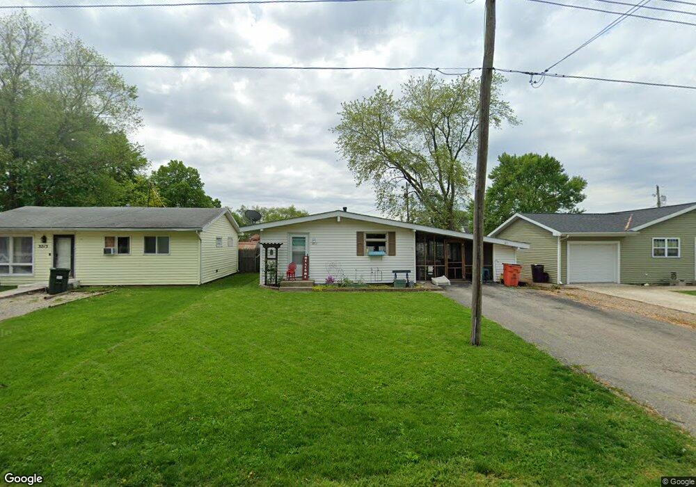
3217 Piatt Ave Mattoon, IL 61938
Estimated Value: $89,947 - $126,000
3
Beds
1
Bath
1,000
Sq Ft
$109/Sq Ft
Est. Value
About This Home
This home is located at 3217 Piatt Ave, Mattoon, IL 61938 and is currently estimated at $109,487, approximately $109 per square foot. 3217 Piatt Ave is a home located in Coles County with nearby schools including Mattoon High School, St Mary School, and St. John's Lutheran School.
Ownership History
Date
Name
Owned For
Owner Type
Purchase Details
Closed on
Dec 15, 2021
Sold by
Land Trust
Bought by
Diepholz Family Limited Liability Company Ser
Current Estimated Value
Purchase Details
Closed on
Feb 11, 2012
Sold by
Bullock Jonathan A and Bullock Samantha M
Bought by
The First National Bank and Land Trust No 095
Purchase Details
Closed on
Jan 31, 2011
Sold by
Donnals Shannon
Bought by
The First National Bank and Land Trust No 095
Purchase Details
Closed on
Apr 12, 2008
Sold by
Eidenhour Greg T and Ridenhour Phyllis J Preston
Bought by
The First National Bank
Create a Home Valuation Report for This Property
The Home Valuation Report is an in-depth analysis detailing your home's value as well as a comparison with similar homes in the area
Home Values in the Area
Average Home Value in this Area
Purchase History
| Date | Buyer | Sale Price | Title Company |
|---|---|---|---|
| Diepholz Family Limited Liability Company Ser | -- | None Listed On Document | |
| The First National Bank | -- | None Available | |
| The First National Bank | -- | None Available | |
| The First National Bank | -- | None Available |
Source: Public Records
Tax History
| Year | Tax Paid | Tax Assessment Tax Assessment Total Assessment is a certain percentage of the fair market value that is determined by local assessors to be the total taxable value of land and additions on the property. | Land | Improvement |
|---|---|---|---|---|
| 2024 | $2,019 | $23,706 | $4,504 | $19,202 |
| 2023 | $1,876 | $21,166 | $4,021 | $17,145 |
| 2022 | $1,825 | $20,817 | $3,955 | $16,862 |
| 2021 | $1,830 | $19,121 | $3,633 | $15,488 |
| 2020 | $1,810 | $19,811 | $3,764 | $16,047 |
| 2019 | $1,782 | $19,121 | $3,633 | $15,488 |
| 2018 | $1,751 | $19,121 | $3,633 | $15,488 |
| 2017 | $1,745 | $19,121 | $3,633 | $15,488 |
| 2016 | $1,708 | $19,121 | $3,633 | $15,488 |
| 2015 | $1,684 | $19,121 | $3,633 | $15,488 |
| 2014 | $1,684 | $19,121 | $3,633 | $15,488 |
| 2013 | $1,684 | $19,121 | $3,633 | $15,488 |
Source: Public Records
Map
Nearby Homes
- 1104 N 32nd St
- 1117 N 32nd St
- 3020 Champaign Ave
- 2800 Shelby Ave
- 2720 Champaign Ave
- 2617 Richmond Ave
- 3433 Western Ave
- 2413 Moultrie Ave
- 2800 Pine Ave
- 109 N 26th St
- 7 Noyes Ct
- 713 N 23rd St
- 2317 Shelby Ave
- 2305 Shelby Ave
- 2516 Pine Ave
- 113 S 25th St
- 2502 Pine Ave
- 2505 Pine Ave
- 2305 Richmond Ave
- 3816 Western Ave
- 3213 Piatt Ave
- 3221 Piatt Ave
- 3209 Piatt Ave
- 3225 Piatt Ave
- 3216 Dewitt Ave
- 3212 Dewitt Ave
- 3220 Dewitt Ave
- 3220 Piatt Ave
- 3216 Piatt Ave
- 3224 Piatt Ave
- 3224 Dewitt Ave
- 720 N 33rd St
- 3208 Dewitt Ave
- 3228 Piatt Ave
- 3228 Dewitt Ave
- 3201 Piatt Ave
- 3232 Dewitt Ave
- 3232 Piatt Ave
- 3200 Piatt Ave
- 809 N 32nd St
Your Personal Tour Guide
Ask me questions while you tour the home.