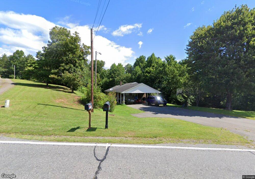
3218 Frank Whisnant Rd Morganton, NC 28655
Estimated Value: $279,142 - $334,000
3
Beds
2
Baths
1,450
Sq Ft
$211/Sq Ft
Est. Value
About This Home
This home is located at 3218 Frank Whisnant Rd, Morganton, NC 28655 and is currently estimated at $305,286, approximately $210 per square foot. 3218 Frank Whisnant Rd is a home located in Burke County with nearby schools including Oak Hill Elementary School, Table Rock Middle School, and Freedom High School.
Ownership History
Date
Name
Owned For
Owner Type
Purchase Details
Closed on
Apr 22, 2019
Sold by
Kincaid Mamie M and Kincaid Willie
Bought by
Prince Aaron David and Prince Rachel Rene
Current Estimated Value
Home Financials for this Owner
Home Financials are based on the most recent Mortgage that was taken out on this home.
Original Mortgage
$147,283
Outstanding Balance
$129,749
Interest Rate
4.4%
Mortgage Type
FHA
Estimated Equity
$175,537
Create a Home Valuation Report for This Property
The Home Valuation Report is an in-depth analysis detailing your home's value as well as a comparison with similar homes in the area
Home Values in the Area
Average Home Value in this Area
Purchase History
| Date | Buyer | Sale Price | Title Company |
|---|---|---|---|
| Prince Aaron David | $150,000 | None Available |
Source: Public Records
Mortgage History
| Date | Status | Borrower | Loan Amount |
|---|---|---|---|
| Open | Prince Aaron David | $147,283 |
Source: Public Records
Tax History Compared to Growth
Tax History
| Year | Tax Paid | Tax Assessment Tax Assessment Total Assessment is a certain percentage of the fair market value that is determined by local assessors to be the total taxable value of land and additions on the property. | Land | Improvement |
|---|---|---|---|---|
| 2025 | $1,447 | $213,385 | $16,170 | $197,215 |
| 2024 | $1,454 | $213,385 | $16,170 | $197,215 |
| 2023 | $1,454 | $213,385 | $16,170 | $197,215 |
| 2022 | $1,277 | $152,273 | $14,669 | $137,604 |
| 2021 | $1,271 | $152,273 | $14,669 | $137,604 |
| 2020 | $1,267 | $152,273 | $14,669 | $137,604 |
| 2019 | $1,267 | $152,273 | $14,669 | $137,604 |
| 2018 | $1,237 | $148,440 | $14,700 | $133,740 |
| 2017 | $1,235 | $148,440 | $14,700 | $133,740 |
| 2016 | $1,208 | $148,440 | $14,700 | $133,740 |
| 2015 | $1,205 | $148,440 | $14,700 | $133,740 |
| 2014 | $1,204 | $148,440 | $14,700 | $133,740 |
| 2013 | $1,189 | $148,440 | $14,700 | $133,740 |
Source: Public Records
Map
Nearby Homes
- 3026 Coventry Dr
- 2937 Frank Whisnant Rd
- 2401 Nc 181
- 2616 Carl Freeman Ave Unit 20
- 2616 Carl Freeman Ave Unit 3
- 2616 Carl Freeman Ave Unit 12
- 3666 Grandview Dr
- 3680 Grandview Dr
- 0 Oak Forest Dr
- 1364 Oak Hill Dr
- 3620 Lake Dr
- 2556 Nc 126
- 3577 Lake Dr Unit 26
- 3639 Lake Dr Unit 25
- 3494 Lake Dr Unit 17
- 3486 Lake Dr Unit 16
- 3076 Hunters Ridge Ct
- 1926 Timber Trace Unit 4
- 3164 Lake Dr Unit Lot 3
- 3188 Lake Dr Unit 4
- 3228 Frank Whisnant Rd
- V/L Frank Whisnant Rd
- 0 Frank Whisnant Rd Unit 9590909
- 0 Frank Whisnant Rd Unit B29151
- 3244 Frank Whisnant Rd
- 3049 Coventry Dr
- 3211 Frank Whisnant Rd
- 3237 Frank Whisnant Rd
- 3207 Frank Whisnant Rd
- 9999 Coventry Dr Unit 15
- 3058 Coventry Dr
- 3060 Coventry Dr Unit 50/51
- 3251 Frank Whisnant Rd
- 3052 Coventry Dr
- 3028 Coventry Dr
- 3029 Coventry Dr
- 3036 Cambridge Dr
- 3024 Coventry Dr
- 3008 Cambridge Dr
- 3272 Frank Whisnant Rd