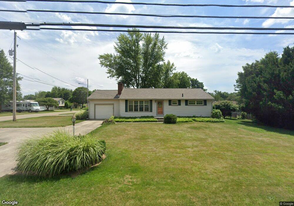
322 Reno Dr Louisville, OH 44641
Estimated Value: $194,155 - $218,000
3
Beds
1
Bath
1,092
Sq Ft
$192/Sq Ft
Est. Value
About This Home
This home is located at 322 Reno Dr, Louisville, OH 44641 and is currently estimated at $209,539, approximately $191 per square foot. 322 Reno Dr is a home located in Stark County with nearby schools including Louisville High School and St. Thomas Aquinas High School & Middle School.
Ownership History
Date
Name
Owned For
Owner Type
Purchase Details
Closed on
Mar 24, 1995
Sold by
Allison Gary W
Bought by
Rich Lynda L
Current Estimated Value
Home Financials for this Owner
Home Financials are based on the most recent Mortgage that was taken out on this home.
Original Mortgage
$50,900
Interest Rate
8.82%
Mortgage Type
New Conventional
Create a Home Valuation Report for This Property
The Home Valuation Report is an in-depth analysis detailing your home's value as well as a comparison with similar homes in the area
Home Values in the Area
Average Home Value in this Area
Purchase History
| Date | Buyer | Sale Price | Title Company |
|---|---|---|---|
| Rich Lynda L | $70,900 | -- |
Source: Public Records
Mortgage History
| Date | Status | Borrower | Loan Amount |
|---|---|---|---|
| Closed | Rich Lynda L | $50,900 |
Source: Public Records
Tax History Compared to Growth
Tax History
| Year | Tax Paid | Tax Assessment Tax Assessment Total Assessment is a certain percentage of the fair market value that is determined by local assessors to be the total taxable value of land and additions on the property. | Land | Improvement |
|---|---|---|---|---|
| 2025 | -- | $54,390 | $18,130 | $36,260 |
| 2024 | -- | $54,390 | $18,130 | $36,260 |
| 2023 | $1,600 | $46,380 | $14,980 | $31,400 |
| 2022 | $972 | $46,380 | $14,980 | $31,400 |
| 2021 | $1,079 | $46,380 | $14,980 | $31,400 |
| 2020 | $1,307 | $41,550 | $13,510 | $28,040 |
| 2019 | $416 | $36,830 | $15,020 | $21,810 |
| 2018 | $1,120 | $36,830 | $15,020 | $21,810 |
| 2017 | $947 | $31,650 | $12,570 | $19,080 |
| 2016 | $967 | $31,650 | $12,570 | $19,080 |
| 2015 | $970 | $31,650 | $12,570 | $19,080 |
| 2014 | $880 | $28,070 | $11,130 | $16,940 |
| 2013 | $443 | $28,070 | $11,130 | $16,940 |
Source: Public Records
Map
Nearby Homes
- 524 Glenbar St
- 614 Reno Dr
- 0 Glenbar St
- 5474 Ravenna Ave
- 428 Honeycrisp Dr NE
- 3047 Mcintosh Dr NE
- 432 Honeycrisp Dr NE
- 2962 Mcintosh Dr NE
- 2963 Mcintosh Dr NE
- 430 Honeycrisp Dr NE
- 2957 Mcintosh Dr NE
- 0 Brookridge Ave
- 316 E Reno Dr
- 300 Kennedy St
- 3580 Brookridge Ave Lot 15
- 910 Crosswyck Cir
- 1175 Sturbridge Dr
- 1149 Sturbridge Dr
- 1170 Winding Ridge Ave
- 325 Lincoln Ave