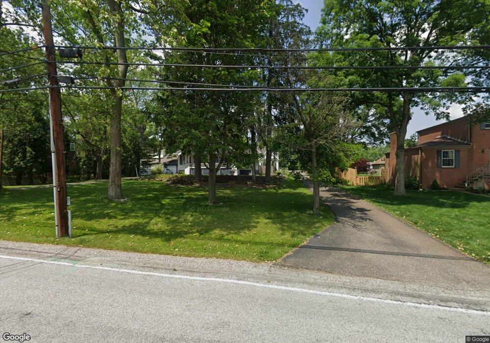
322 Scott Ave Glenshaw, PA 15116
Shaler Township NeighborhoodEstimated Value: $510,000 - $597,138
4
Beds
4
Baths
2,848
Sq Ft
$197/Sq Ft
Est. Value
About This Home
This home is located at 322 Scott Ave, Glenshaw, PA 15116 and is currently estimated at $560,035, approximately $196 per square foot. 322 Scott Ave is a home located in Allegheny County with nearby schools including Shaler Area Elementary School, Scott Primary School, and Shaler Area Middle School.
Ownership History
Date
Name
Owned For
Owner Type
Purchase Details
Closed on
Jun 12, 2024
Sold by
Blobner Michael and Blobner Roslyn
Bought by
Blobner Family Trust and Blobner
Current Estimated Value
Purchase Details
Closed on
Jun 5, 2024
Sold by
Blobner Michael and Blobner Roslyn
Bought by
Blobner Family Trust and Blobner
Purchase Details
Closed on
Oct 12, 2023
Sold by
Blobner Michael and Blobner Roslyn
Bought by
Blobner Family Trust
Purchase Details
Closed on
Nov 24, 2009
Sold by
Porco Robert D
Bought by
Blobner Michael and Blobner Roslyn
Home Financials for this Owner
Home Financials are based on the most recent Mortgage that was taken out on this home.
Original Mortgage
$315,679
Interest Rate
5%
Mortgage Type
FHA
Purchase Details
Closed on
Sep 5, 1998
Sold by
Jacobs Albert B and Jacobs Barbara J
Bought by
Blobner Michael and Blobner Roslyn
Purchase Details
Closed on
Jan 1, 1900
Create a Home Valuation Report for This Property
The Home Valuation Report is an in-depth analysis detailing your home's value as well as a comparison with similar homes in the area
Home Values in the Area
Average Home Value in this Area
Purchase History
| Date | Buyer | Sale Price | Title Company |
|---|---|---|---|
| Blobner Family Trust | -- | -- | |
| Blobner Family Trust | -- | -- | |
| Blobner Michael | -- | -- | |
| Porco Robert D | -- | -- | |
| Blobner Michael | $27,500 | -- | |
| -- | -- | -- | |
| Blobner Family Trust | -- | -- |
Source: Public Records
Mortgage History
| Date | Status | Borrower | Loan Amount |
|---|---|---|---|
| Previous Owner | Porco Robert D | $315,679 |
Source: Public Records
Tax History Compared to Growth
Tax History
| Year | Tax Paid | Tax Assessment Tax Assessment Total Assessment is a certain percentage of the fair market value that is determined by local assessors to be the total taxable value of land and additions on the property. | Land | Improvement |
|---|---|---|---|---|
| 2025 | $10,507 | $337,200 | $46,300 | $290,900 |
| 2024 | $10,507 | $319,100 | $46,200 | $272,900 |
| 2023 | $10,132 | $319,100 | $46,200 | $272,900 |
| 2022 | $10,132 | $319,100 | $46,200 | $272,900 |
| 2021 | $10,131 | $319,100 | $46,200 | $272,900 |
| 2020 | $10,132 | $319,100 | $46,200 | $272,900 |
| 2019 | $9,813 | $319,100 | $46,200 | $272,900 |
| 2018 | $1,509 | $319,100 | $46,200 | $272,900 |
| 2017 | $9,503 | $319,100 | $46,200 | $272,900 |
| 2016 | $1,509 | $319,100 | $46,200 | $272,900 |
| 2015 | $1,509 | $319,100 | $46,200 | $272,900 |
| 2014 | $9,114 | $319,100 | $46,200 | $272,900 |
Source: Public Records
Map
Nearby Homes
- 2603 Sherwood Rd
- 2501 Oakwood Rd
- 2605 Mount Royal Blvd
- 2307 Mount Royal Blvd
- 2609 Autumnwood Dr
- 140 Hodil Rd
- 113 Mcginley Dr
- 620 Northaven Cir
- 104 Meadow Rd
- 404 McElheny Rd
- 163 Richard Dr
- 3305 Laurel Dr
- 308 Sandy Dr
- 208 Andrew Dr
- 222 Elfinwild Ln
- 103 Hodil Rd
- 447 Englewood Dr
- 155 Cherrington Dr
- 530 Glenhaven Dr
- 211 Rosebriar Ave
- 2606 Herron Ln
- 2608 Herron Ln
- 2608 Herron Ln
- 400 Scott Ave
- 320 Scott Ave
- 2709 Phillips Ave
- 2711 Phillips Ave
- 402 Scott Ave
- 2713 Phillips Ave
- 318 Scott Ave
- 316 Scott Ave
- 2610 Herron Ln
- 2715 Phillips Ave
- 2609 1/2 Herron Ln
- 2607 Herron Ln
- 2609 Herron Ln
- 2605 Herron Ln
- 2612 Herron Ln
- 2603 Herron Ln
- 2717 Phillips Ave
