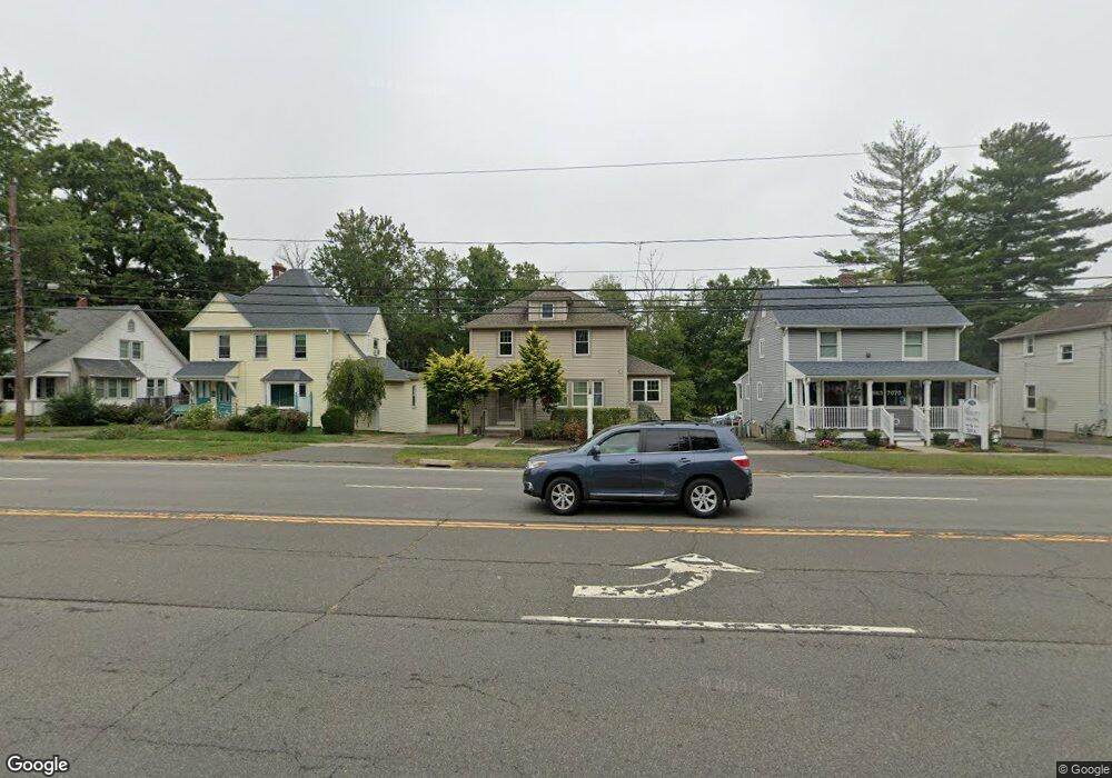
322 Silas Deane Hwy Wethersfield, CT 06109
3
Beds
1
Bath
1,408
Sq Ft
7,405
Sq Ft Lot
About This Home
This home is located at 322 Silas Deane Hwy, Wethersfield, CT 06109. 322 Silas Deane Hwy is a home located in Hartford County with nearby schools including Alfred W. Hanmer School, Silas Deane Middle School, and Wethersfield High School.
Ownership History
Date
Name
Owned For
Owner Type
Purchase Details
Closed on
Jun 11, 2009
Sold by
Lasalle Bank Na Tr
Bought by
Porriello John
Purchase Details
Closed on
Mar 5, 2009
Sold by
Randazzo Paul E and Randazzo Mary
Bought by
Lasalle Bank Na
Purchase Details
Closed on
Dec 20, 2002
Sold by
Bujak Mary Est
Bought by
Randazzo Paul E
Home Financials for this Owner
Home Financials are based on the most recent Mortgage that was taken out on this home.
Original Mortgage
$123,490
Interest Rate
6.16%
Mortgage Type
Commercial
Create a Home Valuation Report for This Property
The Home Valuation Report is an in-depth analysis detailing your home's value as well as a comparison with similar homes in the area
Home Values in the Area
Average Home Value in this Area
Purchase History
| Date | Buyer | Sale Price | Title Company |
|---|---|---|---|
| Porriello John | $100,000 | -- | |
| Lasalle Bank Na | $176,800 | -- | |
| Randazzo Paul E | $149,900 | -- |
Source: Public Records
Mortgage History
| Date | Status | Borrower | Loan Amount |
|---|---|---|---|
| Previous Owner | Randazzo Paul E | $16,110 | |
| Previous Owner | Randazzo Paul E | $176,800 | |
| Previous Owner | Randazzo Paul E | $132,800 | |
| Previous Owner | Randazzo Paul E | $123,490 |
Source: Public Records
Tax History Compared to Growth
Tax History
| Year | Tax Paid | Tax Assessment Tax Assessment Total Assessment is a certain percentage of the fair market value that is determined by local assessors to be the total taxable value of land and additions on the property. | Land | Improvement |
|---|---|---|---|---|
| 2025 | $5,764 | $139,830 | $101,500 | $38,330 |
| 2024 | $6,810 | $157,570 | $87,510 | $70,060 |
| 2023 | $6,583 | $157,570 | $87,510 | $70,060 |
| 2022 | $6,473 | $157,570 | $87,510 | $70,060 |
| 2021 | $6,408 | $157,570 | $87,510 | $70,060 |
| 2020 | $6,412 | $157,570 | $87,510 | $70,060 |
| 2019 | $6,419 | $157,570 | $87,510 | $70,060 |
| 2018 | $8,340 | $204,500 | $94,700 | $109,800 |
| 2017 | $8,133 | $204,500 | $94,700 | $109,800 |
| 2016 | $7,881 | $204,500 | $94,700 | $109,800 |
| 2015 | $7,810 | $204,500 | $94,700 | $109,800 |
| 2014 | $7,513 | $204,500 | $94,700 | $109,800 |
Source: Public Records
Map
Nearby Homes
- 18 Avalon Place
- 9 Avalon Place
- 14 Fernwood St
- 7 Harmund Ct
- 317 Garden St Unit 319
- 26 Tifton Rd
- 193 Wolcott Hill Rd Unit 195
- 118 Church St
- 53 Wolcott Hill Rd Unit C23
- 41 Hartford Ave
- 24 Williams St
- 493 Main St
- 442 Wolcott Hill Rd
- 24 Stillman Rd
- 92 Reed Dr
- 70 Stillman Rd
- 80 Spruce St
- 226 Broad St Unit 1S
- 55 Rutledge Rd
- 35 Stillwold Dr
- 326 Silas Deane Hwy Unit 2
- 326 Silas Deane Hwy
- 318 Silas Deane Hwy
- 330 Silas Deane Hwy
- 312 Silas Deane Hwy
- 334 Silas Deane Hwy
- 327 Silas Deane Hwy Unit 329
- 321 Silas Deane Hwy
- 313 Silas Deane Hwy
- 331 Silas Deane Hwy
- 307 Silas Deane Hwy Unit 309
- 335 Silas Deane Hwy Unit 337
- 301 Silas Deane Hwy
- 350 Silas Deane Hwy Unit 301
- 350 Silas Deane Hwy Unit 303
- 350 Silas Deane Hwy Unit 101
- 350 Silas Deane Hwy Unit 302
- 138 Nott St
- 291 Silas Deane Hwy
- 38 Wright Rd