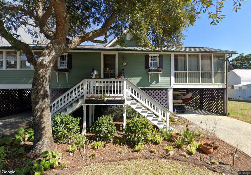
322 Station 19 St Unit B Sullivans Island, SC 29482
Sullivan's Island NeighborhoodEstimated Value: $1,085,000 - $1,402,710
2
Beds
2
Baths
1,658
Sq Ft
$765/Sq Ft
Est. Value
About This Home
This home is located at 322 Station 19 St Unit B, Sullivans Island, SC 29482 and is currently estimated at $1,267,903, approximately $764 per square foot. 322 Station 19 St Unit B is a home located in Charleston County with nearby schools including Sullivans Island Elementary School, Moultrie Middle School, and Wando High School.
Ownership History
Date
Name
Owned For
Owner Type
Purchase Details
Closed on
Dec 11, 2024
Sold by
Coste Karen D
Bought by
Coste Henry O
Current Estimated Value
Purchase Details
Closed on
Apr 27, 2011
Sold by
Coste Henry O
Bought by
Coste Karen D
Home Financials for this Owner
Home Financials are based on the most recent Mortgage that was taken out on this home.
Original Mortgage
$938,250
Interest Rate
4.83%
Mortgage Type
Reverse Mortgage Home Equity Conversion Mortgage
Create a Home Valuation Report for This Property
The Home Valuation Report is an in-depth analysis detailing your home's value as well as a comparison with similar homes in the area
Home Values in the Area
Average Home Value in this Area
Purchase History
| Date | Buyer | Sale Price | Title Company |
|---|---|---|---|
| Coste Henry O | -- | None Listed On Document | |
| Coste Karen D | -- | -- |
Source: Public Records
Mortgage History
| Date | Status | Borrower | Loan Amount |
|---|---|---|---|
| Previous Owner | Coste Karen D | $938,250 |
Source: Public Records
Tax History Compared to Growth
Tax History
| Year | Tax Paid | Tax Assessment Tax Assessment Total Assessment is a certain percentage of the fair market value that is determined by local assessors to be the total taxable value of land and additions on the property. | Land | Improvement |
|---|---|---|---|---|
| 2024 | $2,697 | $20,170 | $0 | $0 |
| 2023 | $2,481 | $20,170 | $0 | $0 |
| 2022 | $2,408 | $20,170 | $0 | $0 |
| 2021 | $2,491 | $20,170 | $0 | $0 |
| 2020 | $2,539 | $20,170 | $0 | $0 |
| 2019 | $2,114 | $17,280 | $0 | $0 |
| 2017 | $1,880 | $19,280 | $0 | $0 |
| 2016 | $1,797 | $19,280 | $0 | $0 |
| 2015 | $2,042 | $19,280 | $0 | $0 |
| 2014 | $1,603 | $0 | $0 | $0 |
| 2011 | -- | $0 | $0 | $0 |
Source: Public Records
Map
Nearby Homes
- 2002 Ion Ave
- 1749 Middle St
- 1750 Ion Ave
- 1773 Atlantic Ave
- 189 Station 18 St
- 1714 Middle St
- 1727 Atlantic Ave
- 409 Station 22 1 2 St
- 1651 Atlantic Ave
- 2307 Ion Ave
- 2414 Goldbug Ave
- 2424 Middle St
- 2524 Middle St
- 1666 Marsh Harbor Ln Unit 101
- 1647 Marsh Harbor Ln
- 2629 Goldbug Ave
- 1608 Marsh Harbor Ln Unit C
- 0 Middle St
- 2630 Bayonne Ave
- 1606 Marsh Harbor Ln Unit C
- 1902 Central Ave Unit A
- 321 Station 19 St
- 1908 Central Ave
- 1903 Back St
- 1856 Central Ave
- 1907 Back St
- 402 Station 18 1/2 St
- 402 Station 18 1 2 St
- 1850 Central Ave
- 401 Station 20 St
- 1918 Central Ave
- 403 Station 20 St
- 403 Station 20 St Unit B
- 403 Station 20 St Unit A
- 1914 Middle St
- 1908 Middle St
- 1902 Middle St Unit 1002
- 1850 Middle St
- 1850 Back St
- 1820 Central Ave