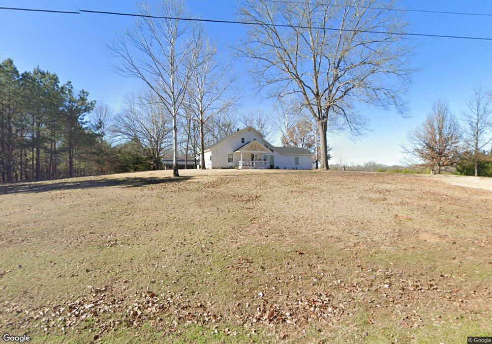
322 Stevenson Rd Gurdon, AR 71743
Estimated Value: $111,000 - $204,000
--
Bed
2
Baths
1,775
Sq Ft
$83/Sq Ft
Est. Value
About This Home
This home is located at 322 Stevenson Rd, Gurdon, AR 71743 and is currently estimated at $146,488, approximately $82 per square foot. 322 Stevenson Rd is a home located in Clark County with nearby schools including Gurdon Primary School, Cabe Middle School, and Gurdon High School.
Ownership History
Date
Name
Owned For
Owner Type
Purchase Details
Closed on
Sep 2, 2021
Sold by
Ray Purifoy Danny and Ray Lea
Bought by
Swayze Justin and Swayze Jordan
Current Estimated Value
Purchase Details
Closed on
Mar 21, 2011
Sold by
Purifoy Terry Dean and Purifoy Janet Leann
Bought by
Swayze Joe and Swayze Jordan
Home Financials for this Owner
Home Financials are based on the most recent Mortgage that was taken out on this home.
Original Mortgage
$45,000
Interest Rate
4.78%
Purchase Details
Closed on
Aug 1, 1984
Bought by
Purifoy Terry D and Purifoy Janet
Create a Home Valuation Report for This Property
The Home Valuation Report is an in-depth analysis detailing your home's value as well as a comparison with similar homes in the area
Home Values in the Area
Average Home Value in this Area
Purchase History
| Date | Buyer | Sale Price | Title Company |
|---|---|---|---|
| Swayze Justin | -- | Harrison David M | |
| Swayze Joe | -- | -- | |
| Purifoy Terry D | -- | -- |
Source: Public Records
Mortgage History
| Date | Status | Borrower | Loan Amount |
|---|---|---|---|
| Previous Owner | Swayze Joe | $45,000 |
Source: Public Records
Tax History Compared to Growth
Tax History
| Year | Tax Paid | Tax Assessment Tax Assessment Total Assessment is a certain percentage of the fair market value that is determined by local assessors to be the total taxable value of land and additions on the property. | Land | Improvement |
|---|---|---|---|---|
| 2024 | $404 | $18,050 | $630 | $17,420 |
| 2023 | $479 | $18,050 | $630 | $17,420 |
| 2022 | $403 | $18,050 | $630 | $17,420 |
| 2021 | $379 | $18,050 | $630 | $17,420 |
| 2020 | $345 | $18,050 | $630 | $17,420 |
| 2019 | $310 | $15,900 | $630 | $15,270 |
| 2018 | $327 | $15,900 | $630 | $15,270 |
| 2017 | $327 | $15,900 | $630 | $15,270 |
| 2016 | $327 | $15,900 | $630 | $15,270 |
| 2015 | $327 | $15,900 | $630 | $15,270 |
| 2014 | $386 | $17,280 | $630 | $16,650 |
Source: Public Records
Map
Nearby Homes
- 196 Stevenson Rd
- 505 Stevenson Rd
- 602 Stevenson Rd
- 845 Stevenson Rd
- 0000 Central Rd
- 652 Center Point
- 718 Southfork Rd
- 4174 Central Rd
- 52 Curtis Rd
- 82 Curtis Rd
- 236 Lockie Rd
- TBD Hwy 67 S
- 108 Curtis Rd
- 236 Curtis Rd
- 248 Curtis Rd
- 1491 Southfork Rd
- 16 Jackson Rd
- 390 Curtis Rd
- 3761 U S 67
- TBD Hudman Rd
- 263 Stevenson Rd
- 249 Stevenson Rd
- 250 Stevenson Rd
- 350 Stevenson Rd
- 238 Stevenson Rd
- 485 Stevenson Rd
- 156 Stevenson Rd
- 490 Stevenson Rd
- 118 Stevenson Rd
- 508 Stevenson Rd
- 102 Stevenson Rd
- 540 Stevenson Rd
- 68 Stevenson Rd
- 4 Mcmillan Rd
- 45 Stevenson Rd
- 1934 Highway 53 N
- 66 Mcmillan Rd
- 1767 Highway 53 N
- 1551 Highway 53 N
- 1480 Highway 53 N