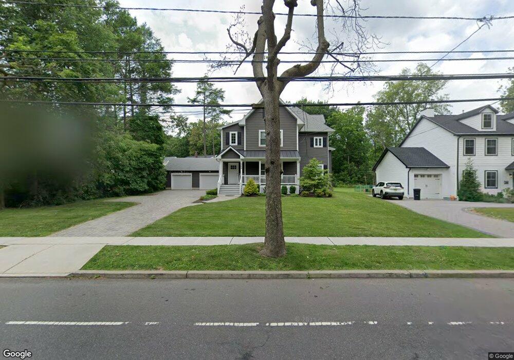
322 Walnut Ave Unit 1 Cranford, NJ 07016
Estimated Value: $1,192,000 - $1,510,000
3
Beds
2
Baths
4,577
Sq Ft
$299/Sq Ft
Est. Value
About This Home
This home is located at 322 Walnut Ave Unit 1, Cranford, NJ 07016 and is currently estimated at $1,367,224, approximately $298 per square foot. 322 Walnut Ave Unit 1 is a home located in Union County with nearby schools including Cranford Sr High School and St Michael School.
Ownership History
Date
Name
Owned For
Owner Type
Purchase Details
Closed on
Mar 7, 2025
Sold by
322 Walnut Llc
Bought by
322 Walnut Cranford Llc
Current Estimated Value
Purchase Details
Closed on
Jul 17, 2019
Sold by
Quinn Justin and Quinn Nicole
Bought by
322 Walnut Llc
Purchase Details
Closed on
May 31, 2017
Sold by
Oneil Joseph D and Oneil Josephine
Bought by
322 Walnut Llc
Purchase Details
Closed on
Jul 27, 2010
Sold by
Oneil Clair
Bought by
Clair T Oneil Family Trust
Create a Home Valuation Report for This Property
The Home Valuation Report is an in-depth analysis detailing your home's value as well as a comparison with similar homes in the area
Home Values in the Area
Average Home Value in this Area
Purchase History
| Date | Buyer | Sale Price | Title Company |
|---|---|---|---|
| 322 Walnut Cranford Llc | $1,390,000 | Chicago Title | |
| 322 Walnut Cranford Llc | $1,390,000 | Chicago Title | |
| 322 Walnut Llc | -- | None Available | |
| 322 Walnut Llc | $596,450 | Suburban Title Examiers Inc | |
| Clair T Oneil Family Trust | -- | None Available |
Source: Public Records
Tax History Compared to Growth
Tax History
| Year | Tax Paid | Tax Assessment Tax Assessment Total Assessment is a certain percentage of the fair market value that is determined by local assessors to be the total taxable value of land and additions on the property. | Land | Improvement |
|---|---|---|---|---|
| 2025 | $14,324 | $211,300 | $85,000 | $126,300 |
| 2024 | $14,087 | $211,300 | $85,000 | $126,300 |
| 2023 | $14,087 | $211,300 | $85,000 | $126,300 |
| 2022 | $13,971 | $211,300 | $85,000 | $126,300 |
| 2021 | $13,910 | $211,300 | $85,000 | $126,300 |
| 2020 | $13,866 | $211,300 | $85,000 | $126,300 |
| 2019 | $13,692 | $210,000 | $118,700 | $91,300 |
| 2018 | $12,865 | $210,000 | $118,700 | $91,300 |
| 2017 | $12,982 | $210,000 | $118,700 | $91,300 |
| 2016 | $12,510 | $210,000 | $118,700 | $91,300 |
| 2015 | $12,182 | $210,000 | $118,700 | $91,300 |
| 2014 | $11,932 | $210,000 | $118,700 | $91,300 |
Source: Public Records
Map
Nearby Homes
- 2 Pine St
- 247 Walnut Ave
- 113 Retford Ave
- 211 High St
- 37 Broad St
- 166 N Lehigh Ave
- 383 Lincoln Ave E
- 45 Hillcrest Ave
- 11 Mendell Ave
- 219 Centennial Ave Unit B
- 98 Winans Ave
- 129 Thomas St
- 108 James Ave
- 155 Hillcrest Ave
- 10 Alan O Kell Place
- 27 Cranford Terrace
- 18 Springfield Ave Unit 2D
- 18 Springfield Ave Unit 3A
- 24 Oneida Place
- 113 Winslow Place Unit 3