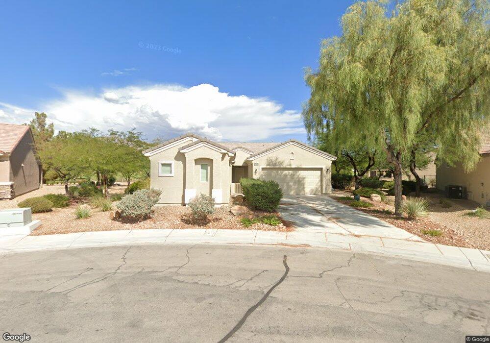
3220 Lapwing Dr Unit 2 North Las Vegas, NV 89084
Aliante NeighborhoodEstimated Value: $409,000 - $469,000
2
Beds
2
Baths
1,570
Sq Ft
$285/Sq Ft
Est. Value
About This Home
This home is located at 3220 Lapwing Dr Unit 2, North Las Vegas, NV 89084 and is currently estimated at $446,851, approximately $284 per square foot. 3220 Lapwing Dr Unit 2 is a home located in Clark County with nearby schools including Vincent L. Triggs Elementary School, Anthony Saville Middle School, and Shadow Ridge High School.
Ownership History
Date
Name
Owned For
Owner Type
Purchase Details
Closed on
Nov 21, 2022
Sold by
Monsees Gary B and Monsees Leslie D
Bought by
Leslie D Monsees Living Trust
Current Estimated Value
Purchase Details
Closed on
Aug 22, 2003
Sold by
Pn Ii Inc
Bought by
Monsees Gary B and Monsees Leslie D
Home Financials for this Owner
Home Financials are based on the most recent Mortgage that was taken out on this home.
Original Mortgage
$267,668
Interest Rate
5.46%
Mortgage Type
Unknown
Create a Home Valuation Report for This Property
The Home Valuation Report is an in-depth analysis detailing your home's value as well as a comparison with similar homes in the area
Home Values in the Area
Average Home Value in this Area
Purchase History
| Date | Buyer | Sale Price | Title Company |
|---|---|---|---|
| Leslie D Monsees Living Trust | -- | -- | |
| Monsees Gary B | $311,451 | Lawyers Title Of Nevada |
Source: Public Records
Mortgage History
| Date | Status | Borrower | Loan Amount |
|---|---|---|---|
| Previous Owner | Monsees Gary B | $267,668 |
Source: Public Records
Tax History Compared to Growth
Tax History
| Year | Tax Paid | Tax Assessment Tax Assessment Total Assessment is a certain percentage of the fair market value that is determined by local assessors to be the total taxable value of land and additions on the property. | Land | Improvement |
|---|---|---|---|---|
| 2025 | $2,894 | $133,658 | $37,188 | $96,470 |
| 2024 | $2,810 | $133,658 | $37,188 | $96,470 |
| 2023 | $2,810 | $131,892 | $41,125 | $90,767 |
| 2022 | $2,729 | $118,130 | $34,563 | $83,567 |
| 2021 | $2,649 | $111,562 | $32,375 | $79,187 |
| 2020 | $2,565 | $109,402 | $31,063 | $78,339 |
| 2019 | $2,491 | $107,736 | $30,625 | $77,111 |
| 2018 | $2,418 | $100,654 | $26,250 | $74,404 |
| 2017 | $2,290 | $98,474 | $23,800 | $74,674 |
| 2016 | $2,290 | $92,578 | $18,200 | $74,378 |
| 2015 | $2,285 | $74,881 | $15,260 | $59,621 |
| 2014 | $2,214 | $63,224 | $11,900 | $51,324 |
Source: Public Records
Map
Nearby Homes
- 3220 Flinthead Dr
- 3312 Lapwing Dr
- 7741 Fruit Dove St Unit 4
- 3405 Kingbird Dr
- 7921 Fantail Dr
- 7910 Kiskadee St
- 7927 Crested Starling Ct
- 3124 Kookaburra Way
- 7905 Grey Teal St
- 7804 Island Rail Dr
- 7948 Fantail Dr Unit 3
- 7839 Lyrebird Dr
- 3516 Herring Gull Ln Unit 3
- 2822 Horned Owl Way
- 7649 Broadwing Dr
- 7617 Fieldfare Dr
- 7937 Lily Trotter St
- 3109 Frigate Way
- 7713 Lily Trotter St
- 7908 House Sparrow St
- 3224 Lapwing Dr
- 3224 Lapwing Dr Unit n/a
- 3216 Lapwing Dr
- 7869 Broadwing Dr
- 3228 Lapwing Dr
- 7873 Broadwing Dr
- 3217 Lapwing Dr
- 3304 Lapwing Dr
- 7881 Broadwing Dr Unit 2
- 7860 Broadwing Dr
- 3305 Lapwing Dr Unit 2
- 7854 Broadwing Dr
- 7866 Broadwing Dr
- 7848 Broadwing Dr
- 3308 Lapwing Dr
- 7872 Broadwing Dr
- 3309 Lapwing Dr
- 7878 Broadwing Dr Unit 4
- 3313 Lapwing Dr
- 3204 Flinthead Dr