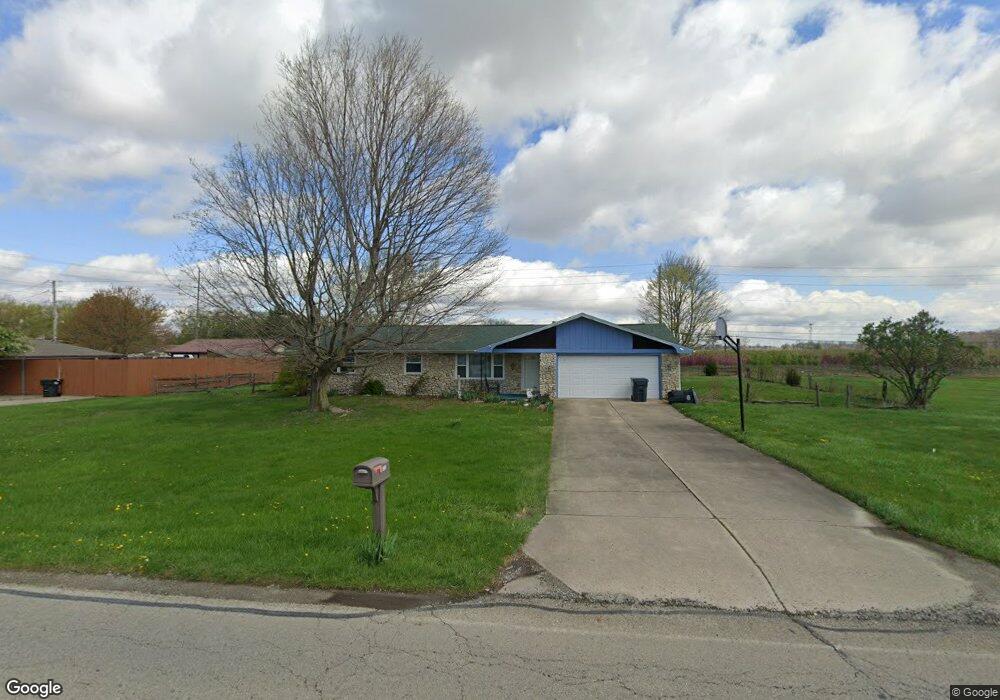
3220 W 53rd St Anderson, IN 46011
Estimated Value: $180,366 - $191,000
2
Beds
2
Baths
1,221
Sq Ft
$153/Sq Ft
Est. Value
About This Home
This home is located at 3220 W 53rd St, Anderson, IN 46011 and is currently estimated at $186,842, approximately $153 per square foot. 3220 W 53rd St is a home located in Madison County with nearby schools including Anderson Elementary School, Highland Middle School, and Anderson High School.
Ownership History
Date
Name
Owned For
Owner Type
Purchase Details
Closed on
Oct 2, 2015
Sold by
Jacobs Rhonda S
Bought by
Barnes Brook L
Current Estimated Value
Home Financials for this Owner
Home Financials are based on the most recent Mortgage that was taken out on this home.
Original Mortgage
$79,532
Outstanding Balance
$62,058
Interest Rate
3.88%
Mortgage Type
FHA
Estimated Equity
$124,784
Create a Home Valuation Report for This Property
The Home Valuation Report is an in-depth analysis detailing your home's value as well as a comparison with similar homes in the area
Home Values in the Area
Average Home Value in this Area
Purchase History
| Date | Buyer | Sale Price | Title Company |
|---|---|---|---|
| Barnes Brook L | -- | -- |
Source: Public Records
Mortgage History
| Date | Status | Borrower | Loan Amount |
|---|---|---|---|
| Open | Barnes Brook L | $79,532 |
Source: Public Records
Tax History
| Year | Tax Paid | Tax Assessment Tax Assessment Total Assessment is a certain percentage of the fair market value that is determined by local assessors to be the total taxable value of land and additions on the property. | Land | Improvement |
|---|---|---|---|---|
| 2025 | $1,086 | $111,500 | $19,900 | $91,600 |
| 2024 | $1,086 | $101,200 | $19,900 | $81,300 |
| 2023 | $995 | $93,100 | $18,900 | $74,200 |
| 2022 | $1,004 | $93,600 | $18,700 | $74,900 |
| 2021 | $927 | $86,700 | $18,500 | $68,200 |
| 2020 | $882 | $82,600 | $17,700 | $64,900 |
| 2019 | $860 | $80,700 | $17,700 | $63,000 |
| 2018 | $799 | $74,800 | $17,700 | $57,100 |
| 2017 | $759 | $75,900 | $17,700 | $58,200 |
| 2016 | $759 | $75,900 | $17,700 | $58,200 |
| 2014 | $1,620 | $81,000 | $14,900 | $66,100 |
| 2013 | $1,620 | $81,000 | $14,900 | $66,100 |
Source: Public Records
Map
Nearby Homes
- 4812 Picea Blvd
- 5330 Dr Martin Luther King jr Blvd
- 4727 Malus Blvd
- 3640 W 67th St
- 0 S Layton Rd Unit NRA835553
- 3905 Doctor Martin Luther King Junior Blvd
- 3235 Raible Ave
- 4260 S Ridgeview Rd
- 1021 Sandra Dr
- 1035 Redrock Dr
- 827 Country Ln
- 4406 S Madison Ave
- 425 Janis Ave
- 5260 S State Road 67
- 4406 Delmar Ct
- 5618 Harmeson Dr
- 815 Delmar Rd
- 2803 Dewey St
- 14 Crescent Ct
- 4413 Brenda Dr
Your Personal Tour Guide
Ask me questions while you tour the home.