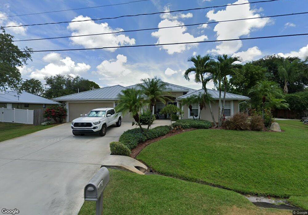
3221 SE Quay St Port Saint Lucie, FL 34984
Southbend Lakes NeighborhoodEstimated Value: $568,918 - $651,000
4
Beds
2
Baths
2,626
Sq Ft
$235/Sq Ft
Est. Value
About This Home
This home is located at 3221 SE Quay St, Port Saint Lucie, FL 34984 and is currently estimated at $616,480, approximately $234 per square foot. 3221 SE Quay St is a home located in St. Lucie County with nearby schools including Floresta Elementary School, Morningside Elementary School, and Mariposa Elementary School.
Ownership History
Date
Name
Owned For
Owner Type
Purchase Details
Closed on
May 10, 2013
Sold by
Taylor Frank R and Taylor Patti M
Bought by
Smith Fred
Current Estimated Value
Purchase Details
Closed on
Aug 24, 2005
Sold by
Thornton Christopher and Thornton Michelle
Bought by
Taylor Frank
Home Financials for this Owner
Home Financials are based on the most recent Mortgage that was taken out on this home.
Original Mortgage
$361,500
Interest Rate
8.35%
Mortgage Type
Purchase Money Mortgage
Purchase Details
Closed on
Jan 8, 2002
Sold by
Iadevaio Anthony and Iadevaio Antoinette
Bought by
Thornton Christopher and Thornton Michelle
Create a Home Valuation Report for This Property
The Home Valuation Report is an in-depth analysis detailing your home's value as well as a comparison with similar homes in the area
Home Values in the Area
Average Home Value in this Area
Purchase History
| Date | Buyer | Sale Price | Title Company |
|---|---|---|---|
| Smith Fred | $88,000 | Aaa Premier Title | |
| Taylor Frank | $402,000 | Chelsea Title Company | |
| Thornton Christopher | $15,600 | -- |
Source: Public Records
Mortgage History
| Date | Status | Borrower | Loan Amount |
|---|---|---|---|
| Previous Owner | Taylor Frank | $361,500 |
Source: Public Records
Tax History Compared to Growth
Tax History
| Year | Tax Paid | Tax Assessment Tax Assessment Total Assessment is a certain percentage of the fair market value that is determined by local assessors to be the total taxable value of land and additions on the property. | Land | Improvement |
|---|---|---|---|---|
| 2024 | $4,235 | $208,413 | -- | -- |
| 2023 | $4,235 | $202,343 | $0 | $0 |
| 2022 | $4,078 | $196,450 | $0 | $0 |
| 2021 | $4,007 | $190,729 | $0 | $0 |
| 2020 | $4,034 | $188,096 | $0 | $0 |
| 2019 | $3,998 | $183,868 | $0 | $0 |
| 2018 | $3,807 | $180,440 | $0 | $0 |
| 2017 | $3,856 | $245,300 | $43,200 | $202,100 |
| 2016 | $3,807 | $244,300 | $39,100 | $205,200 |
| 2015 | $3,848 | $200,900 | $26,400 | $174,500 |
| 2014 | $3,649 | $170,528 | $0 | $0 |
Source: Public Records
Map
Nearby Homes
- 208 SE Sims Cir
- 219 SE Sims Cir
- 3214 SE West Snow Rd
- 3209 SE Quay St
- 3206 SE Otis Ln
- 2904 SE Eagle Dr
- 126 SW Andover Ct
- 3300 SE Quay St
- 152 SW Hawthorne Cir
- 3257 SE West Snow Rd
- 3009 SE Wake Rd
- 3103 SE Mall Terrace
- 3013 SE Galt Cir
- 3073 SW Ann Arbor Rd
- 3243 SE Pinto St
- 121 SW Hawthorne Cir
- 2951 SE Bella Rd
- 3156 SW Ann Arbor Rd
- 165 SW Hawthorne Cir
- 3020 SW Ann Arbor Rd
- 3223 SE Quay St
- 210 SE Sims Cir
- 212 SE Sims Cir
- 200 SE Sims Cir
- 225 SE Sims Cir
- 224 SE Sims Cir
- 226 SE Sims Cir
- 3224 SE Quay St
- 228 SE Sims Cir
- 216 SE Sims Cir
- 3220 SE Quay St
- 234 SE Sims Cir
- 3226 SE Quay St
- 209 SE Sims Cir
- 3218 SE Quay St
- 207 SE Sims Cir
- 211 SE Sims Cir
- 3219 SE West Snow Rd
- 3219 SE Snow Rd
- 213 SE Sims Cir