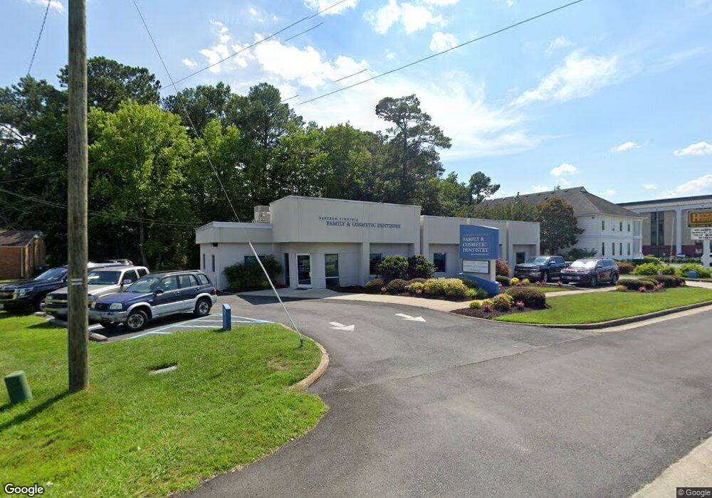
3221 Western Branch Blvd Chesapeake, VA 23321
Western Branch NeighborhoodEstimated Value: $912,728
--
Bed
--
Bath
3,818
Sq Ft
$239/Sq Ft
Est. Value
About This Home
This home is located at 3221 Western Branch Blvd, Chesapeake, VA 23321 and is currently estimated at $912,728, approximately $239 per square foot. 3221 Western Branch Blvd is a home located in Chesapeake City with nearby schools including Western Branch Primary School, Western Branch Intermediate School, and Western Branch Middle School.
Ownership History
Date
Name
Owned For
Owner Type
Purchase Details
Closed on
Aug 31, 2016
Sold by
Flat Iron Llc A Virginia Limited Liabili
Bought by
Kss Holdings Llc A Virginia Limited Liab
Current Estimated Value
Home Financials for this Owner
Home Financials are based on the most recent Mortgage that was taken out on this home.
Original Mortgage
$270,984
Outstanding Balance
$216,799
Interest Rate
3.48%
Mortgage Type
Commercial
Estimated Equity
$695,929
Create a Home Valuation Report for This Property
The Home Valuation Report is an in-depth analysis detailing your home's value as well as a comparison with similar homes in the area
Home Values in the Area
Average Home Value in this Area
Purchase History
| Date | Buyer | Sale Price | Title Company |
|---|---|---|---|
| Kss Holdings Llc A Virginia Limited Liab | $546,512 | Attorney |
Source: Public Records
Mortgage History
| Date | Status | Borrower | Loan Amount |
|---|---|---|---|
| Open | Kss Holdings Llc A Virginia Limited Liab | $270,984 |
Source: Public Records
Tax History Compared to Growth
Tax History
| Year | Tax Paid | Tax Assessment Tax Assessment Total Assessment is a certain percentage of the fair market value that is determined by local assessors to be the total taxable value of land and additions on the property. | Land | Improvement |
|---|---|---|---|---|
| 2025 | $4,648 | $462,700 | $310,000 | $152,700 |
| 2024 | $4,648 | $460,200 | $310,000 | $150,200 |
| 2023 | $5,770 | $451,100 | $297,600 | $153,500 |
| 2022 | $5,835 | $577,700 | $297,600 | $280,100 |
| 2021 | $6,854 | $652,800 | $297,600 | $355,200 |
| 2020 | $7,000 | $666,700 | $297,600 | $369,100 |
| 2019 | $6,170 | $587,600 | $297,600 | $290,000 |
| 2018 | $5,883 | $530,900 | $260,400 | $270,500 |
| 2017 | $5,720 | $544,800 | $272,800 | $272,000 |
| 2016 | $5,574 | $530,900 | $260,400 | $270,500 |
| 2015 | $5,574 | $530,900 | $260,400 | $270,500 |
| 2014 | $5,574 | $530,900 | $260,400 | $270,500 |
Source: Public Records
Map
Nearby Homes
- 4323 Stafford Dr
- 3454 Bruin Dr
- 3408 Kenley Ct
- 3352 Brandywine Dr
- 3836 Old Farm Rd
- 6205 Dunkirk St
- 3604 Pierce St
- 3380 Brandywine Dr
- 6002 Campbell St
- 3113 Woodbaugh Dr
- 6015 Arthur Ave
- 3424 Brandywine Dr
- 3317 Foxgrove Ln
- 5911 Dunkirk St
- 3791 Towne Point Rd
- 1004 Christiana Cir
- 3236 Bruin Dr
- 1047 Christiana Cir Unit 40
- 3715 Magnolia Dr
- 3616 Bowden St
- 3237 Western Branch Blvd
- 3220 Western Branch Blvd
- 3216 Western Branch Blvd
- 3228 Western Branch Blvd
- 3235 Western Branch Blvd
- 3201 Western Branch Blvd
- 4050 Taylor Rd
- 4400 Ashland Dr
- 3212 Western Branch Blvd
- 4404 Ashland Dr
- 4408 Ashland Dr
- 3236 Western Branch Blvd
- 3205 Churchland Blvd
- 3241 Western Branch Blvd
- 3207 Churchland Blvd
- 4048 Taylor Rd
- 4412 Ashland Dr
- 3200 Western Branch Blvd
- 4401 Ashland Dr
- 4405 Ashland Dr
