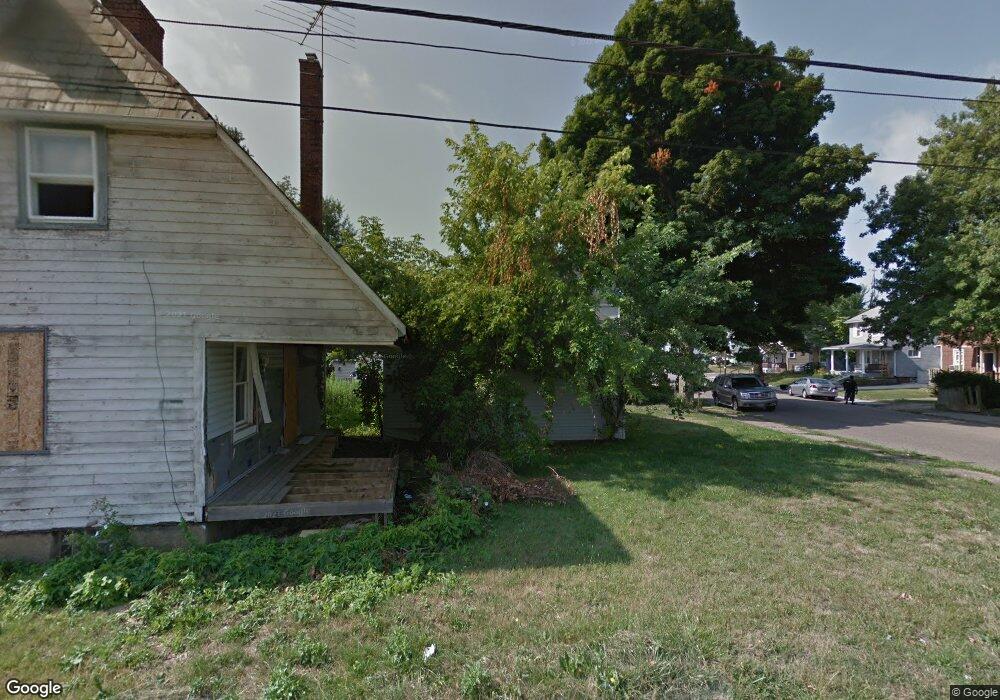
3222 13th St SW Canton, OH 44710
Souers NeighborhoodEstimated Value: $39,000
--
Bed
1
Bath
--
Sq Ft
4,617
Sq Ft Lot
About This Home
This home is located at 3222 13th St SW, Canton, OH 44710 and is currently priced at $39,000. 3222 13th St SW is a home located in Stark County with nearby schools including Harter Elementary School, Early Learning Center @ Schreiber, and McGregor Elementary School.
Ownership History
Date
Name
Owned For
Owner Type
Purchase Details
Closed on
Feb 13, 2025
Sold by
City Of Canton
Bought by
Brown Brandon T
Current Estimated Value
Purchase Details
Closed on
Feb 24, 2020
Sold by
Stark County Land Reutilization Corp
Bought by
City Of Canton
Purchase Details
Closed on
Jul 29, 2015
Sold by
Johnson Brian M
Bought by
Stark County Land Reutilization Corp
Purchase Details
Closed on
Apr 28, 1995
Sold by
Mcclain Wendy L
Bought by
Johnson Brian M
Home Financials for this Owner
Home Financials are based on the most recent Mortgage that was taken out on this home.
Original Mortgage
$32,631
Interest Rate
8.42%
Mortgage Type
FHA
Purchase Details
Closed on
Nov 15, 1988
Create a Home Valuation Report for This Property
The Home Valuation Report is an in-depth analysis detailing your home's value as well as a comparison with similar homes in the area
Home Values in the Area
Average Home Value in this Area
Purchase History
| Date | Buyer | Sale Price | Title Company |
|---|---|---|---|
| Brown Brandon T | -- | None Listed On Document | |
| City Of Canton | -- | None Available | |
| Stark County Land Reutilization Corp | -- | Attorney | |
| Johnson Brian M | $32,900 | -- | |
| -- | $24,500 | -- |
Source: Public Records
Mortgage History
| Date | Status | Borrower | Loan Amount |
|---|---|---|---|
| Previous Owner | Johnson Brian M | $32,631 |
Source: Public Records
Tax History Compared to Growth
Tax History
| Year | Tax Paid | Tax Assessment Tax Assessment Total Assessment is a certain percentage of the fair market value that is determined by local assessors to be the total taxable value of land and additions on the property. | Land | Improvement |
|---|---|---|---|---|
| 2025 | $1 | $980 | $980 | -- |
| 2024 | -- | $980 | $980 | -- |
| 2023 | -- | $2,590 | $2,590 | -- |
| 2022 | $159 | $2,590 | $2,590 | $0 |
| 2021 | $161 | $2,590 | $2,590 | $0 |
| 2020 | -- | $2,140 | $2,140 | $0 |
| 2019 | $0 | $2,140 | $2,140 | $0 |
| 2018 | $0 | $2,140 | $2,140 | $0 |
| 2017 | $6 | $6,270 | $3,360 | $2,910 |
| 2016 | $0 | $6,270 | $3,360 | $2,910 |
| 2015 | -- | $8,790 | $3,360 | $5,430 |
| 2014 | $840 | $12,010 | $3,500 | $8,510 |
| 2013 | $599 | $14,280 | $3,500 | $10,780 |
Source: Public Records
Map
Nearby Homes
- 1214 Roslyn Ave SW
- 1361 Crescent Rd SW
- 3204 14th St SW
- 1013 Maryland Ave SW
- 1023 Wertz Ave SW
- 1256 Dartmouth Ave SW
- 3800 11th St SW
- 929 Wertz Ave SW
- 1226 Poplar Ave SW
- 2711 Blair Place SW
- 1019 Dartmouth Ave SW
- 3029 7th St SW
- 921 Clarendon Ave SW
- 1729 Gambrinus Ave SW
- 1622 Clarendon Ave SW
- 3006 6th St SW
- 1102 Rockwood Ave SW
- 1547 Alden Ave SW
- 1009 Arlington Ave SW
- 1259 Hawthorne Ave SW
- 1306 Roslyn Ave SW
- 3216 13th St SW
- 1312 Roslyn Ave SW
- 3212 13th St SW
- 3300 13th St SW
- 3229 13th St SW
- 3225 13th St SW
- 3215 Belmont Place SW
- 3221 13th St SW
- 3217 Belmont Place SW
- 1307 Roslyn Ave SW
- 3210 13th St SW
- 3223 Belmont Place SW
- 3211 Belmont Place SW
- 3217 13th St SW
- 3301 13th St SW
- 1311 Roslyn Ave SW
- 3207 Belmont Place SW
- 3305 13th St SW
- 3206 13th St SW