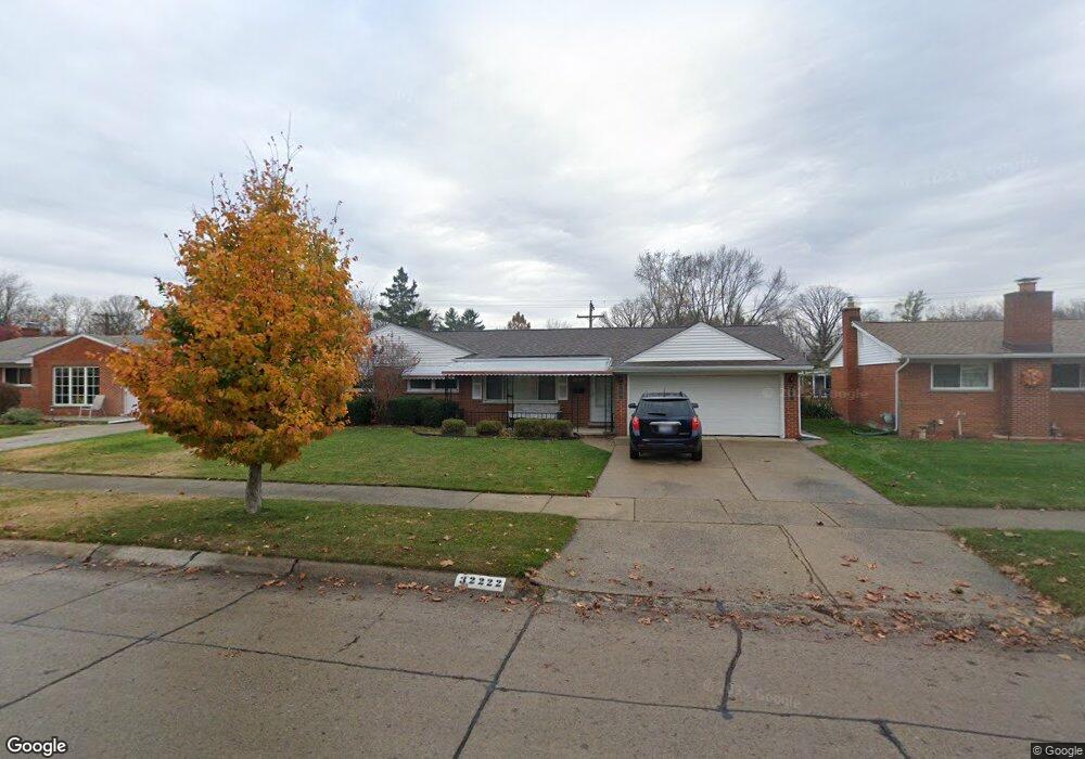
32222 Bretton St Livonia, MI 48152
Estimated Value: $268,784 - $314,000
--
Bed
1
Bath
1,257
Sq Ft
$237/Sq Ft
Est. Value
About This Home
This home is located at 32222 Bretton St, Livonia, MI 48152 and is currently estimated at $297,696, approximately $236 per square foot. 32222 Bretton St is a home located in Wayne County with nearby schools including Webster Elementary School, Coolidge Elementary School, and Riley Upper Elementary School.
Ownership History
Date
Name
Owned For
Owner Type
Purchase Details
Closed on
Oct 31, 2014
Sold by
Proctor Wayne M and Proctor Gregory T
Bought by
Proctor Wayne M and Proctor Gregory T
Current Estimated Value
Purchase Details
Closed on
Sep 21, 1994
Sold by
Proctor Michael J
Bought by
Wayne M and Proctor Gregory T
Home Financials for this Owner
Home Financials are based on the most recent Mortgage that was taken out on this home.
Original Mortgage
$76,000
Interest Rate
8.64%
Mortgage Type
New Conventional
Create a Home Valuation Report for This Property
The Home Valuation Report is an in-depth analysis detailing your home's value as well as a comparison with similar homes in the area
Home Values in the Area
Average Home Value in this Area
Purchase History
| Date | Buyer | Sale Price | Title Company |
|---|---|---|---|
| Proctor Wayne M | -- | Reputation First Title Agenc | |
| Wayne M | $80,000 | -- |
Source: Public Records
Mortgage History
| Date | Status | Borrower | Loan Amount |
|---|---|---|---|
| Closed | Wayne M | $76,000 |
Source: Public Records
Tax History Compared to Growth
Tax History
| Year | Tax Paid | Tax Assessment Tax Assessment Total Assessment is a certain percentage of the fair market value that is determined by local assessors to be the total taxable value of land and additions on the property. | Land | Improvement |
|---|---|---|---|---|
| 2025 | $1,488 | $135,000 | $0 | $0 |
| 2024 | $1,488 | $125,000 | $0 | $0 |
| 2023 | $1,419 | $118,000 | $0 | $0 |
| 2022 | $2,492 | $105,800 | $0 | $0 |
| 2021 | $2,421 | $98,200 | $0 | $0 |
| 2019 | $2,322 | $83,900 | $0 | $0 |
| 2018 | $1,200 | $74,700 | $0 | $0 |
| 2017 | $2,059 | $70,600 | $0 | $0 |
| 2016 | $2,165 | $69,400 | $0 | $0 |
| 2015 | $5,241 | $64,090 | $0 | $0 |
| 2012 | -- | $49,590 | $11,550 | $38,040 |
Source: Public Records
Map
Nearby Homes
- 32038 Pembroke St
- 19647 Osmus St
- 20133 Osmus St
- 19443 Auburndale St
- 31419 Fairfax St
- 32805 Fargo St
- 32965 Fargo St
- 19436 Donna St
- 31502 Merriwood Park Dr Unit 32
- 30947 Kenwood Ct
- 19292 Farmington Rd
- 19288 Farmington Rd
- 19250 Farmington Rd
- 19021 Merriman Rd
- 20221 Sunset St
- 20215 Sunset St
- Vacant Newburg Newburg
- 20257 Sunset St
- 18902 Westmore St
- 33155 Meadowlark St
- 32234 Bretton St
- 32208 Bretton St
- 32162 Pembroke St
- 32248 Bretton St
- 32263 Bretton St
- 32209 Bretton St
- 32150 Pembroke St
- 19675 Hardy St
- 19930 Hubbard St
- 32201 Bretton St
- 32120 Bretton St
- 32262 Bretton St
- 32149 Pembroke St
- 19658 Hardy St
- 19661 Hardy St
- 32121 Bretton St
- 19934 Hubbard St
- 19940 Hubbard St
- 32255 Bretton St
- 32138 Pembroke St