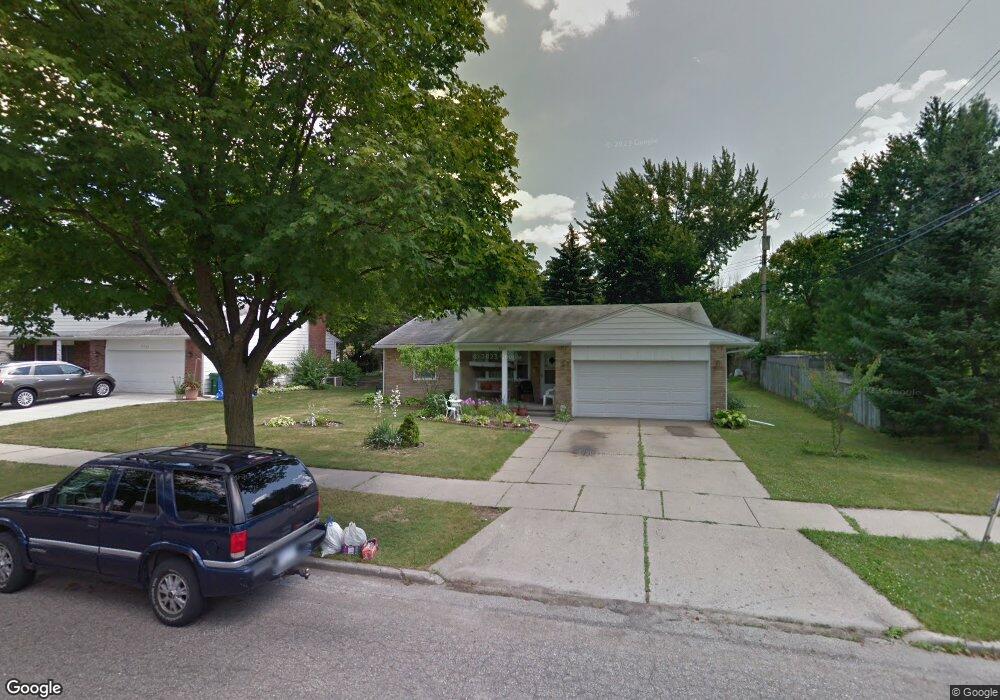
3225 Gingersnap Ln Lansing, MI 48911
Averill Woods NeighborhoodEstimated Value: $220,000 - $247,000
--
Bed
1
Bath
1,720
Sq Ft
$136/Sq Ft
Est. Value
About This Home
This home is located at 3225 Gingersnap Ln, Lansing, MI 48911 and is currently estimated at $233,148, approximately $135 per square foot. 3225 Gingersnap Ln is a home located in Ingham County with nearby schools including Averill Elementary School, Attwood School, and J.W. Sexton High School.
Ownership History
Date
Name
Owned For
Owner Type
Purchase Details
Closed on
Oct 5, 2022
Sold by
Gedeon Bishara and Gedeon Floren
Bought by
Gedeon Bishara
Current Estimated Value
Create a Home Valuation Report for This Property
The Home Valuation Report is an in-depth analysis detailing your home's value as well as a comparison with similar homes in the area
Home Values in the Area
Average Home Value in this Area
Purchase History
| Date | Buyer | Sale Price | Title Company |
|---|---|---|---|
| Gedeon Bishara | -- | Land Title | |
| Gedeon Bishara M | -- | -- |
Source: Public Records
Tax History Compared to Growth
Tax History
| Year | Tax Paid | Tax Assessment Tax Assessment Total Assessment is a certain percentage of the fair market value that is determined by local assessors to be the total taxable value of land and additions on the property. | Land | Improvement |
|---|---|---|---|---|
| 2025 | $3,948 | $109,900 | $14,400 | $95,500 |
| 2024 | $32 | $96,100 | $14,400 | $81,700 |
| 2023 | $3,700 | $88,800 | $14,400 | $74,400 |
| 2022 | $3,333 | $81,200 | $12,700 | $68,500 |
| 2021 | $3,264 | $77,000 | $12,300 | $64,700 |
| 2020 | $3,244 | $73,700 | $12,300 | $61,400 |
| 2019 | $3,111 | $65,500 | $12,300 | $53,200 |
| 2018 | $2,914 | $59,600 | $12,300 | $47,300 |
| 2017 | $2,790 | $59,600 | $12,300 | $47,300 |
| 2016 | $2,668 | $52,600 | $12,300 | $40,300 |
| 2015 | $2,668 | $48,700 | $24,596 | $24,104 |
| 2014 | $2,668 | $47,800 | $24,596 | $23,204 |
Source: Public Records
Map
Nearby Homes
- 2838 Sunderland Rd
- 2905 S Catherine St
- 3200 Lawdor Rd
- 2710 Bedford Rd
- 0 S Deerfield Ave
- 3600 Sandhurst Dr
- 3510 Christine Dr
- 3212 Ingham St
- 3425 Cooley Dr
- 3334 Ingham St
- 3421 Troon Cir Unit 29
- 3324 Viking St
- 4.5 Locust Ln
- 3614 Cooley Dr
- 3700 W Holmes Rd
- 3424 S Catherine St
- 2800 S Waverly Hwy
- 2409 Victor Ave
- 3100 Glenbrook Dr
- 3508 Muirfield Dr