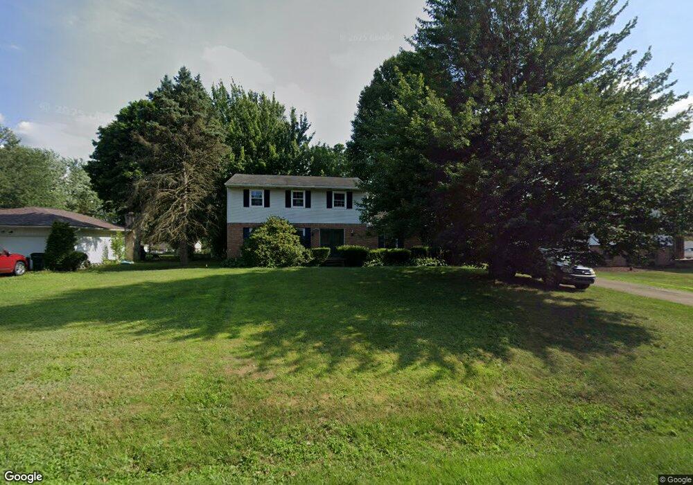
3226 Wright Rd NW Uniontown, OH 44685
Estimated Value: $294,384 - $363,000
4
Beds
3
Baths
1,928
Sq Ft
$169/Sq Ft
Est. Value
About This Home
This home is located at 3226 Wright Rd NW, Uniontown, OH 44685 and is currently estimated at $326,596, approximately $169 per square foot. 3226 Wright Rd NW is a home located in Stark County with nearby schools including North Canton Middle School, Hoover High School, and St Paul School.
Ownership History
Date
Name
Owned For
Owner Type
Purchase Details
Closed on
Dec 20, 1996
Sold by
Ostrowske Crystal D
Bought by
Baker Hulton E and Baker Heidi
Current Estimated Value
Home Financials for this Owner
Home Financials are based on the most recent Mortgage that was taken out on this home.
Original Mortgage
$120,174
Outstanding Balance
$12,260
Interest Rate
7.74%
Mortgage Type
New Conventional
Estimated Equity
$314,336
Purchase Details
Closed on
Jul 24, 1992
Create a Home Valuation Report for This Property
The Home Valuation Report is an in-depth analysis detailing your home's value as well as a comparison with similar homes in the area
Home Values in the Area
Average Home Value in this Area
Purchase History
| Date | Buyer | Sale Price | Title Company |
|---|---|---|---|
| Baker Hulton E | $121,000 | -- | |
| -- | $99,000 | -- |
Source: Public Records
Mortgage History
| Date | Status | Borrower | Loan Amount |
|---|---|---|---|
| Open | Baker Hulton E | $120,174 |
Source: Public Records
Tax History
| Year | Tax Paid | Tax Assessment Tax Assessment Total Assessment is a certain percentage of the fair market value that is determined by local assessors to be the total taxable value of land and additions on the property. | Land | Improvement |
|---|---|---|---|---|
| 2025 | -- | $83,130 | $29,610 | $53,520 |
| 2024 | -- | $83,130 | $29,610 | $53,520 |
| 2023 | $3,509 | $66,360 | $23,590 | $42,770 |
| 2022 | $3,365 | $66,360 | $23,590 | $42,770 |
| 2021 | $3,463 | $66,360 | $23,590 | $42,770 |
| 2020 | $3,317 | $58,070 | $20,340 | $37,730 |
| 2019 | $3,105 | $58,070 | $20,340 | $37,730 |
Source: Public Records
Map
Nearby Homes
- 10344 Sudbury Cir NW Unit 10344
- 0 Heckman St NW Unit 5170772
- 3475 Heckman St NW
- 9520-9570 Cleveland Ave NW
- 3863 Heckman St NW
- 11597 Forest Meadows Cir NW
- 4943 Mayfair Rd
- 11931 Walton Cir NW
- 1771 Midway St NW
- 2601 Lake Center St NW
- 2815 Byron Dr
- 2368 Vixen St NW
- 8876 Blitzen Rd NW
- 8628 Essex Ave NW
- 8817 Pleasantwood Ave NW
- Sarasota Plan at Spring Hill - Spring Hill Villas
- Chester Plan at Spring Hill - Spring Hill Villas
- Kenai Plan at Spring Hill - Spring Hill Villas
- Holston Plan at Spring Hill - Spring Hill Villas
- Bradbern Plan at Spring Hill - Spring Hill Villas
- 3204 Wright Rd NW
- 3244 Wright Rd NW
- 10483 Cleveland Ave NW
- 3221 Wright Rd NW
- 10533 Cleveland Ave NW
- 3247 Wright Rd NW
- 3280 Wright Rd NW
- 3215 Cain St NW
- 3231 Cain St NW
- 3253 Cain St NW
- 3195 Cain St NW
- 10484 Cleveland Ave NW
- 10568 Charney Ave NW
- 3300 Wright Rd NW
- 0 Cleveland and Wright Rd NW Unit 4389438
- 3285 Wright Rd NW
- 3271 Cain St NW
- 10532 Cleveland Ave NW
- 10423 Cleveland Ave NW
- 10554 Cleveland Ave NW
