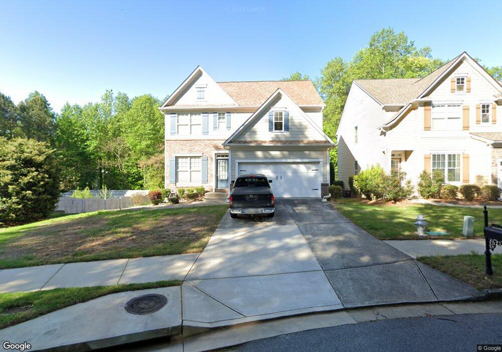
3227 Wyesham Cir Duluth, GA 30096
Estimated Value: $475,943 - $555,000
4
Beds
3
Baths
2,184
Sq Ft
$233/Sq Ft
Est. Value
About This Home
This home is located at 3227 Wyesham Cir, Duluth, GA 30096 and is currently estimated at $509,486, approximately $233 per square foot. 3227 Wyesham Cir is a home located in Gwinnett County with nearby schools including B.B. Harris Elementary School, Duluth Middle School, and Duluth High School.
Ownership History
Date
Name
Owned For
Owner Type
Purchase Details
Closed on
Jan 14, 2005
Sold by
Bowen Family Homes Inc
Bought by
Kotey Daniel D
Current Estimated Value
Home Financials for this Owner
Home Financials are based on the most recent Mortgage that was taken out on this home.
Original Mortgage
$45,200
Outstanding Balance
$22,455
Interest Rate
5.61%
Mortgage Type
New Conventional
Estimated Equity
$487,031
Create a Home Valuation Report for This Property
The Home Valuation Report is an in-depth analysis detailing your home's value as well as a comparison with similar homes in the area
Home Values in the Area
Average Home Value in this Area
Purchase History
| Date | Buyer | Sale Price | Title Company |
|---|---|---|---|
| Kotey Daniel D | $226,500 | -- |
Source: Public Records
Mortgage History
| Date | Status | Borrower | Loan Amount |
|---|---|---|---|
| Open | Kotey Daniel D | $45,200 | |
| Open | Kotey Daniel D | $181,150 |
Source: Public Records
Tax History
| Year | Tax Paid | Tax Assessment Tax Assessment Total Assessment is a certain percentage of the fair market value that is determined by local assessors to be the total taxable value of land and additions on the property. | Land | Improvement |
|---|---|---|---|---|
| 2025 | $1,386 | $214,560 | $29,920 | $184,640 |
| 2024 | $4,815 | $199,840 | $34,800 | $165,040 |
| 2023 | $4,815 | $183,840 | $34,800 | $149,040 |
| 2022 | $3,317 | $126,360 | $24,000 | $102,360 |
| 2021 | $3,403 | $126,360 | $24,000 | $102,360 |
| 2020 | $3,226 | $116,680 | $22,000 | $94,680 |
| 2019 | $4,033 | $116,680 | $22,000 | $94,680 |
| 2018 | $3,101 | $110,440 | $18,400 | $92,040 |
| 2016 | $2,637 | $89,040 | $14,400 | $74,640 |
| 2015 | $3,226 | $89,040 | $14,400 | $74,640 |
| 2014 | $2,505 | $80,840 | $13,600 | $67,240 |
Source: Public Records
Map
Nearby Homes
- 3377 Montheath Pass
- 3097 Wyesham Cir
- 3080 Governors Ave
- 3357 Wyesham Cir
- 3302 Monarch Ave
- 3250 Governors Ct
- 3221 Bromley Rowe
- 3104 Tofte Dr
- 3204 Westphall Ct NW
- 3411 Swallowtail Terrace
- 3057 Orchard Ridge Cir
- 3143 Claiborne Dr
- 3196 Moor View Rd Unit 27
- 2862 Evanshire Ave Unit 115
- 2852 Evanshire Ave Unit 114
- 2842 Evanshire Ave Unit 113
- 2822 Evanshire Ave Unit 111
- 2832 Evanshire Ave Unit 112
- 3355 Cresswell Link Way
- 2812 Evanshire Ave Unit 110
- 3217 Wyesham Cir
- 3207 Wyesham Cir
- 3247 Wyesham Cir
- 3130 Governors Ct
- 3257 Wyesham Cir
- 3140 Governors Ct
- 3267 Wyesham Cir
- 3095 Saint Andrews Dr
- 3187 Wyesham Cir
- 3105 Saint Andrews Dr
- 3177 Wyesham Cir
- 3367 Montheath Pass
- 3150 Governors Ct
- 3287 Wyesham Cir
- 3167 Wyesham Cir
- 3075 Saint Andrews Dr
- 3115 Saint Andrews Dr
- 3297 Wyesham Cir
- 3157 Wyesham Cir
- 3130 Governors Ave
Your Personal Tour Guide
Ask me questions while you tour the home.