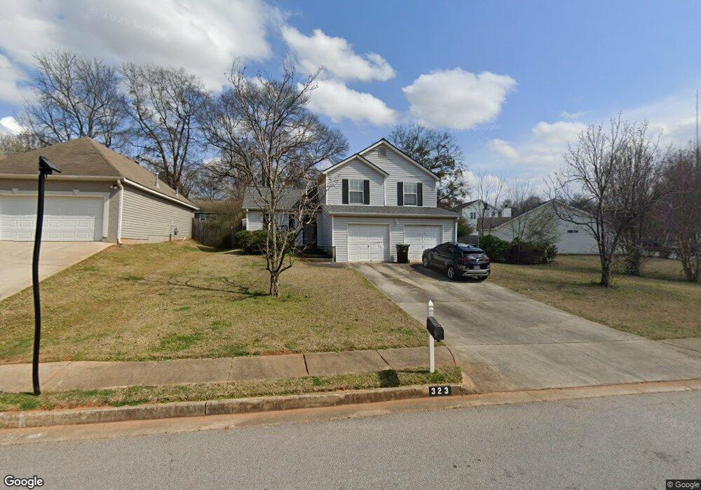
323 Brookside Dr Unit 1 McDonough, GA 30253
Estimated Value: $225,000 - $245,000
3
Beds
2
Baths
1,368
Sq Ft
$171/Sq Ft
Est. Value
About This Home
This home is located at 323 Brookside Dr Unit 1, McDonough, GA 30253 and is currently estimated at $233,537, approximately $170 per square foot. 323 Brookside Dr Unit 1 is a home located in Henry County with nearby schools including Oakland Elementary School, Eagle's Landing Middle School, and Eagle's Landing High School.
Ownership History
Date
Name
Owned For
Owner Type
Purchase Details
Closed on
May 29, 1998
Sold by
G T Architecture Contractors Corp
Bought by
Smith Marcel
Current Estimated Value
Home Financials for this Owner
Home Financials are based on the most recent Mortgage that was taken out on this home.
Original Mortgage
$90,716
Outstanding Balance
$17,803
Interest Rate
7.15%
Mortgage Type
New Conventional
Estimated Equity
$215,734
Create a Home Valuation Report for This Property
The Home Valuation Report is an in-depth analysis detailing your home's value as well as a comparison with similar homes in the area
Home Values in the Area
Average Home Value in this Area
Purchase History
| Date | Buyer | Sale Price | Title Company |
|---|---|---|---|
| Smith Marcel | $89,900 | -- |
Source: Public Records
Mortgage History
| Date | Status | Borrower | Loan Amount |
|---|---|---|---|
| Open | Smith Marcel | $90,716 |
Source: Public Records
Tax History Compared to Growth
Tax History
| Year | Tax Paid | Tax Assessment Tax Assessment Total Assessment is a certain percentage of the fair market value that is determined by local assessors to be the total taxable value of land and additions on the property. | Land | Improvement |
|---|---|---|---|---|
| 2025 | $2,601 | $88,320 | $14,000 | $74,320 |
| 2024 | $2,601 | $89,200 | $14,000 | $75,200 |
| 2023 | $2,219 | $92,800 | $12,000 | $80,800 |
| 2022 | $2,187 | $69,720 | $12,000 | $57,720 |
| 2021 | $1,773 | $52,840 | $12,000 | $40,840 |
| 2020 | $1,666 | $48,560 | $8,000 | $40,560 |
| 2019 | $1,594 | $44,800 | $8,000 | $36,800 |
| 2018 | $1,375 | $39,240 | $7,200 | $32,040 |
| 2016 | $1,236 | $35,360 | $7,200 | $28,160 |
| 2015 | $1,129 | $31,880 | $7,200 | $24,680 |
| 2014 | $908 | $27,040 | $6,000 | $21,040 |
Source: Public Records
Map
Nearby Homes
- 273 Village Dr
- 205 Coral Cir
- 371 Coral Cir
- 608 Pelican Place
- 261 Coral Cir
- 263 Coral Cir
- 433 Kara Ln
- 326 Coral Cir
- 401 Bainbridge Dr
- 169 Parkview Place Dr
- 173 Parkview Place Dr
- 121 Parkview Place Dr
- 125 Parkview Place Dr
- 129 Parkview Place Dr
- 816 Royal Red Ct
- 235 London Dr
- 167 London Dr
- 501 Epris Ln Unit 61
- 408 Kendall Ln
- 853 Parkside Place Ave
- 317 Brookside Dr
- 255 Village Dr
- 257 Village Dr Unit 1
- 329 Brookside Dr Unit 1
- 326 Brookside Dr
- 253 Village Dr Unit 1
- 259 Village Dr
- 324 Brookside Dr Unit 1
- 328 Brookside Dr
- 331 Brookside Dr
- 331 Brookside Dr Unit 2
- 1199 Village Dr
- 0 Village Dr Unit 7564559
- 0 Village Dr Unit 8617307
- 0 Village Dr Unit 8375798
- 0 Village Dr Unit 7578160
- 0 Village Dr Unit 3217039
- 0 Village Dr Unit 3165487
- 0 Village Dr Unit 7188159
- 0 Village Dr Unit 3242692