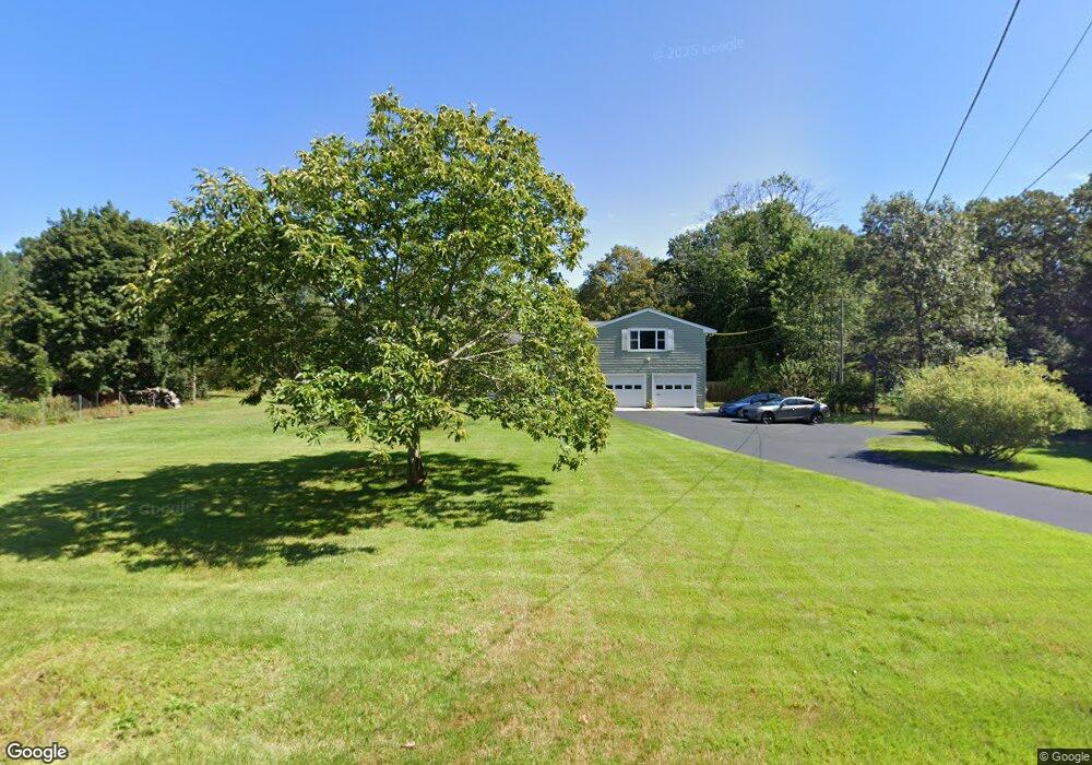
323 Madison St Wrentham, MA 02093
Estimated Value: $695,000 - $777,000
3
Beds
3
Baths
2,275
Sq Ft
$324/Sq Ft
Est. Value
About This Home
This home is located at 323 Madison St, Wrentham, MA 02093 and is currently estimated at $738,058, approximately $324 per square foot. 323 Madison St is a home located in Norfolk County with nearby schools including Delaney Elementary School, Charles E Roderick, and Cadence Academy Preschool - North Attleborough.
Ownership History
Date
Name
Owned For
Owner Type
Purchase Details
Closed on
Mar 8, 1986
Bought by
Mcgarry Edward C
Current Estimated Value
Create a Home Valuation Report for This Property
The Home Valuation Report is an in-depth analysis detailing your home's value as well as a comparison with similar homes in the area
Home Values in the Area
Average Home Value in this Area
Purchase History
| Date | Buyer | Sale Price | Title Company |
|---|---|---|---|
| Mcgarry Edward C | -- | -- |
Source: Public Records
Mortgage History
| Date | Status | Borrower | Loan Amount |
|---|---|---|---|
| Open | Mcgarry Edward C | $83,000 | |
| Closed | Mcgarry Edward C | $20,000 | |
| Closed | Mcgarry Edward C | $46,000 |
Source: Public Records
Tax History Compared to Growth
Tax History
| Year | Tax Paid | Tax Assessment Tax Assessment Total Assessment is a certain percentage of the fair market value that is determined by local assessors to be the total taxable value of land and additions on the property. | Land | Improvement |
|---|---|---|---|---|
| 2025 | $7,813 | $674,100 | $300,000 | $374,100 |
| 2024 | $7,381 | $615,100 | $300,000 | $315,100 |
| 2023 | $7,236 | $573,400 | $273,000 | $300,400 |
| 2022 | $6,734 | $492,600 | $234,900 | $257,700 |
| 2021 | $6,196 | $440,400 | $246,600 | $193,800 |
| 2020 | $6,421 | $450,600 | $175,800 | $274,800 |
| 2019 | $6,018 | $426,200 | $168,400 | $257,800 |
| 2018 | $5,958 | $418,400 | $168,500 | $249,900 |
| 2017 | $5,593 | $392,500 | $165,300 | $227,200 |
| 2016 | $5,722 | $400,700 | $177,800 | $222,900 |
| 2015 | $5,265 | $351,500 | $155,800 | $195,700 |
| 2014 | $5,219 | $340,900 | $149,900 | $191,000 |
Source: Public Records
Map
Nearby Homes
- 120 Hawes St
- 155 Clark Rd Unit 155
- 319 Taunton St
- 483 Thurston St
- 362 East St
- 65 Pond St
- 10 Nature View Dr
- 15 Nature View Dr
- 1 Lorraine Metcalf Dr
- 270 Dedham St
- 11 Earle Stewart Ln
- Lot 1 - Blueberry 2 Car Plan at King Philip Estates
- Lot 8 - Blueberry 2 Car Plan at King Philip Estates
- Lot 5 - Hughes 2 car Plan at King Philip Estates
- Lot 6 - Blueberry 3 Car Plan at King Philip Estates
- Lot 2 - Camden 2 Car Plan at King Philip Estates
- Lot 7 - Cedar Plan at King Philip Estates
- Lot 4 - Hemingway 2 Car Plan at King Philip Estates
- Lot 3 - Blueberry 2 Car Plan at King Philip Estates
- Lot 3 - 14 Earle Stewart Ln
- 335 Madison St
- 324 Madison St
- 345 Madison St
- 314 Madison St
- 336 Madison St
- 15 Stoney Brook Ln
- 311 Madison St
- 25 Stoney Brook Ln
- 306 Madison St
- 15 Regent Rd
- 354 Madison St
- 10 Stoney Brook Ln
- 359 Madison St
- 291 Madison St
- 35 Stoney Brook Ln
- 10 Regent Rd
- 298 Madison St
- 369 Madison St
- 20 Stoney Brook Ln
- 25 Regent Rd