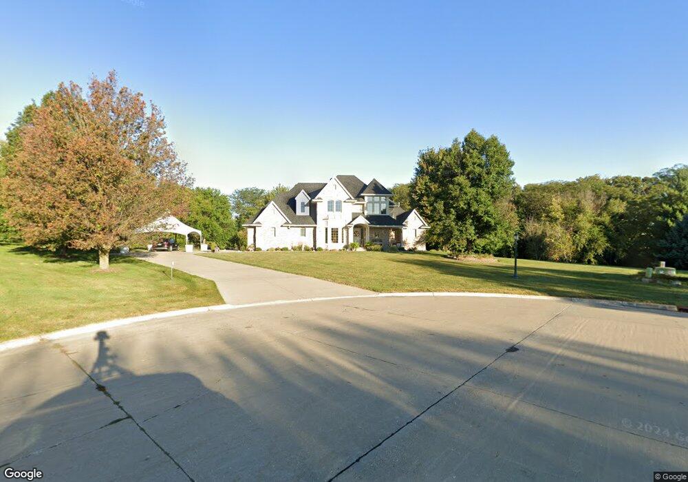
3231 Maple Ct Waukee, IA 50263
Estimated Value: $816,000 - $1,190,298
5
Beds
5
Baths
3,257
Sq Ft
$304/Sq Ft
Est. Value
About This Home
This home is located at 3231 Maple Ct, Waukee, IA 50263 and is currently estimated at $990,325, approximately $304 per square foot. 3231 Maple Ct is a home located in Dallas County with nearby schools including Timberline School, Prairieview Middle School, and Waukee High School.
Ownership History
Date
Name
Owned For
Owner Type
Purchase Details
Closed on
Jun 23, 2011
Sold by
Davis Donald M and Davis Rochelle A
Bought by
Schlotfeldt Thomas J
Current Estimated Value
Home Financials for this Owner
Home Financials are based on the most recent Mortgage that was taken out on this home.
Original Mortgage
$48,000
Outstanding Balance
$32,731
Interest Rate
4.63%
Mortgage Type
Credit Line Revolving
Estimated Equity
$957,594
Create a Home Valuation Report for This Property
The Home Valuation Report is an in-depth analysis detailing your home's value as well as a comparison with similar homes in the area
Home Values in the Area
Average Home Value in this Area
Purchase History
| Date | Buyer | Sale Price | Title Company |
|---|---|---|---|
| Schlotfeldt Thomas J | $435,000 | None Available |
Source: Public Records
Mortgage History
| Date | Status | Borrower | Loan Amount |
|---|---|---|---|
| Open | Schlotfeldt Thomas J | $48,000 | |
| Closed | Schlotfeldt Thomas J | $352,000 |
Source: Public Records
Tax History
| Year | Tax Paid | Tax Assessment Tax Assessment Total Assessment is a certain percentage of the fair market value that is determined by local assessors to be the total taxable value of land and additions on the property. | Land | Improvement |
|---|---|---|---|---|
| 2025 | $12,696 | $819,620 | $160,000 | $659,620 |
| 2024 | $11,172 | $769,590 | $160,000 | $609,590 |
| 2023 | $11,172 | $769,590 | $160,000 | $609,590 |
| 2022 | $10,096 | $583,890 | $75,000 | $508,890 |
| 2021 | $10,096 | $534,360 | $75,000 | $459,360 |
| 2020 | $9,962 | $508,530 | $75,000 | $433,530 |
| 2019 | $10,050 | $508,530 | $75,000 | $433,530 |
| 2018 | $10,050 | $488,100 | $75,000 | $413,100 |
| 2017 | $8,756 | $488,100 | $75,000 | $413,100 |
| 2016 | $8,546 | $450,970 | $60,200 | $390,770 |
| 2015 | $6,104 | $315,670 | $0 | $0 |
| 2014 | $7,552 | $315,670 | $0 | $0 |
Source: Public Records
Map
Nearby Homes
- 1005 Hemlock Ln
- 995 Hemlock Ln
- 930 Harrington Way
- 795 Canterbury Cir
- 805 Canterbury Cir
- 790 Hamilton Rd
- 3565 Azalea Dr
- 3520 Azalea Dr
- 3890 Fieldstone Dr
- 820 Hamilton Rd
- 955 Harrington Way
- 950 Harrington Way
- 975 Harrington Way
- 935 Harrington Way
- 3585 Paradise Ln
- 3560 Azalea Dr
- 860 Hamilton Rd
- 3595 Paradise Ln
- 3570 Azalea Dr
- 3605 Paradise Ln
- 3232 Maple Ct
- 3235 Maple Ct
- 3236 Maple Ct
- 3239 Maple Ct
- 3240 Maple Ct
- 890 Harrington Way
- 3237 Oakview Ct
- 3233 Oakview Ct
- 3062 Cottonwood Dr
- 960 Harrington Way
- 795 Canterbury Cir Unit 36781162
- 795 Canterbury Cir Unit 36781133
- 795 Canterbury Cir Unit 36781143
- 795 Canterbury Cir Unit 36781018
- 795 Canterbury Cir Unit 36781091
- 795 Canterbury Cir Unit 36780000
- 795 Canterbury Cir Unit 36750090
- 795 Canterbury Cir Unit 36750086
- 795 Canterbury Cir Unit 36750083
- 795 Canterbury Cir Unit 36750080
Your Personal Tour Guide
Ask me questions while you tour the home.