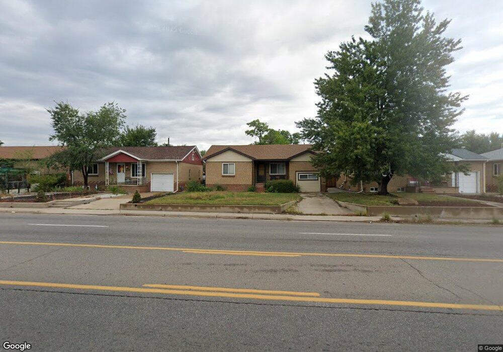
3231 Sheridan Blvd Wheat Ridge, CO 80212
East Wheat Ridge NeighborhoodEstimated Value: $519,758 - $581,000
2
Beds
1
Bath
1,125
Sq Ft
$487/Sq Ft
Est. Value
About This Home
This home is located at 3231 Sheridan Blvd, Wheat Ridge, CO 80212 and is currently estimated at $548,190, approximately $487 per square foot. 3231 Sheridan Blvd is a home located in Jefferson County with nearby schools including Stevens Elementary School, Everitt Middle School, and Wheat Ridge High School.
Ownership History
Date
Name
Owned For
Owner Type
Purchase Details
Closed on
Jun 11, 2004
Sold by
Vigil Claudio
Bought by
Vigil Claudio M and Vigil Carmen M
Current Estimated Value
Home Financials for this Owner
Home Financials are based on the most recent Mortgage that was taken out on this home.
Original Mortgage
$133,000
Interest Rate
4.75%
Mortgage Type
Purchase Money Mortgage
Create a Home Valuation Report for This Property
The Home Valuation Report is an in-depth analysis detailing your home's value as well as a comparison with similar homes in the area
Home Values in the Area
Average Home Value in this Area
Purchase History
| Date | Buyer | Sale Price | Title Company |
|---|---|---|---|
| Vigil Claudio M | -- | Fahtco |
Source: Public Records
Mortgage History
| Date | Status | Borrower | Loan Amount |
|---|---|---|---|
| Closed | Vigil Claudio M | $133,000 |
Source: Public Records
Tax History Compared to Growth
Tax History
| Year | Tax Paid | Tax Assessment Tax Assessment Total Assessment is a certain percentage of the fair market value that is determined by local assessors to be the total taxable value of land and additions on the property. | Land | Improvement |
|---|---|---|---|---|
| 2024 | $2,529 | $28,920 | $15,107 | $13,813 |
| 2023 | $2,529 | $28,920 | $15,107 | $13,813 |
| 2022 | $2,096 | $23,539 | $10,282 | $13,257 |
| 2021 | $2,125 | $24,216 | $10,578 | $13,638 |
| 2020 | $1,959 | $22,435 | $10,413 | $12,022 |
| 2019 | $1,932 | $22,435 | $10,413 | $12,022 |
| 2018 | $1,961 | $22,010 | $5,388 | $16,622 |
| 2017 | $1,771 | $22,010 | $5,388 | $16,622 |
| 2016 | $1,443 | $16,778 | $3,851 | $12,927 |
| 2015 | $1,273 | $16,778 | $3,851 | $12,927 |
| 2014 | $1,273 | $13,889 | $3,557 | $10,332 |
Source: Public Records
Map
Nearby Homes
- 3280 Ames St
- 3100 Ames St
- 5040 W 33rd Ave
- 5050 W 33rd Ave
- 3450 Benton St
- 4940 W 31st Ave
- 3501 Sheridan Blvd
- 3019 Chase St
- 5051 W 35th Ave
- 2933 Benton St
- 5125 W 29th Ave Unit 1
- 3530 Chase St
- 2834 Benton St
- 3022 Fenton St
- 3625 Chase St
- 3530 Fenton St
- 4720 W 37th Ave Unit 29
- 3515 Gray St
- 4400 W 32nd Ave
- 3422 Utica St
- 3221 Sheridan Blvd
- 3251 Sheridan Blvd
- 3251 Sheridan Blvd Unit 3251 Sheridan Blvd
- 3219 Sheridan Blvd
- 3230 Ames St
- 3261 Sheridan Blvd
- 5124 W Moncrieff Place
- 3220 Ames St
- 3246 Ames St
- 3201 Sheridan Blvd
- 3210 Ames St
- 3271 Sheridan Blvd
- 3258 Ames St
- 3233 Zenobia St
- 3200 Sheridan Blvd Unit 3204
- 5167 W Moncrieff Place
- 3217 Zenobia St
- 3281 Sheridan Blvd
- 3264 Ames St
- 5101 W 32nd Ave