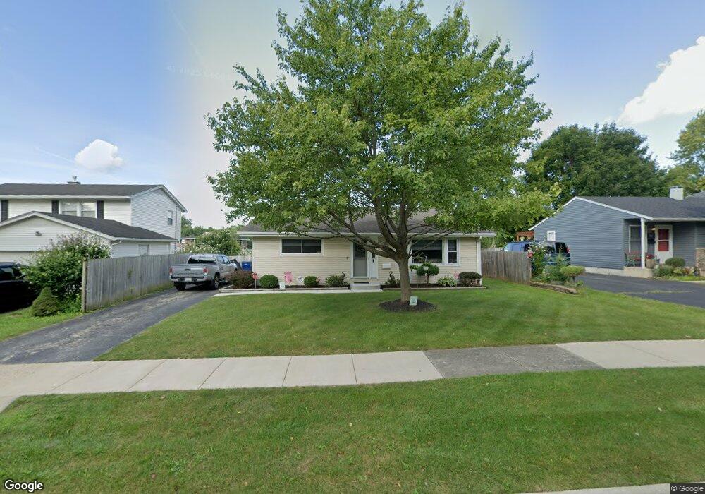
3232 Twyford Rd Unit 2 Waukegan, IL 60087
Estimated Value: $236,000 - $306,000
3
Beds
1
Bath
1,073
Sq Ft
$245/Sq Ft
Est. Value
About This Home
This home is located at 3232 Twyford Rd Unit 2, Waukegan, IL 60087 and is currently estimated at $262,563, approximately $244 per square foot. 3232 Twyford Rd Unit 2 is a home located in Lake County with nearby schools including H R McCall Elementary School, Jack Benny Middle School, and Waukegan High School.
Ownership History
Date
Name
Owned For
Owner Type
Purchase Details
Closed on
Oct 25, 1996
Sold by
Crane Thomas J and Crane Joan L
Bought by
Campbell Sean L and Campbell Lisa M
Current Estimated Value
Home Financials for this Owner
Home Financials are based on the most recent Mortgage that was taken out on this home.
Original Mortgage
$105,950
Outstanding Balance
$10,654
Interest Rate
8.32%
Mortgage Type
FHA
Estimated Equity
$251,909
Create a Home Valuation Report for This Property
The Home Valuation Report is an in-depth analysis detailing your home's value as well as a comparison with similar homes in the area
Home Values in the Area
Average Home Value in this Area
Purchase History
| Date | Buyer | Sale Price | Title Company |
|---|---|---|---|
| Campbell Sean L | $107,000 | First American Title |
Source: Public Records
Mortgage History
| Date | Status | Borrower | Loan Amount |
|---|---|---|---|
| Open | Campbell Sean L | $105,950 |
Source: Public Records
Tax History Compared to Growth
Tax History
| Year | Tax Paid | Tax Assessment Tax Assessment Total Assessment is a certain percentage of the fair market value that is determined by local assessors to be the total taxable value of land and additions on the property. | Land | Improvement |
|---|---|---|---|---|
| 2024 | $4,927 | $66,693 | $10,576 | $56,117 |
| 2023 | $4,727 | $60,250 | $9,554 | $50,696 |
| 2022 | $4,727 | $54,350 | $8,192 | $46,158 |
| 2021 | $4,576 | $49,888 | $7,801 | $42,087 |
| 2020 | $4,588 | $46,477 | $7,268 | $39,209 |
| 2019 | $4,565 | $42,589 | $6,660 | $35,929 |
| 2018 | $3,925 | $36,743 | $8,569 | $28,174 |
| 2017 | $3,771 | $32,507 | $7,581 | $24,926 |
| 2016 | $3,438 | $28,248 | $6,588 | $21,660 |
| 2015 | $3,257 | $25,282 | $5,896 | $19,386 |
| 2014 | $2,857 | $22,424 | $6,135 | $16,289 |
| 2012 | $3,761 | $24,294 | $6,646 | $17,648 |
Source: Public Records
Map
Nearby Homes
- 3211 Rugby Ct
- 3411 N Lewis Ave
- 3101 Country Club Ln
- 37966 N Cornell Rd
- 1636 Rice St
- 1730 W Beach Rd
- 2625 Vercoe Ave
- 38683 N Lewis Ave
- 1612 Whitney St
- 12312 W Audrey Ave
- 38127 N Shore Ave
- 2613 N Lewis Ave
- 38362 N Manor Ave
- 12582 W Beach Rd
- 37905 N Loyola Ave
- 2708 Dana Ave
- 38697 N Cedar Ave
- 11345 W Carnahan Ave
- 2705 Dana Ave
- 11342-11364 W Wadsworth Rd
- 3228 Twyford Rd Unit 2
- 3236 Twyford Rd
- 3226 Twyford Rd
- 2301 Dover Rd
- 3220 Twyford Rd
- 3229 Twyford Rd
- 3233 Twyford Rd
- 3225 Twyford Rd
- 2205 Dover Rd
- 3221 Twyford Rd
- 3218 Twyford Rd
- 2304 Dover Rd Unit 2
- 3217 Twyford Rd
- 2300 Dover Rd
- 2212 Dover Rd
- 2308 Dover Rd
- 3214 Twyford Rd
- 2123 Dover Rd
- 2312 Dover Rd
- 2208 Dover Rd