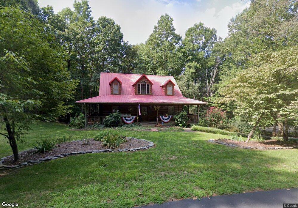
3233 Auld Farm Dr Lenoir, NC 28645
Estimated Value: $317,000 - $723,000
3
Beds
3
Baths
1,806
Sq Ft
$247/Sq Ft
Est. Value
About This Home
This home is located at 3233 Auld Farm Dr, Lenoir, NC 28645 and is currently estimated at $446,620, approximately $247 per square foot. 3233 Auld Farm Dr is a home located in Caldwell County with nearby schools including Lower Creek Elementary School, William Lenoir Middle School, and Hibriten High School.
Ownership History
Date
Name
Owned For
Owner Type
Purchase Details
Closed on
Jul 14, 2023
Sold by
Moore Charles Curtis and Moore Joanne P
Bought by
Petrosanu Virgil and Carpenter Mindy Kate
Current Estimated Value
Purchase Details
Closed on
Feb 9, 1999
Bought by
Moore Charles Alan and Moore Brenda
Purchase Details
Closed on
Feb 1, 1999
Purchase Details
Closed on
Nov 24, 1998
Bought by
D & J Properties
Purchase Details
Closed on
Nov 1, 1998
Create a Home Valuation Report for This Property
The Home Valuation Report is an in-depth analysis detailing your home's value as well as a comparison with similar homes in the area
Home Values in the Area
Average Home Value in this Area
Purchase History
| Date | Buyer | Sale Price | Title Company |
|---|---|---|---|
| Petrosanu Virgil | $5,500 | None Listed On Document | |
| Moore Charles Alan | $16,000 | -- | |
| -- | $16,000 | -- | |
| D & J Properties | $19,000 | -- | |
| -- | $19,000 | -- |
Source: Public Records
Tax History Compared to Growth
Tax History
| Year | Tax Paid | Tax Assessment Tax Assessment Total Assessment is a certain percentage of the fair market value that is determined by local assessors to be the total taxable value of land and additions on the property. | Land | Improvement |
|---|---|---|---|---|
| 2025 | $1,710 | $345,800 | $15,400 | $330,400 |
| 2024 | $1,710 | $220,500 | $15,400 | $205,100 |
| 2023 | $1,596 | $220,500 | $15,400 | $205,100 |
| 2022 | $1,565 | $220,500 | $15,400 | $205,100 |
| 2021 | $1,554 | $220,500 | $15,400 | $205,100 |
| 2020 | $1,522 | $211,600 | $30,000 | $181,600 |
| 2019 | $1,522 | $211,600 | $30,000 | $181,600 |
| 2018 | $1,522 | $211,600 | $0 | $0 |
| 2017 | $1,522 | $211,600 | $0 | $0 |
| 2016 | $1,522 | $211,600 | $0 | $0 |
| 2015 | $1,453 | $211,600 | $0 | $0 |
| 2014 | $1,453 | $211,600 | $0 | $0 |
Source: Public Records
Map
Nearby Homes
- 3218 Auld Farm Dr
- Lot# 24 Brittany Dr
- 0 Rusty Ln
- 2813 Lakeview Dr
- 2770 Lakeview Dr
- 2250 Cedar Rock Estate Dr
- 000 Rockwood Dr Unit 63,64,65
- LOT 97 Cedar Crest Dr Unit 97
- 97 Cedar Crest Dr
- 2108 Blue Ridge Cir
- 2219 Flanagan Dr
- 2330 Cedar Rock Cir
- 255 Wildwood Rd
- 113 Stoney Brook Dr
- 2042 Piper Ridge Dr
- 112 Stoney Brook Dr
- 111 Stoney Brook Dr
- 110 Stoney Brook Dr
- LOT 113 Stoney Brook Dr Unit 113
- LOT 112 Stoney Brook Dr Unit 112
- 3239 Auld Farm Dr
- 3238 Auld Farm Dr
- 3225 Auld Farm Dr
- 3215 Auld Farm Dr
- 3212 Auld Farm Dr
- 2536 Bradford Ln
- 2418 Davin Ln
- Lot 23 Brittany Dr Unit 23
- 2520 Brittany Dr
- 3190 Auld Farm Dr
- 3185 Auld Farm Dr
- 2421 Thornfield Dr
- 2536 Brittany Dr
- 3165 Auld Farm Dr
- 2540 Brittany Dr
- 2431 Davin Ln
- 3155 Auld Farm Dr
- 2424 Thornfield Dr
- 000 Thornfield Dr
- 2412 Thornfield Dr