Estimated Value: $244,000 - $453,000
3
Beds
2
Baths
2,776
Sq Ft
$139/Sq Ft
Est. Value
About This Home
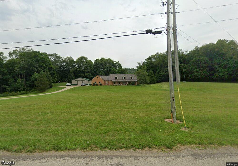
This home is located at 3235 Lucas Perrysville Rd, Lucas, OH 44843 and is currently estimated at $386,965, approximately $139 per square foot. 3235 Lucas Perrysville Rd is a home located in Richland County with nearby schools including Lucas Elementary School, Lucas Heritage Middle School, and Lucas High School.
Ownership History
Date
Name
Owned For
Owner Type
Purchase Details
Closed on
May 18, 2015
Sold by
Kurtz John W and Kurtz Alma J
Bought by
Kurtz John W and Kurtz Alma J
Current Estimated Value
Purchase Details
Closed on
Jul 1, 2014
Sold by
Tucker Archie T and Tucker Amber R
Bought by
Tucker Archie T and Tucker Amber R
Purchase Details
Closed on
Apr 17, 2008
Sold by
Spring Donald L and Spring Vanessa M
Bought by
Tucker Archie T and Tucker Amber R
Purchase Details
Closed on
Sep 15, 1997
Sold by
Kurtz John W
Bought by
Spring Donald L and Spring Vanessa M
Home Financials for this Owner
Home Financials are based on the most recent Mortgage that was taken out on this home.
Original Mortgage
$36,000
Interest Rate
7.44%
Mortgage Type
New Conventional
Create a Home Valuation Report for This Property
The Home Valuation Report is an in-depth analysis detailing your home's value as well as a comparison with similar homes in the area
Home Values in the Area
Average Home Value in this Area
Purchase History
| Date | Buyer | Sale Price | Title Company |
|---|---|---|---|
| Kurtz John W | -- | Chicago Title | |
| Tucker Archie T | -- | Attorney | |
| Tucker Archie T | $200,000 | Chicago Title | |
| Spring Donald L | $198,000 | -- |
Source: Public Records
Mortgage History
| Date | Status | Borrower | Loan Amount |
|---|---|---|---|
| Closed | Spring Donald L | $36,000 |
Source: Public Records
Tax History Compared to Growth
Tax History
| Year | Tax Paid | Tax Assessment Tax Assessment Total Assessment is a certain percentage of the fair market value that is determined by local assessors to be the total taxable value of land and additions on the property. | Land | Improvement |
|---|---|---|---|---|
| 2024 | $4,109 | $97,960 | $14,900 | $83,060 |
| 2023 | $4,109 | $97,960 | $14,900 | $83,060 |
| 2022 | $3,776 | $80,370 | $13,320 | $67,050 |
| 2021 | $3,783 | $80,370 | $13,320 | $67,050 |
| 2020 | $3,845 | $80,370 | $13,320 | $67,050 |
| 2019 | $3,494 | $68,640 | $11,290 | $57,350 |
| 2018 | $3,596 | $68,640 | $11,290 | $57,350 |
| 2017 | $3,620 | $68,640 | $11,290 | $57,350 |
| 2016 | $3,621 | $69,530 | $10,240 | $59,290 |
| 2015 | $3,618 | $69,530 | $10,240 | $59,290 |
| 2014 | $3,638 | $69,530 | $10,240 | $59,290 |
| 2012 | $3,566 | $69,530 | $10,240 | $59,290 |
Source: Public Records
Map
Nearby Homes
- 0 Moffett Rd
- 174 W Main St
- 2905 Tucker Rd
- 3261 Moffett Rd
- 0 Applegate Rd
- 2428 Applegate Rd
- 2221 Pleasant Valley Rd
- 0 Mount Zion Rd Unit 9069748
- 0 Tucker Rd
- 1679 Pulver Rd
- 1307 Sweetbriar Dr
- 3386 Trumpower Rd
- 1135 E Hanley Rd
- 68.40 Acres Trumpower Rd
- 0 Trumpower Rd
- 2061 Washington North Rd
- 0 Garver Rd Washington Rd S Unit 20253648
- 1875 Mansfield Lucas Rd
- 0 State Route 39 & I-71 Northeast Quadrant
- 0 State Route 39 & I-71 Southeast Quadrant
- 3188 Lucas Perrysville Rd
- 3117 Lucas Perrysville Rd
- 3331 Lucas Perrysville Rd
- 3101 Lucas Perrysville Rd
- 3085 Lucas Perrysville Rd
- 3053 Lucas Perrysville Rd
- 3368 Lucas Perrysville Rd
- 3045 Lucas Perrysville Rd
- 2255 Twp Rd 1265
- 210
- 0 Pleasant Valley Rd Unit 605417
- 0 Pleasant Valley Rd Unit 607710
- 0 Pleasant Valley Rd Unit 607496
- 0 Pleasant Valley Rd Unit 604239
- 0 Pleasant Valley Rd Unit 51619
- 0 Pleasant Valley Rd Unit 9007520
- 0 Pleasant Valley Rd Unit 9009115
- 0 Pleasant Valley Rd Unit 2909392
- 0 St Michaels St Unit 9052800
- 3021 Lucas Perrysville Rd