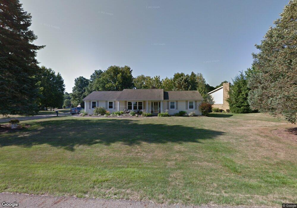
3236 Townsend St NW Uniontown, OH 44685
Estimated Value: $276,573 - $330,000
3
Beds
2
Baths
1,500
Sq Ft
$198/Sq Ft
Est. Value
About This Home
This home is located at 3236 Townsend St NW, Uniontown, OH 44685 and is currently estimated at $296,893, approximately $197 per square foot. 3236 Townsend St NW is a home located in Stark County with nearby schools including Lake Middle/High School, Lake Center Christian School, and Mayfair Christian School.
Ownership History
Date
Name
Owned For
Owner Type
Purchase Details
Closed on
Jun 2, 2004
Sold by
Edmunds Sheila K
Bought by
Edmunds Daniel L and Edmunds Sheila K
Current Estimated Value
Home Financials for this Owner
Home Financials are based on the most recent Mortgage that was taken out on this home.
Original Mortgage
$41,700
Outstanding Balance
$10,742
Interest Rate
6.17%
Mortgage Type
Stand Alone Refi Refinance Of Original Loan
Estimated Equity
$286,151
Purchase Details
Closed on
Sep 23, 1992
Purchase Details
Closed on
Dec 22, 1989
Create a Home Valuation Report for This Property
The Home Valuation Report is an in-depth analysis detailing your home's value as well as a comparison with similar homes in the area
Home Values in the Area
Average Home Value in this Area
Purchase History
| Date | Buyer | Sale Price | Title Company |
|---|---|---|---|
| Edmunds Daniel L | -- | -- | |
| -- | -- | -- | |
| -- | $78,000 | -- |
Source: Public Records
Mortgage History
| Date | Status | Borrower | Loan Amount |
|---|---|---|---|
| Open | Edmunds Daniel L | $41,700 |
Source: Public Records
Tax History Compared to Growth
Tax History
| Year | Tax Paid | Tax Assessment Tax Assessment Total Assessment is a certain percentage of the fair market value that is determined by local assessors to be the total taxable value of land and additions on the property. | Land | Improvement |
|---|---|---|---|---|
| 2025 | -- | $91,280 | $29,750 | $61,530 |
| 2024 | -- | $91,280 | $29,750 | $61,530 |
| 2023 | $3,182 | $62,440 | $17,710 | $44,730 |
| 2022 | $3,193 | $62,440 | $17,710 | $44,730 |
| 2021 | $3,227 | $62,440 | $17,710 | $44,730 |
| 2020 | $3,128 | $54,080 | $15,260 | $38,820 |
| 2019 | $3,103 | $54,080 | $15,260 | $38,820 |
| 2018 | $3,106 | $54,080 | $15,260 | $38,820 |
| 2017 | $3,003 | $48,380 | $13,620 | $34,760 |
| 2016 | $3,008 | $48,380 | $13,620 | $34,760 |
| 2015 | $3,415 | $48,380 | $13,620 | $34,760 |
| 2014 | $958 | $42,180 | $11,870 | $30,310 |
| 2013 | $1,479 | $42,180 | $11,870 | $30,310 |
Source: Public Records
Map
Nearby Homes
- 0 Heckman St NW Unit 5170772
- 11316 Cleveland Ave NW
- 3648 Mulberry St NW
- 2601 Lake Center St NW
- 12235 Cantburg Ave NW
- 3863 Heckman St NW
- 3851 Cromford Cir NW
- 11056 Peach Glen Ave NW
- 11065 Dunsby Ave NW
- 843 Brodie Ct
- 835 Brodie Ct
- 12494 Bridgemont Ave NW
- 10531 Newbury Ave NW
- 2693 Ledgestone Dr NW
- 3048 Wright Rd NW
- 3026 Wright Rd NW
- 2490 Ledgestone Dr NW
- 2335 Ledgestone Dr NW
- 2273 Ledgestone Dr NW
- 2319 Ledgestone Dr NW
- 3270 Townsend St NW
- 11645 Whitehall Ave NW
- 11670 Whitehall Ave NW
- 3235 Townsend St NW
- 11646 Whitehall Ave NW
- 3301 Hampton St NW
- 3259 Townsend St NW
- 3287 Hampton St NW
- 3201 Townsend St NW
- 3273 Townsend St NW
- 11625 Whitehall Ave NW
- 3285 Townsend St NW
- 3181 Townsend St NW
- 3277 Hampton St NW
- 11616 Whitehall Ave NW
- 3301 Townsend St NW
- 3164 Townsend St NW
- 11611 Whitehall Ave NW
- 3256 Lake Center St NW
- 3269 Hampton St NW