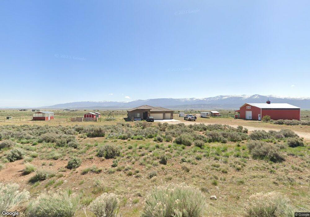
3237 S 8800 W Cedar City, UT 84720
Estimated Value: $666,993 - $798,000
--
Bed
--
Bath
--
Sq Ft
7.69
Acres
About This Home
This home is located at 3237 S 8800 W, Cedar City, UT 84720 and is currently estimated at $742,248. 3237 S 8800 W is a home with nearby schools including Iron Springs School, Canyon View Middle School, and Canyon View High School.
Ownership History
Date
Name
Owned For
Owner Type
Purchase Details
Closed on
Feb 22, 2021
Sold by
Smith Patsy Leigh and Smith John Larry
Bought by
Smith Patsy Leigh
Current Estimated Value
Home Financials for this Owner
Home Financials are based on the most recent Mortgage that was taken out on this home.
Original Mortgage
$216,267
Outstanding Balance
$193,427
Interest Rate
2.7%
Mortgage Type
VA
Estimated Equity
$548,821
Purchase Details
Closed on
Jun 28, 2012
Sold by
Anb Ventures Llc
Bought by
Iron Dirt Llc
Purchase Details
Closed on
Feb 22, 2010
Sold by
Hunter Ridge Ventures Llc
Bought by
Anb Ventures Llc
Create a Home Valuation Report for This Property
The Home Valuation Report is an in-depth analysis detailing your home's value as well as a comparison with similar homes in the area
Home Values in the Area
Average Home Value in this Area
Purchase History
| Date | Buyer | Sale Price | Title Company |
|---|---|---|---|
| Smith Patsy Leigh | -- | Elevated Title Llc | |
| Iron Dirt Llc | -- | First American Title Company | |
| Anb Ventures Llc | $2,500,000 | -- |
Source: Public Records
Mortgage History
| Date | Status | Borrower | Loan Amount |
|---|---|---|---|
| Open | Smith Patsy Leigh | $216,267 |
Source: Public Records
Tax History Compared to Growth
Tax History
| Year | Tax Paid | Tax Assessment Tax Assessment Total Assessment is a certain percentage of the fair market value that is determined by local assessors to be the total taxable value of land and additions on the property. | Land | Improvement |
|---|---|---|---|---|
| 2025 | $3,129 | $401,376 | $168,021 | $233,355 |
| 2023 | $2,922 | $403,895 | $160,020 | $243,875 |
| 2022 | $3,074 | $343,585 | $133,350 | $210,235 |
| 2021 | $1,714 | $191,640 | $41,475 | $150,165 |
| 2020 | $2,589 | $172,060 | $41,475 | $130,585 |
| 2019 | $1,071 | $155,035 | $41,475 | $113,560 |
| 2018 | $1,614 | $149,630 | $41,475 | $108,155 |
| 2017 | $1,389 | $129,065 | $27,275 | $101,790 |
| 2016 | $415 | $34,790 | $27,275 | $7,515 |
| 2015 | $473 | $37,800 | $0 | $0 |
| 2014 | $501 | $37,800 | $0 | $0 |
Source: Public Records
Map
Nearby Homes
- 13245 W 3000 S
- 9410 W 2200 S
- 8592 W 2200 S
- 9035 W 1900 S
- .66 Acres Off Hwy 56 & 9500 W
- 4367 W 1900 S
- 4206 W 1900 S
- 1/2 Acre Ft Water South Hwy 56
- 7700 W 2400 S
- 1 AF Water South Hwy 56
- 1 AF Water South of Hwy 56
- 1/2 ACRE Ft Water South of Hwy 56
- 8023 W 1800 S
- 7945 W 1800 S
- 3500 S 7700 W
- 7745 W 1800 S
- 7146 Vandenbergh Rd
- 3600 3600 S
- 2401 S 6700 W Unit (Address is approxim