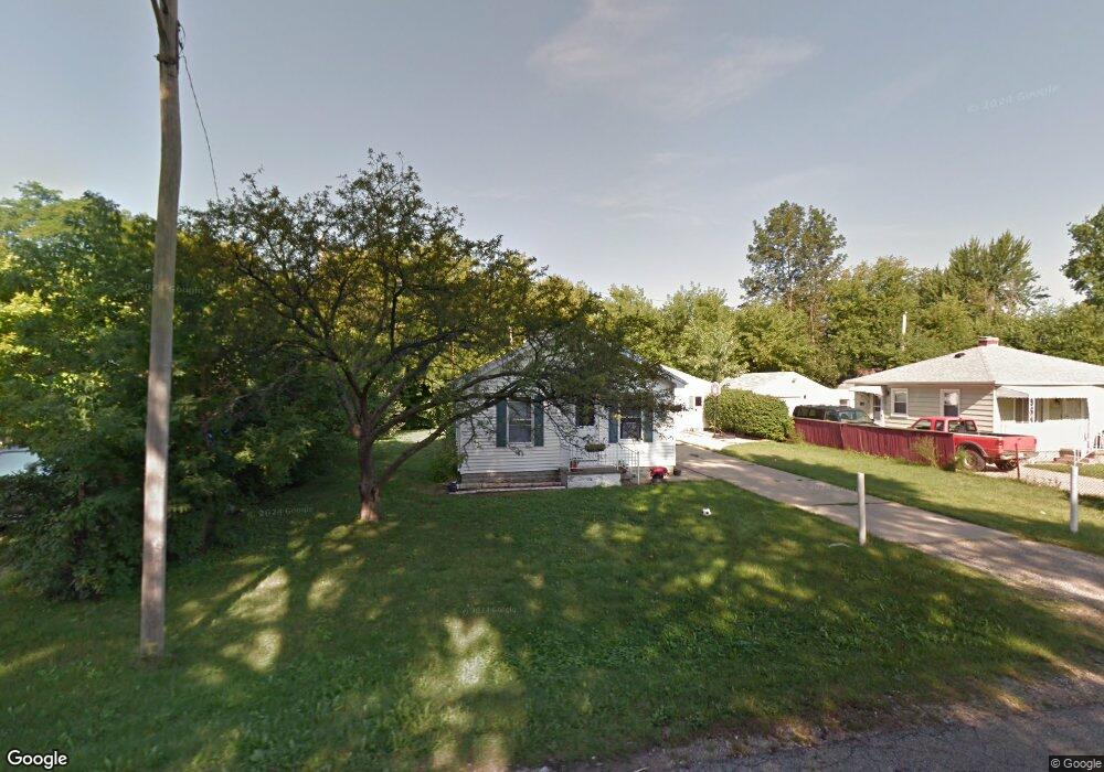
3239 Sheffer Ave Lansing, MI 48906
Northwestside NeighborhoodEstimated Value: $126,970 - $133,000
2
Beds
1
Bath
942
Sq Ft
$138/Sq Ft
Est. Value
About This Home
This home is located at 3239 Sheffer Ave, Lansing, MI 48906 and is currently estimated at $129,743, approximately $137 per square foot. 3239 Sheffer Ave is a home located in Ingham County with nearby schools including Cumberland Elementary School, Pattengill Academy, and J.W. Sexton High School.
Ownership History
Date
Name
Owned For
Owner Type
Purchase Details
Closed on
Sep 8, 2023
Sold by
Cook Richard W
Bought by
Richard Wesley Cook Trust and Cook
Current Estimated Value
Purchase Details
Closed on
Aug 20, 2010
Sold by
Cook Tamara
Bought by
Cook Richard
Purchase Details
Closed on
Nov 15, 2004
Sold by
Alton K & Ruth L Cairns Revocable Trust
Bought by
Cook Richard W and Cook Tamara L
Home Financials for this Owner
Home Financials are based on the most recent Mortgage that was taken out on this home.
Original Mortgage
$61,520
Interest Rate
5.86%
Mortgage Type
Purchase Money Mortgage
Create a Home Valuation Report for This Property
The Home Valuation Report is an in-depth analysis detailing your home's value as well as a comparison with similar homes in the area
Home Values in the Area
Average Home Value in this Area
Purchase History
| Date | Buyer | Sale Price | Title Company |
|---|---|---|---|
| Richard Wesley Cook Trust | -- | None Listed On Document | |
| Cook Richard | -- | None Available | |
| Cook Richard W | $76,900 | Trans |
Source: Public Records
Mortgage History
| Date | Status | Borrower | Loan Amount |
|---|---|---|---|
| Previous Owner | Cook Richard W | $61,520 |
Source: Public Records
Tax History
| Year | Tax Paid | Tax Assessment Tax Assessment Total Assessment is a certain percentage of the fair market value that is determined by local assessors to be the total taxable value of land and additions on the property. | Land | Improvement |
|---|---|---|---|---|
| 2025 | $2,835 | $51,600 | $11,400 | $40,200 |
| 2024 | $23 | $50,700 | $11,400 | $39,300 |
| 2023 | $2,668 | $45,100 | $11,400 | $33,700 |
| 2022 | $2,437 | $40,500 | $11,400 | $29,100 |
| 2021 | $2,380 | $37,000 | $9,500 | $27,500 |
| 2020 | $2,363 | $35,100 | $9,500 | $25,600 |
| 2019 | $2,283 | $33,200 | $9,500 | $23,700 |
| 2018 | $2,165 | $30,700 | $9,500 | $21,200 |
| 2017 | $2,084 | $30,700 | $9,500 | $21,200 |
| 2016 | $2,001 | $28,600 | $9,500 | $19,100 |
| 2015 | $2,001 | $27,100 | $19,029 | $8,071 |
| 2014 | $2,001 | $26,500 | $20,171 | $6,329 |
Source: Public Records
Map
Nearby Homes
- 3304 Sheffer Ave
- 3230 Sheffer Ave
- 3017 Alfred Ave
- 4221 N Grand River Ave
- 2601 Newport Dr
- 2519 Byrnes Rd
- 3500 Colchester Rd
- 3116 Colchester Rd
- 3733 Colchester Rd
- 2313 Kuerbitz Dr
- 4005 N Grand River Ave
- 2300 Byrnes Rd
- 2302 Northwest Ave
- 3336 Tecumseh River Rd
- 2209 Barstow Rd
- 2800 Tecumseh River Rd
- 2111 Delta River Dr
- 1805 Boynton Dr
- 1930 Briarwood Dr
- Lot 1a Rachael Fairfax Dr
- 3307 Sheffer Ave
- 3235 Sheffer Ave
- 3231 Sheffer Ave
- 3234 Jonis Cir
- 3238 Sheffer Ave
- 3234 Sheffer Ave
- 3227 Sheffer Ave
- 3310 Jonis Cir
- 3310 Sheffer Ave
- 3312 Sheffer Ave
- 3221 Sheffer Ave
- 3224 Sheffer Ave
- 3323 Sheffer Ave
- 3318 Sheffer Ave
- 3303 Westmont Ave
- 3235 Westmont Ave
- 3220 Sheffer Ave
- 3309 Westmont Ave
- 3324 Jonis Cir
Your Personal Tour Guide
Ask me questions while you tour the home.