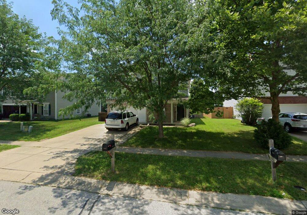
3244 Underwood Dr Whiteland, IN 46184
Estimated Value: $251,000 - $286,000
3
Beds
3
Baths
2,008
Sq Ft
$135/Sq Ft
Est. Value
About This Home
This home is located at 3244 Underwood Dr, Whiteland, IN 46184 and is currently estimated at $271,770, approximately $135 per square foot. 3244 Underwood Dr is a home located in Johnson County with nearby schools including Pleasant Crossing Elementary School, Clark-Pleasant Middle School, and Whiteland Community High School.
Ownership History
Date
Name
Owned For
Owner Type
Purchase Details
Closed on
Sep 19, 2014
Sold by
American Homes 4 Rent Properties Ten Llc
Bought by
Amh 2014 2 Borrower Llc
Current Estimated Value
Home Financials for this Owner
Home Financials are based on the most recent Mortgage that was taken out on this home.
Original Mortgage
$513,315,800
Outstanding Balance
$391,957,980
Interest Rate
4.07%
Estimated Equity
-$391,686,210
Purchase Details
Closed on
Nov 21, 2013
Sold by
Atwood Christopher and Atwood Michelle
Bought by
American Homes 4 Rent Properties Ten Llc
Purchase Details
Closed on
Jun 24, 2008
Sold by
C P Morgan Communities L P
Bought by
Atwood Christopher and Atwood Michelle
Home Financials for this Owner
Home Financials are based on the most recent Mortgage that was taken out on this home.
Original Mortgage
$130,405
Interest Rate
6.1%
Create a Home Valuation Report for This Property
The Home Valuation Report is an in-depth analysis detailing your home's value as well as a comparison with similar homes in the area
Home Values in the Area
Average Home Value in this Area
Purchase History
| Date | Buyer | Sale Price | Title Company |
|---|---|---|---|
| Amh 2014 2 Borrower Llc | -- | None Available | |
| American Homes 4 Rent Properties Ten Llc | $90,000 | None Available | |
| Atwood Christopher | -- | Hts |
Source: Public Records
Mortgage History
| Date | Status | Borrower | Loan Amount |
|---|---|---|---|
| Open | Amh 2014 2 Borrower Llc | $513,315,800 | |
| Previous Owner | Atwood Christopher | $130,405 |
Source: Public Records
Tax History Compared to Growth
Tax History
| Year | Tax Paid | Tax Assessment Tax Assessment Total Assessment is a certain percentage of the fair market value that is determined by local assessors to be the total taxable value of land and additions on the property. | Land | Improvement |
|---|---|---|---|---|
| 2025 | $2,876 | $137,700 | $56,000 | $81,700 |
| 2024 | $2,876 | $137,700 | $56,000 | $81,700 |
| 2023 | $2,872 | $137,700 | $56,000 | $81,700 |
| 2022 | $2,860 | $137,700 | $29,900 | $107,800 |
| 2021 | $2,872 | $137,700 | $29,900 | $107,800 |
| 2020 | $2,891 | $137,700 | $29,900 | $107,800 |
| 2019 | $2,891 | $137,700 | $29,900 | $107,800 |
| 2018 | $2,620 | $129,600 | $17,500 | $112,100 |
| 2017 | $2,530 | $126,000 | $17,500 | $108,500 |
| 2016 | $2,646 | $132,300 | $17,500 | $114,800 |
| 2014 | $2,496 | $124,800 | $21,400 | $103,400 |
| 2013 | $2,496 | $125,900 | $21,400 | $104,500 |
Source: Public Records
Map
Nearby Homes
- 2916 Lodgepole Dr
- 623 Scotch Pine Dr
- 768 Tall Timber Dr
- 2545 Wildflower Ln
- 577 Stobus Dr
- 2489 Wildflower Ln
- 725 Pine Lake Dr
- 698 Pine Lake Dr
- 2418 Ashton Ln
- 767 Mountain Pine Dr
- 731 W 600 N
- 2277 Maple Stone Ln
- 2400 Grand Fir Dr
- 700 Mountain Pine Dr
- 841 Cherry Tree Ln
- 3481 S Honey Creek Rd
- 660 Mountain Pine Dr
- 2357 Grand Fir Dr
- 2333 Grand Fir Dr
- 2284 Blossom Dr
- 3244 Underwood Dr
- 3244 Underwood Dr
- 3232 Underwood Dr
- 3256 Underwood Dr
- 3220 Underwood Dr
- 3268 Underwood Dr
- 3208 Underwood Dr
- 3280 Underwood Dr
- 3237 Underwood Dr
- 3253 Underwood Dr
- 3225 Underwood Dr
- 3275 Underwood Dr
- 3213 Underwood Dr
- 3196 Underwood Dr
- 3201 Underwood Dr
- 3184 Underwood Dr
- 3304 Hurst St
- 3287 Underwood Dr
- 3198 Hurst St
- 3206 Hurst St