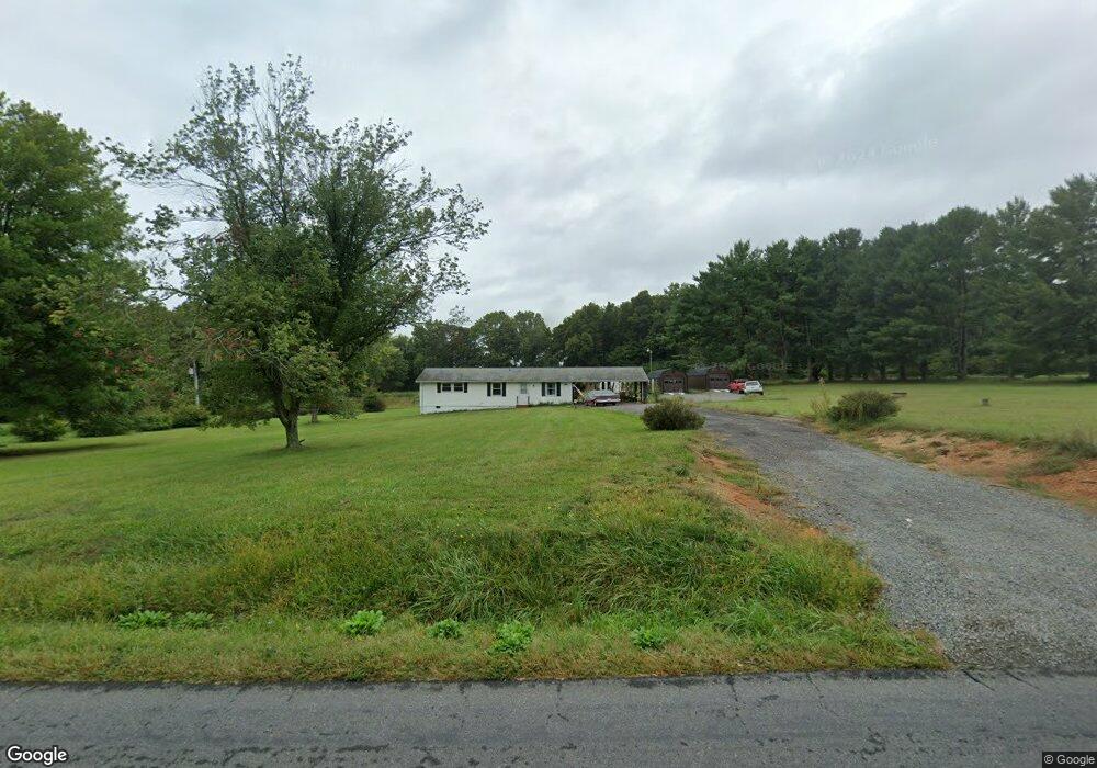
32456 Zoar Rd Locust Grove, VA 22508
Estimated Value: $312,000 - $375,000
3
Beds
2
Baths
1,200
Sq Ft
$281/Sq Ft
Est. Value
About This Home
This home is located at 32456 Zoar Rd, Locust Grove, VA 22508 and is currently estimated at $337,740, approximately $281 per square foot. 32456 Zoar Rd is a home located in Orange County with nearby schools including Locust Grove Elementary School, Locust Grove Primary School, and Locust Grove Middle School.
Ownership History
Date
Name
Owned For
Owner Type
Purchase Details
Closed on
Jun 14, 2021
Sold by
Getty Frederick J and Lana Gail Lvbore Estate
Bought by
Forshey Neil Lucas
Current Estimated Value
Home Financials for this Owner
Home Financials are based on the most recent Mortgage that was taken out on this home.
Original Mortgage
$242,500
Outstanding Balance
$218,595
Interest Rate
2.9%
Mortgage Type
New Conventional
Estimated Equity
$119,145
Create a Home Valuation Report for This Property
The Home Valuation Report is an in-depth analysis detailing your home's value as well as a comparison with similar homes in the area
Home Values in the Area
Average Home Value in this Area
Purchase History
| Date | Buyer | Sale Price | Title Company |
|---|---|---|---|
| Forshey Neil Lucas | $250,000 | Old Republic Title |
Source: Public Records
Mortgage History
| Date | Status | Borrower | Loan Amount |
|---|---|---|---|
| Open | Forshey Neil Lucas | $242,500 |
Source: Public Records
Tax History Compared to Growth
Tax History
| Year | Tax Paid | Tax Assessment Tax Assessment Total Assessment is a certain percentage of the fair market value that is determined by local assessors to be the total taxable value of land and additions on the property. | Land | Improvement |
|---|---|---|---|---|
| 2025 | $1,238 | $164,900 | $54,300 | $110,600 |
| 2024 | $1,238 | $164,900 | $54,300 | $110,600 |
| 2023 | $1,238 | $164,900 | $54,300 | $110,600 |
| 2022 | $1,238 | $164,900 | $54,300 | $110,600 |
| 2021 | $1,182 | $164,200 | $54,300 | $109,900 |
| 2020 | $1,182 | $164,200 | $54,300 | $109,900 |
| 2019 | $1,098 | $136,600 | $49,300 | $87,300 |
| 2018 | $1,098 | $136,600 | $49,300 | $87,300 |
| 2017 | $1,098 | $136,600 | $49,300 | $87,300 |
| 2016 | $1,098 | $136,600 | $49,300 | $87,300 |
| 2015 | $1,133 | $157,400 | $72,900 | $84,500 |
| 2014 | $1,133 | $157,400 | $72,900 | $84,500 |
Source: Public Records
Map
Nearby Homes
- 0 Constitution Hwy Unit VAOR2012262
- 32314 Deep Meadow Ln
- 32236 Deep Meadow Ln
- 0 Zoar Rd Unit VAOR2010406
- 0 Zoar Rd
- 0 Zoar Rd Unit VAOR2010396
- 0 Zoar Rd Unit VAOR2010404
- 31078 Old Office Rd
- 31380 Paynes Farm Dr
- 111 Butler Cir
- 104 Butler Cir
- 112 Butler Cir
- 7719 Vermont Rd
- 109 Aspen Ct
- 0 Indiantown Rd Unit VAOR2012522
- 203 Battlefield Rd
- 108 Confederate Cir
- 537 Monticello Cir
- 604 Stratford Cir
- 29727 New Hampshire Rd
- 32432 Zoar Rd
- 32480 Zoar Rd
- 32455 Zoar Rd
- 7045 Gov Almond Rd
- 32311 Constitution Hwy
- 32396 Zoar Rd
- Patriot Ct
- 32281 Constitution Hwy
- 32301 Constitution Hwy
- 32318 Constitution Hwy
- 32163 Constitution Hwy
- 32345 Constitution Hwy
- 32268 Constitution Hwy
- 7207 Gold Dale Rd
- 7050 Gov Almond Rd
- 7050 Governor Almond Rd
- 32361 Constitution Hwy
- 7240 Gold Dale Rd
- 32187 Constitution Hwy
- 32401 Constitution Hwy