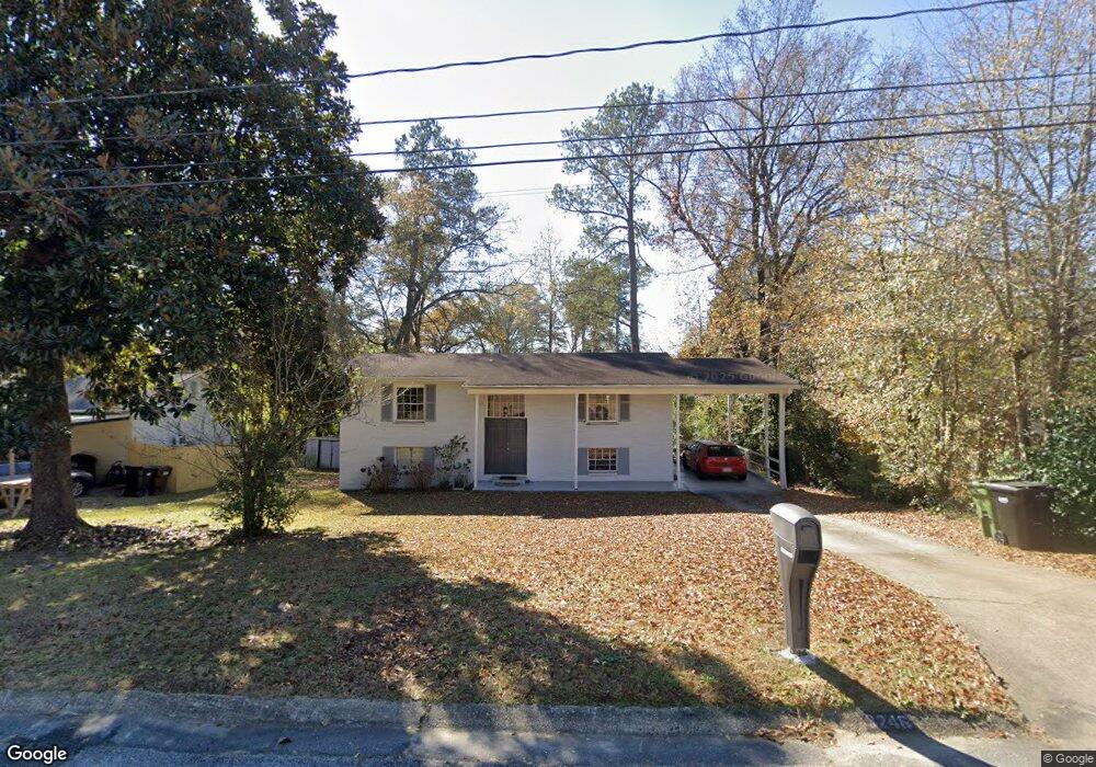
3246 Apache Dr Columbus, GA 31909
North Columbus NeighborhoodEstimated Value: $189,021 - $243,000
5
Beds
3
Baths
2,050
Sq Ft
$103/Sq Ft
Est. Value
About This Home
This home is located at 3246 Apache Dr, Columbus, GA 31909 and is currently estimated at $211,005, approximately $102 per square foot. 3246 Apache Dr is a home located in Muscogee County with nearby schools including Allen Elementary School, Arnold Middle School, and Jordan Vocational High School.
Ownership History
Date
Name
Owned For
Owner Type
Purchase Details
Closed on
Dec 11, 2019
Sold by
Mls Holdings Grp Llc
Bought by
Dejesus Mannie
Current Estimated Value
Home Financials for this Owner
Home Financials are based on the most recent Mortgage that was taken out on this home.
Original Mortgage
$156,900
Outstanding Balance
$138,600
Interest Rate
3.7%
Mortgage Type
VA
Estimated Equity
$72,405
Purchase Details
Closed on
Jan 3, 2019
Sold by
Webster Joy R
Bought by
Mls Holdings Grp Llc
Create a Home Valuation Report for This Property
The Home Valuation Report is an in-depth analysis detailing your home's value as well as a comparison with similar homes in the area
Home Values in the Area
Average Home Value in this Area
Purchase History
| Date | Buyer | Sale Price | Title Company |
|---|---|---|---|
| Dejesus Mannie | $156,900 | -- | |
| Mls Holdings Grp Llc | $100,000 | -- |
Source: Public Records
Mortgage History
| Date | Status | Borrower | Loan Amount |
|---|---|---|---|
| Open | Dejesus Mannie | $156,900 |
Source: Public Records
Tax History
| Year | Tax Paid | Tax Assessment Tax Assessment Total Assessment is a certain percentage of the fair market value that is determined by local assessors to be the total taxable value of land and additions on the property. | Land | Improvement |
|---|---|---|---|---|
| 2025 | $1,572 | $61,896 | $8,588 | $53,308 |
| 2024 | $1,571 | $61,896 | $8,588 | $53,308 |
| 2023 | $886 | $61,896 | $8,588 | $53,308 |
| 2022 | $1,638 | $50,548 | $8,588 | $41,960 |
| 2021 | $1,631 | $53,336 | $8,588 | $44,748 |
| 2020 | $1,632 | $53,336 | $8,588 | $44,748 |
| 2019 | $1,050 | $53,336 | $8,588 | $44,748 |
| 2018 | $1,050 | $53,336 | $8,588 | $44,748 |
| 2017 | $1,055 | $53,336 | $8,588 | $44,748 |
| 2016 | $1,060 | $70,137 | $5,843 | $64,294 |
| 2015 | $1,063 | $70,137 | $5,843 | $64,294 |
| 2014 | $1,066 | $70,137 | $5,843 | $64,294 |
| 2013 | -- | $70,137 | $5,843 | $64,294 |
Source: Public Records
Map
Nearby Homes
- 3091 Mustang Dr
- 5502 Southlea Ln
- 3121 Bellanca St
- 3342 Windermere St
- 5836 Sherborne Dr
- 2924 Beech St
- 5921 Canterbury Dr
- 5829 Ventura Dr
- 5724 Sanford Ave
- 6002 Canterbury Dr
- 5820 Windsor Dr
- 2723 N Walnut St
- 3504 Vernon Dr
- 3325 N Quay Dr
- 3514 Vernon Dr
- 3101 Waco St
- 3630 Vernon Dr
- 6221 Charing Dr
- 2528 Lorraine St
- 5829 Moon Rd
- 3240 Apache Dr
- 3252 Apache Dr
- 3233 Mustang Dr
- 3225 Mustang Dr
- 3234 Apache Dr
- 3302 Apache Dr
- 3239 Mustang Dr
- 3219 Mustang Dr
- 3249 Apache Dr
- 3243 Apache Dr
- 3255 Apache Dr
- 3245 Mustang Dr
- 3308 Apache Dr
- 3237 Apache Dr
- 3213 Mustang Dr
- 3305 Apache Dr
- 3251 Mustang Dr
- 3229 Apache Dr
- 3314 Apache Dr
- 3222 Apache Dr
Your Personal Tour Guide
Ask me questions while you tour the home.