Estimated Value: $504,528 - $630,000
3
Beds
2
Baths
1,260
Sq Ft
$449/Sq Ft
Est. Value
About This Home
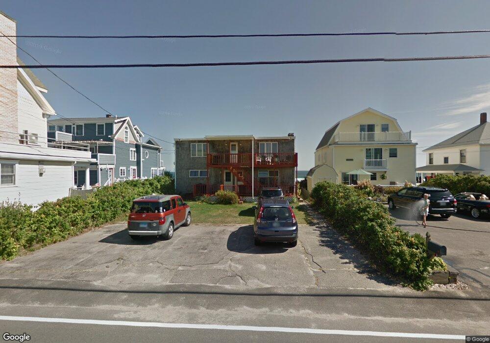
This home is located at 325 Atlantic Ave Unit 1, Wells, ME 04090 and is currently estimated at $565,882, approximately $449 per square foot. 325 Atlantic Ave Unit 1 is a home located in York County with nearby schools including Wells Junior High School, Wells Elementary School, and Wells High School.
Ownership History
Date
Name
Owned For
Owner Type
Purchase Details
Closed on
Nov 21, 2022
Sold by
Beaudoin Gene
Bought by
Beaudoin Gene and Beaudoin Marilyn B
Current Estimated Value
Home Financials for this Owner
Home Financials are based on the most recent Mortgage that was taken out on this home.
Original Mortgage
$482,000
Outstanding Balance
$459,029
Interest Rate
4.5%
Mortgage Type
Purchase Money Mortgage
Estimated Equity
$106,853
Purchase Details
Closed on
Jul 18, 2006
Sold by
Paul E Cantrell Ret and Cantrell
Bought by
Beaudoin Gene
Home Financials for this Owner
Home Financials are based on the most recent Mortgage that was taken out on this home.
Original Mortgage
$465,000
Interest Rate
6.71%
Mortgage Type
Purchase Money Mortgage
Create a Home Valuation Report for This Property
The Home Valuation Report is an in-depth analysis detailing your home's value as well as a comparison with similar homes in the area
Home Values in the Area
Average Home Value in this Area
Purchase History
| Date | Buyer | Sale Price | Title Company |
|---|---|---|---|
| Beaudoin Gene | -- | None Available | |
| Beaudoin Gene | -- | None Available | |
| Beaudoin Gene | -- | -- | |
| Beaudoin Gene | -- | -- | |
| Beaudoin Gene | -- | -- |
Source: Public Records
Mortgage History
| Date | Status | Borrower | Loan Amount |
|---|---|---|---|
| Open | Beaudoin Gene | $482,000 | |
| Closed | Beaudoin Gene | $482,000 | |
| Previous Owner | Beaudoin Gene | $465,000 |
Source: Public Records
Tax History Compared to Growth
Tax History
| Year | Tax Paid | Tax Assessment Tax Assessment Total Assessment is a certain percentage of the fair market value that is determined by local assessors to be the total taxable value of land and additions on the property. | Land | Improvement |
|---|---|---|---|---|
| 2024 | $3,452 | $567,780 | $308,270 | $259,510 |
| 2023 | $3,384 | $567,780 | $308,270 | $259,510 |
| 2022 | $3,532 | $337,660 | $140,150 | $197,510 |
| 2021 | $3,552 | $337,660 | $140,150 | $197,510 |
| 2020 | $3,309 | $315,720 | $140,150 | $175,570 |
| 2019 | $3,290 | $315,720 | $140,150 | $175,570 |
| 2018 | $3,200 | $315,720 | $140,150 | $175,570 |
| 2017 | $3,208 | $315,720 | $140,150 | $175,570 |
| 2016 | $3,176 | $315,720 | $140,150 | $175,570 |
| 2015 | $3,141 | $315,720 | $140,150 | $175,570 |
| 2013 | $2,879 | $315,720 | $140,150 | $175,570 |
Source: Public Records
Map
Nearby Homes
- 9 Robert Ln
- 229 Atlantic Ave
- 225 Atlantic Ave
- 446 Atlantic Ave
- 500 Atlantic Ave Unit 2
- 75 Ox Cart Ln Unit 2
- 61 Atlantic Ave Unit 3
- 46 Ox Cart Ln
- 42 Rachel Carson Ln
- 163 Island Beach Rd
- 4 Tidal Ct
- 1373 Post Rd Unit 1F
- 1373 Post Rd Unit 7C
- 1373 Post Rd Unit 6B
- 1373 Post Rd Unit 10A
- 1516 Post Rd
- 1413 Post Rd Unit 58
- 1290 Post Rd
- 60 Mile Rd Unit 58
- 1372 Post Rd Unit 1C
- 325 Atlantic Ave Unit 3
- 325 Atlantic Ave Unit 2
- 325 Atlantic Ave Unit ID1248570P
- 325 Atlantic Ave Unit ID1248589P
- 331 Atlantic Ave
- 321 Atlantic Ave
- 326 Atlantic Ave
- 328 Atlantic Ave
- 330 Atlantic Ave
- 15 Robert Ln
- 334 Atlantic Ave
- 317 Atlantic Ave
- 335 Atlantic Ave
- 338 Atlantic Ave Unit 2
- 338 Atlantic Ave Unit 1
- 10 Robert Ln
- 14 Robert Ln
- 322 Atlantic Ave
- 313 Atlantic Ave
- 339 Atlantic Ave